Property Record
3971 N Whitaker Rd, Amarillo, TX 79108

Property Detail
3971 N Whitaker Rd
R-200-1030-0110-0
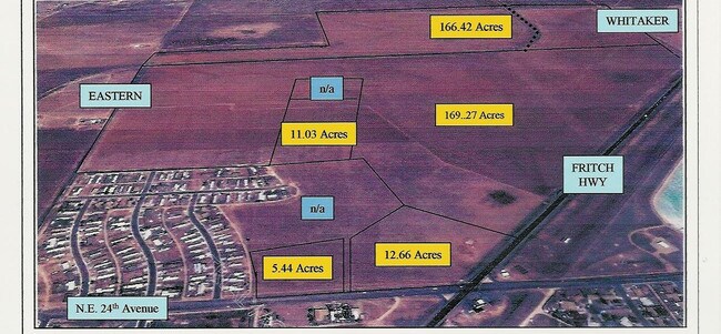
SECT 103 A B & M BLK 0002, 48.63 AC TR BEG AT NE COR OF SECT LESS 1.44 AC IN ROW, 47.1900 ACRES
Warehouse
POTTER
B and X Area of moderate flood hazard, usually the area between the limits of the 100-year and 500-year floods.
Texas
2024
47.19 AC
2025
Amarillo
015100
Other Market Areas
32,000 SF
Amarillo, TX
NEARBY LISTINGS FOR SALE OR LEASE
-
-
View all Amarillo listings for sale on LoopNet.com
DEMOGRAPHICS near 3971 N Whitaker Rd
1 mile
3 mile
5 mile
2024 Total Population
1,170
22,353
55,941
2029 Population
1,135
21,895
55,308
Pop Growth 2024-2029
(2.99%)
(2.05%)
(1.13%)
Average Age
35
36
37
2024 Total Households
340
5,756
17,375
HH Growth 2024-2029
(2.94%)
(2.48%)
(1.26%)
Median Household Inc
$59,721
$43,580
$45,180
Avg Household Size
3.30
3.10
2.90
2024 Avg HH Vehicles
2.00
2.00
2.00
Median Home Value
$103,684
$102,241
$119,147
Median Year Built
1965
1961
1960
Nearby Places
Map Layers
Map Styles
 Street
 Aerial
Transit
 Traffic
 Biking
Places
Listings with unknown addresses are not visible on the map
- Restaurants
- Banks
- Shops
- Fitness
- Groceries
Nearby Properties
Address
Land Use
TOTAL SIZE
Lot Size
Zoning
Address
Land Use
TOTAL SIZE
Lot Size
Zoning
1,079,953 SF
106.07 AC
Address
Land Use
TOTAL SIZE
Lot Size
Zoning
265,956 SF
48 AC
Address
Land Use
TOTAL SIZE
Lot Size
Zoning
91,802 SF
7 AC
Address
Land Use
TOTAL SIZE
Lot Size
Zoning
315,634 SF
53.49 AC
Address
Land Use
TOTAL SIZE
Lot Size
Zoning
76,777 SF
17.10 AC
Address
Land Use
TOTAL SIZE
Lot Size
Zoning
132,820 SF
15.85 AC
R2
Address
Land Use
TOTAL SIZE
Lot Size
Zoning
64,847 SF
25.67 AC
R1
Address
Land Use
TOTAL SIZE
Lot Size
Zoning
39,430 SF
38.42 AC
Address
Land Use
TOTAL SIZE
Lot Size
Zoning
92,341 SF
9.91 AC
R3
Address
Land Use
TOTAL SIZE
Lot Size
Zoning
23.39 AC
Address
Land Use
TOTAL SIZE
Lot Size
Zoning
37,134 SF
3.26 AC
Address
Land Use
TOTAL SIZE
Lot Size
Zoning
71,907 SF
8.54 AC
2F
Address
Land Use
TOTAL SIZE
Lot Size
Zoning
73,258 SF
7.58 AC
R2
Address
Land Use
TOTAL SIZE
Lot Size
Zoning
79,521 SF
Address
Land Use
TOTAL SIZE
Lot Size
Zoning
89,982 SF
9.75 AC
Address
Land Use
TOTAL SIZE
Lot Size
Zoning
58,977 SF
25.27 AC
PD
Address
Land Use
TOTAL SIZE
Lot Size
Zoning
65,730 SF
9.09 AC
A
Address
Land Use
TOTAL SIZE
Lot Size
Zoning
64,496 SF
8.85 AC
Address
Land Use
TOTAL SIZE
Lot Size
Zoning
201,990 SF
23.17 AC
MF1
Address
Land Use
TOTAL SIZE
Lot Size
Zoning
122,298 SF
8 AC
MF1
Address
Land Use
TOTAL SIZE
Lot Size
Zoning
63,497 SF
49.20 AC
I1
Address
Land Use
TOTAL SIZE
Lot Size
Zoning
26,133 SF
12.36 AC
R2
Address
Land Use
TOTAL SIZE
Lot Size
Zoning
64,408 SF
Address
Land Use
TOTAL SIZE
Lot Size
Zoning
50,000 SF
16.68 AC
Address
Land Use
TOTAL SIZE
Lot Size
Zoning
138,823 SF
13.74 AC
MF1
Address
Land Use
TOTAL SIZE
Lot Size
Zoning
25,168 SF
4.30 AC
Address
Land Use
TOTAL SIZE
Lot Size
Zoning
417,945 SF
24.94 AC
I1
Address
Land Use
TOTAL SIZE
Lot Size
Zoning
82,202 SF
24.18 AC
1F3S
Address
Land Use
TOTAL SIZE
Lot Size
Zoning
50,000 SF
5.59 AC
Address
Land Use
TOTAL SIZE
Lot Size
Zoning
191,071 SF
20.46 AC
I1
The World's #1 Commercial Real Estate Marketplace
Connect with us
© 2026 CoStar Group
The information above has been obtained from sources believed reliable. While we do not doubt its accuracy we have not verified it and make no guarantee, warranty or representation about it. It is your responsibility to independently confirm its accuracy and completeness. Any projections, opinions, assumptions, or estimates used are for example only and do not represent the current or future performance of the property. The value of this transaction to you depends on tax and other factors which should be evaluated by your tax, financial, and legal advisors. You and your advisors should conduct a careful, independent investigation of the property to determine to your satisfaction the suitability of the property for your needs.