Property Record
3972 Hands Mill Hwy, York, SC 29745
Property Detail
3972 Hands Mill Hwy
5570000002
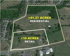
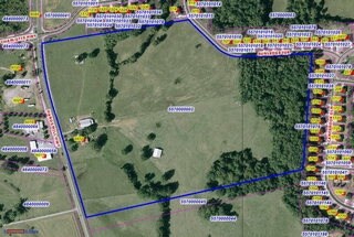
THE GOAT FARM 6.879 AC / TR#1
Governmentalpublicusegeneral
York
RCI
South Carolina
B and X Area of moderate flood hazard, usually the area between the limits of the 100-year and 500-year floods.
6.88 AC
0
York County
2025
Charlotte
061708
Charlotte-Concord-Gastonia, NC-SC
1,730 SF
NEARBY LISTINGS FOR SALE OR LEASE
DEMOGRAPHICS near 3972 Hands Mill Hwy
1 mile
3 mile
5 mile
2025 Total Population
4,124
20,831
48,968
2030 Population
4,374
22,149
52,587
Pop Growth 2025-2030
+ 6.06%
+ 6.33%
+ 7.39%
Average Age
39
42
42
2025 Total Households
1,459
8,067
18,580
HH Growth 2025-2030
+ 6.17%
+ 6.37%
+ 7.49%
Median Household Inc
$104,681
$110,677
$121,916
Avg Household Size
2.80
2.50
2.60
2025 Avg HH Vehicles
2.00
2.00
2.00
Median Home Value
$448,571
$497,932
$534,350
Median Year Built
2009
2006
2006
Nearby Places
Map Layers
Map Styles
 Street
 Aerial
Layers
 Traffic
 Biking
Places
Listings with unknown addresses are not visible on the map
- Restaurants
- Banks
- Shops
- Fitness
- Groceries
PUBLIC TRANSPORTATION
AIRPORT
Charlotte/Douglas International
Drive
Walk
Distance
Charlotte/Douglas International
32 min
18.5 mi
Concord-Padgett Regional
Drive
Walk
Distance
Concord-Padgett Regional
54 min
40.0 mi
Freight Ports
North Charleston Terminal
Drive
Walk
Distance
North Charleston Terminal
218 min
188.6 mi
Nearby Properties
Address
Land Use
TOTAL SIZE
Lot Size
Zoning
Address
Land Use
TOTAL SIZE
Lot Size
Zoning
551.16 AC
ID
Address
Land Use
TOTAL SIZE
Lot Size
Zoning
381 AC
ID
Address
Land Use
TOTAL SIZE
Lot Size
Zoning
21,537 SF
3.32 AC
BDIII
Address
Land Use
TOTAL SIZE
Lot Size
Zoning
38,142 SF
30.01 AC
PD
Address
Land Use
TOTAL SIZE
Lot Size
Zoning
27,372 SF
14.37 AC
RDII
Address
Land Use
TOTAL SIZE
Lot Size
Zoning
14.43 AC
RDI
Address
Land Use
TOTAL SIZE
Lot Size
Zoning
27,600 SF
35.50 AC
RDI
Address
Land Use
TOTAL SIZE
Lot Size
Zoning
7,840 SF
10.44 AC
RDI
Address
Land Use
TOTAL SIZE
Lot Size
Zoning
4.97 AC
BDI
Address
Land Use
TOTAL SIZE
Lot Size
Zoning
44,977 SF
24.59 AC
BDIII
Address
Land Use
TOTAL SIZE
Lot Size
Zoning
8.89 AC
BDIII
Address
Land Use
TOTAL SIZE
Lot Size
Zoning
10.18 AC
Address
Land Use
TOTAL SIZE
Lot Size
Zoning
3.89 AC
BDIII
Address
Land Use
TOTAL SIZE
Lot Size
Zoning
6,103 SF
65.50 AC
RUD
Address
Land Use
TOTAL SIZE
Lot Size
Zoning
8,876 SF
3.64 AC
RDII
Address
Land Use
TOTAL SIZE
Lot Size
Zoning
3,438 SF
46.81 AC
RCI
Address
Land Use
TOTAL SIZE
Lot Size
Zoning
4,910 SF
0.69 AC
RDI
Address
Land Use
TOTAL SIZE
Lot Size
Zoning
2.92 AC
BDIII
Address
Land Use
TOTAL SIZE
Lot Size
Zoning
3.53 AC
BDIII
Address
Land Use
TOTAL SIZE
Lot Size
Zoning
4,865 SF
1.03 AC
RDII
Address
Land Use
TOTAL SIZE
Lot Size
Zoning
3,816 SF
1.18 AC
Address
Land Use
TOTAL SIZE
Lot Size
Zoning
170.90 AC
PD
Address
Land Use
TOTAL SIZE
Lot Size
Zoning
4,172 SF
1.03 AC
RDII
Address
Land Use
TOTAL SIZE
Lot Size
Zoning
4,486 SF
1.07 AC
RDII
Address
Land Use
TOTAL SIZE
Lot Size
Zoning
2,772 SF
2 AC
RUD
Address
Land Use
TOTAL SIZE
Lot Size
Zoning
183,578 SF
23.80 AC
BDIII
Address
Land Use
TOTAL SIZE
Lot Size
Zoning
5,176 SF
2.27 AC
RDII
Address
Land Use
TOTAL SIZE
Lot Size
Zoning
2,792 SF
1.24 AC
RDII
Address
Land Use
TOTAL SIZE
Lot Size
Zoning
4,425 SF
RCI
The World's #1 Commercial Real Estate Marketplace
Connect with us
© 2026 CoStar Group
The information above has been obtained from sources believed reliable. While we do not doubt its accuracy we have not verified it and make no guarantee, warranty or representation about it. It is your responsibility to independently confirm its accuracy and completeness. Any projections, opinions, assumptions, or estimates used are for example only and do not represent the current or future performance of the property. The value of this transaction to you depends on tax and other factors which should be evaluated by your tax, financial, and legal advisors. You and your advisors should conduct a careful, independent investigation of the property to determine to your satisfaction the suitability of the property for your needs.