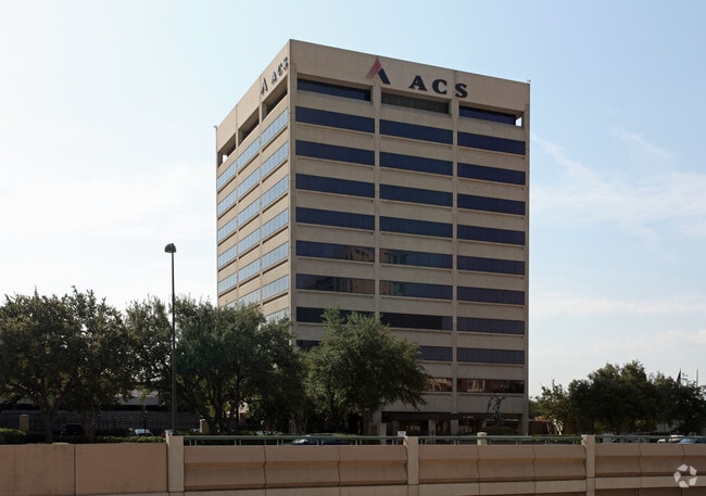
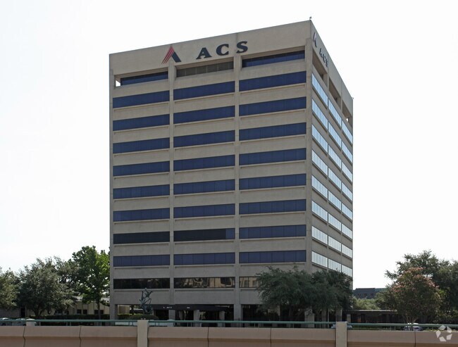
Property Record
3972 N Central Expy, Dallas, TX 75204


Save to a Folder
{{folder.Name}}
{{folder.ListingIds.length}} Properties
{{folder.ListingIds.length}} Property
Create a New Folder
Property Detail
3972 N Central Expy
002006001802A0000
XEROX BUSINESS SERVICES BLK 18/2006 PT LT 2A ACS 9.2697 INT201700164042 DD06092017 CO-DC 2006 018 02A00 7DA2006 018
Commercialacreage
DALLAS
Z239
Texas
B and X Area of moderate flood hazard, usually the area between the limits of the 100-year and 500-year floods.
2a
2025
9.27 AC
2025
Central Expressway
000802
Dallas/Ft Worth
43,644 SF
Dallas-Fort Worth-Arlington, TX
NEARBY LISTINGS FOR SALE OR LEASE
DEMOGRAPHICS near 3972 N Central Expy
1 mile
3 mile
5 mile
2025 Total Population
47,433
218,306
411,881
2030 Population
49,787
228,673
430,506
Pop Growth 2025-2030
+ 4.96%
+ 4.75%
+ 4.52%
Average Age
36
37
37
2025 Total Households
29,751
115,316
197,285
HH Growth 2025-2030
+ 4.90%
+ 5.02%
+ 4.72%
Median Household Inc
$104,390
$97,121
$87,734
Avg Household Size
1.60
1.80
2.00
2025 Avg HH Vehicles
1.00
1.00
1.00
Median Home Value
$512,519
$673,174
$646,706
Median Year Built
2002
1999
1991
Nearby Places
Map Layers
Map Styles
 Street
 Aerial
Layers
 Traffic
 Biking
Places
Listings with unknown addresses are not visible on the map
- Restaurants
- Banks
- Shops
- Fitness
- Groceries
PUBLIC TRANSPORTATION
TRANSIT/SUBWAY
Cityplace/Uptown (Blue Line - Dallas Area Rapid Transit (DART), Orange Line - Dallas Area Rapid Transit (DART), Red Line - Dallas Area Rapid Transit (DART))
Drive
Walk
Distance
Cityplace/Uptown (Blue Line - Dallas Area Rapid Transit (DART), Orange Line - Dallas Area Rapid Transit (DART), Red Line - Dallas Area Rapid Transit (DART))
6 min
4 min
0.2 mi
Cityplace (McKinney Avenue) (McKinney Avenue Streetcar - Dallas Area Rapid Transit (DART))
Drive
Walk
Distance
Cityplace (McKinney Avenue) (McKinney Avenue Streetcar - Dallas Area Rapid Transit (DART))
3 min
5 min
0.3 mi
McKinney and Blackburn (McKinney Avenue Streetcar - Dallas Area Rapid Transit (DART))
Drive
Walk
Distance
McKinney and Blackburn (McKinney Avenue Streetcar - Dallas Area Rapid Transit (DART))
3 min
6 min
0.3 mi
Cole And Blackburn (McKinney Avenue Streetcar - Dallas Area Rapid Transit (DART))
Drive
Walk
Distance
Cole And Blackburn (McKinney Avenue Streetcar - Dallas Area Rapid Transit (DART))
4 min
8 min
0.4 mi
Cole And Lemmon (McKinney Avenue Streetcar - Dallas Area Rapid Transit (DART))
Drive
Walk
Distance
Cole And Lemmon (McKinney Avenue Streetcar - Dallas Area Rapid Transit (DART))
4 min
11 min
0.6 mi
COMMUTER RAIL
Drive
Walk
Distance
7 min
3.8 mi
Drive
Walk
Distance
9 min
4.2 mi
AIRPORT
Dallas Love Field
Drive
Walk
Distance
Dallas Love Field
12 min
5.3 mi
Dallas-Fort Worth International
Drive
Walk
Distance
Dallas-Fort Worth International
31 min
21.2 mi
Nearby Properties
Address
Land Use
TOTAL SIZE
Lot Size
Zoning
Address
Land Use
TOTAL SIZE
Lot Size
Zoning
2,658,374 SF
37.70 AC
Z116
Address
Land Use
TOTAL SIZE
Lot Size
Zoning
1,634,356 SF
92.90 AC
Z421
Address
Land Use
TOTAL SIZE
Lot Size
Zoning
3,713,071 SF
9.94 AC
Address
Land Use
TOTAL SIZE
Lot Size
Zoning
815,000 SF
7.20 AC
Z239
Address
Land Use
TOTAL SIZE
Lot Size
Zoning
1,676,176 SF
2.18 AC
Z239
Address
Land Use
TOTAL SIZE
Lot Size
Zoning
906,730 SF
3.09 AC
Z239
Address
Land Use
TOTAL SIZE
Lot Size
Zoning
858,872 SF
23.90 AC
Z421
Address
Land Use
TOTAL SIZE
Lot Size
Zoning
1,003,498 SF
22.15 AC
Z116
Address
Land Use
TOTAL SIZE
Lot Size
Zoning
1,308,710 SF
8.42 AC
Z21
Address
Land Use
TOTAL SIZE
Lot Size
Zoning
731,849 SF
3.13 AC
Z239
Address
Land Use
TOTAL SIZE
Lot Size
Zoning
1,896,570 SF
18.08 AC
Z151
Address
Land Use
TOTAL SIZE
Lot Size
Zoning
299,170 SF
9.71 AC
Z97
Address
Land Use
TOTAL SIZE
Lot Size
Zoning
1,480,246 SF
1.86 AC
Z21
Address
Land Use
TOTAL SIZE
Lot Size
Zoning
1,291,660 SF
2.56 AC
Z248
Address
Land Use
TOTAL SIZE
Lot Size
Zoning
1,026,046 SF
2.89 AC
Z248
Address
Land Use
TOTAL SIZE
Lot Size
Zoning
864,909 SF
3.02 AC
Z248
Address
Land Use
TOTAL SIZE
Lot Size
Zoning
504,533 SF
9.95 AC
Z151
Address
Land Use
TOTAL SIZE
Lot Size
Zoning
1,424,070 SF
1.36 AC
Z21
Address
Land Use
TOTAL SIZE
Lot Size
Zoning
724,979 SF
1.05 AC
Z239
Address
Land Use
TOTAL SIZE
Lot Size
Zoning
893,159 SF
1.17 AC
Z21
Address
Land Use
TOTAL SIZE
Lot Size
Zoning
100 SF
27.05 AC
Z421
Address
Land Use
TOTAL SIZE
Lot Size
Zoning
1,980,000 SF
2.57 AC
Z21
Address
Land Use
TOTAL SIZE
Lot Size
Zoning
857,292 SF
1.47 AC
Z239
Address
Land Use
TOTAL SIZE
Lot Size
Zoning
602,716 SF
11.21 AC
Z239
Address
Land Use
TOTAL SIZE
Lot Size
Zoning
763,198 SF
3.01 AC
Z248
Address
Land Use
TOTAL SIZE
Lot Size
Zoning
638,046 SF
2.11 AC
Z239
Address
Land Use
TOTAL SIZE
Lot Size
Zoning
486,300 SF
1.55 AC
Z239
Address
Land Use
TOTAL SIZE
Lot Size
Zoning
906,627 SF
3.83 AC
Z239
Address
Land Use
TOTAL SIZE
Lot Size
Zoning
226,331 SF
1 AC
Address
Land Use
TOTAL SIZE
Lot Size
Zoning
653,557 SF
0.68 AC
Z248
The World's #1 Commercial Real Estate Marketplace
Connect with us
© 2026 CoStar Group
The information above has been obtained from sources believed reliable. While we do not doubt its accuracy we have not verified it and make no guarantee, warranty or representation about it. It is your responsibility to independently confirm its accuracy and completeness. Any projections, opinions, assumptions, or estimates used are for example only and do not represent the current or future performance of the property. The value of this transaction to you depends on tax and other factors which should be evaluated by your tax, financial, and legal advisors. You and your advisors should conduct a careful, independent investigation of the property to determine to your satisfaction the suitability of the property for your needs.