Property Record
3975 Ewing Rd, Austell, GA 30106
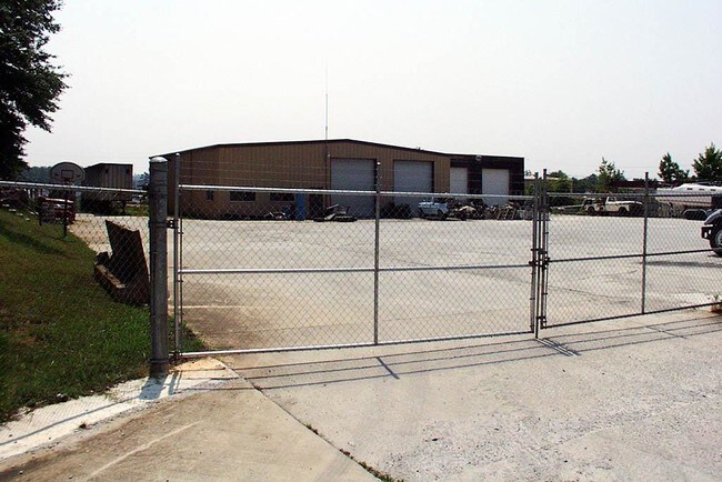

Property Detail
3975 Ewing Rd
19-0913-0-025-0
ALL THAT TRACT OR PARCEL OF LAND LYING AND BEING IN THE 19TH DISTRICT, 2ND SECTION, COBB COUNTY, GEORGIA, LYING WITHIN LAND LOT 913, IDENTIFIED AS TAX PARCEL 25, ON THE FIELD
Commercialnec
COBB
HI
Georgia
B and X Area of moderate flood hazard, usually the area between the limits of the 100-year and 500-year floods.
913
2025
1.75 AC
2025
I-20 W/Douglasville
031411
Atlanta
6,888 SF
Atlanta-Sandy Springs-Roswell, GA
NEARBY LISTINGS FOR SALE OR LEASE
DEMOGRAPHICS near 3975 Ewing Rd
1 mile
3 mile
5 mile
2025 Total Population
5,003
58,105
157,065
2030 Population
5,075
59,801
161,942
Pop Growth 2025-2030
+ 1.44%
+ 2.92%
+ 3.11%
Average Age
39
39
39
2025 Total Households
1,780
20,856
55,417
HH Growth 2025-2030
+ 1.12%
+ 2.92%
+ 3.15%
Median Household Inc
$65,148
$81,176
$86,422
Avg Household Size
2.70
2.70
2.70
2025 Avg HH Vehicles
2.00
2.00
2.00
Median Home Value
$276,872
$336,514
$356,746
Median Year Built
1988
1987
1988
Nearby Places
Map Layers
Map Styles
 Street
 Aerial
Transit
 Traffic
 Biking
Places
Listings with unknown addresses are not visible on the map
- Restaurants
- Banks
- Shops
- Fitness
- Groceries
PUBLIC TRANSPORTATION
AIRPORT
Hartsfield - Jackson Atlanta International
Drive
Walk
Distance
Hartsfield - Jackson Atlanta International
44 min
28.7 mi
Freight Ports
Georgia Ports - Savannah
Drive
Walk
Distance
Georgia Ports - Savannah
307 min
268.0 mi
Nearby Properties
Address
Land Use
TOTAL SIZE
Lot Size
Zoning
Address
Land Use
TOTAL SIZE
Lot Size
Zoning
494,972 SF
25.60 AC
CF
Address
Land Use
TOTAL SIZE
Lot Size
Zoning
403,898 SF
37.53 AC
RM-12
Address
Land Use
TOTAL SIZE
Lot Size
Zoning
370,201 SF
28.35 AC
RM-12
Address
Land Use
TOTAL SIZE
Lot Size
Zoning
25,956 SF
12.78 AC
PVC
Address
Land Use
TOTAL SIZE
Lot Size
Zoning
272,170 SF
26.40 AC
RM-12
Address
Land Use
TOTAL SIZE
Lot Size
Zoning
238,984 SF
17.51 AC
RM-12
Address
Land Use
TOTAL SIZE
Lot Size
Zoning
9,882 SF
4.61 AC
CBD
Address
Land Use
TOTAL SIZE
Lot Size
Zoning
Address
Land Use
TOTAL SIZE
Lot Size
Zoning
209,649 SF
13.51 AC
RM-12
Address
Land Use
TOTAL SIZE
Lot Size
Zoning
219,402 SF
10.33 AC
RM-12
Address
Land Use
TOTAL SIZE
Lot Size
Zoning
179,048 SF
25.97 AC
RM-12
Address
Land Use
TOTAL SIZE
Lot Size
Zoning
118,069 SF
0.38 AC
OI
Address
Land Use
TOTAL SIZE
Lot Size
Zoning
188,988 SF
15.30 AC
OI
Address
Land Use
TOTAL SIZE
Lot Size
Zoning
161,927 SF
7.95 AC
OI
Address
Land Use
TOTAL SIZE
Lot Size
Zoning
198,052 SF
24.52 AC
NRC/CRC
Address
Land Use
TOTAL SIZE
Lot Size
Zoning
92,468 SF
13.69 AC
RM-8
Address
Land Use
TOTAL SIZE
Lot Size
Zoning
78.60 AC
R20
Address
Land Use
TOTAL SIZE
Lot Size
Zoning
83,314 SF
15.74 AC
NRC
Address
Land Use
TOTAL SIZE
Lot Size
Zoning
98,574 SF
10.27 AC
CRC
Address
Land Use
TOTAL SIZE
Lot Size
Zoning
170,892 SF
29.16 AC
CRC/LRO
Address
Land Use
TOTAL SIZE
Lot Size
Zoning
79,348 SF
12.04 AC
CRC
Address
Land Use
TOTAL SIZE
Lot Size
Zoning
134,592 SF
13.43 AC
CBD
Address
Land Use
TOTAL SIZE
Lot Size
Zoning
12,374 SF
1.42 AC
CBD
Address
Land Use
TOTAL SIZE
Lot Size
Zoning
2,636 SF
2.97 AC
NRC
Address
Land Use
TOTAL SIZE
Lot Size
Zoning
104,538 SF
9.18 AC
RM-12
Address
Land Use
TOTAL SIZE
Lot Size
Zoning
101,340 SF
4.24 AC
CRC
Address
Land Use
TOTAL SIZE
Lot Size
Zoning
44,097 SF
3.45 AC
OI
Address
Land Use
TOTAL SIZE
Lot Size
Zoning
38,418 SF
2.27 AC
GC
Address
Land Use
TOTAL SIZE
Lot Size
Zoning
175,923 SF
12.75 AC
GC
Address
Land Use
TOTAL SIZE
Lot Size
Zoning
94,074 SF
5 AC
PSC
The World's #1 Commercial Real Estate Marketplace
Connect with us
© 2026 CoStar Group
The information above has been obtained from sources believed reliable. While we do not doubt its accuracy we have not verified it and make no guarantee, warranty or representation about it. It is your responsibility to independently confirm its accuracy and completeness. Any projections, opinions, assumptions, or estimates used are for example only and do not represent the current or future performance of the property. The value of this transaction to you depends on tax and other factors which should be evaluated by your tax, financial, and legal advisors. You and your advisors should conduct a careful, independent investigation of the property to determine to your satisfaction the suitability of the property for your needs.