Property Record
3975 N 68Th St, Milwaukee, WI 53216
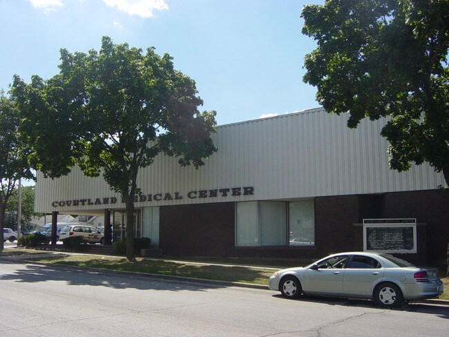


Property Detail
3975 N 68Th St
264-0194-210-5
CAPITOL MANOR NO 2 IN NW 1/4 SEC 10-7-21 BLOCK 6 LOT 6 & E 39 LOT 5 & E 80 (LOTS 7-8&9) & ALL OF VAC ALLEY ADJ
Medicalbuilding
Milwaukee
LB2
Wisconsin
B and X Area of moderate flood hazard, usually the area between the limits of the 100-year and 500-year floods.
5,6
2024
0.50 AC
2025
Milwaukee NW
005100
Milwaukee/Madison
18,482 SF
Milwaukee-Waukesha, WI
NEARBY LISTINGS FOR SALE OR LEASE
DEMOGRAPHICS near 3975 N 68Th St
1 mile
3 mile
5 mile
2025 Total Population
18,937
188,470
383,698
2030 Population
18,839
188,849
385,005
Pop Growth 2025-2030
(0.52%)
+ 0.20%
+ 0.34%
Average Age
38
37
37
2025 Total Households
7,583
74,371
154,210
HH Growth 2025-2030
(0.57%)
+ 0.04%
+ 0.22%
Median Household Inc
$53,506
$54,304
$53,397
Avg Household Size
2.40
2.40
2.40
2025 Avg HH Vehicles
1.00
1.00
1.00
Median Home Value
$154,197
$180,608
$197,079
Median Year Built
1955
1951
1952
Nearby Places
Map Layers
Map Styles
 Street
 Aerial
Layers
 Traffic
 Biking
Places
Listings with unknown addresses are not visible on the map
- Restaurants
- Banks
- Shops
- Fitness
- Groceries
PUBLIC TRANSPORTATION
COMMUTER RAIL
Milwaukee (Empire Builder - Amtrak)
Drive
Walk
Distance
Milwaukee (Empire Builder - Amtrak)
15 min
7.4 mi
AIRPORT
General Mitchell International
Drive
Walk
Distance
General Mitchell International
27 min
14.0 mi
Freight Ports
Port Milwaukee
Drive
Walk
Distance
Port Milwaukee
19 min
9.8 mi
SALE & LEASE HISTORY
LISTING DATE
SALE/LEASE

Sep 25, 2016
For Lease
Nearby Properties
Address
Land Use
TOTAL SIZE
Lot Size
Zoning
Address
Land Use
TOTAL SIZE
Lot Size
Zoning
70.73 AC
Address
Land Use
TOTAL SIZE
Lot Size
Zoning
5,104 SF
0.11 AC
LB1
Address
Land Use
TOTAL SIZE
Lot Size
Zoning
1.91 AC
Address
Land Use
TOTAL SIZE
Lot Size
Zoning
28,800 SF
3.30 AC
C2
Address
Land Use
TOTAL SIZE
Lot Size
Zoning
3.74 AC
PUD
Address
Land Use
TOTAL SIZE
Lot Size
Zoning
106,495 SF
9.70 AC
PUD
Address
Land Use
TOTAL SIZE
Lot Size
Zoning
0.36 AC
Address
Land Use
TOTAL SIZE
Lot Size
Zoning
2.45 AC
C2
Address
Land Use
TOTAL SIZE
Lot Size
Zoning
8.78 AC
Address
Land Use
TOTAL SIZE
Lot Size
Zoning
Address
Land Use
TOTAL SIZE
Lot Size
Zoning
0.71 AC
RM2
Address
Land Use
TOTAL SIZE
Lot Size
Zoning
8.03 AC
RM1
Address
Land Use
TOTAL SIZE
Lot Size
Zoning
1.76 AC
LB2
Address
Land Use
TOTAL SIZE
Lot Size
Zoning
Address
Land Use
TOTAL SIZE
Lot Size
Zoning
12.49 AC
TL
Address
Land Use
TOTAL SIZE
Lot Size
Zoning
169,550 SF
12.04 AC
RB2
Address
Land Use
TOTAL SIZE
Lot Size
Zoning
17.84 AC
TL
Address
Land Use
TOTAL SIZE
Lot Size
Zoning
2.21 AC
C2
Address
Land Use
TOTAL SIZE
Lot Size
Zoning
18.54 AC
RS6
Address
Land Use
TOTAL SIZE
Lot Size
Zoning
163,539 SF
7.17 AC
PUD
Address
Land Use
TOTAL SIZE
Lot Size
Zoning
Address
Land Use
TOTAL SIZE
Lot Size
Zoning
4.17 AC
PUD
Address
Land Use
TOTAL SIZE
Lot Size
Zoning
0.51 AC
RT2
Address
Land Use
TOTAL SIZE
Lot Size
Zoning
1.26 AC
Address
Land Use
TOTAL SIZE
Lot Size
Zoning
7.38 AC
TL
Address
Land Use
TOTAL SIZE
Lot Size
Zoning
6.73 AC
C2
Address
Land Use
TOTAL SIZE
Lot Size
Zoning
122,360 SF
PD
Address
Land Use
TOTAL SIZE
Lot Size
Zoning
0.66 AC
Address
Land Use
TOTAL SIZE
Lot Size
Zoning
65,274 SF
3.91 AC
C2
Address
Land Use
TOTAL SIZE
Lot Size
Zoning
1.40 AC
RM1
The World's #1 Commercial Real Estate Marketplace
Connect with us
© 2026 CoStar Group
The information above has been obtained from sources believed reliable. While we do not doubt its accuracy we have not verified it and make no guarantee, warranty or representation about it. It is your responsibility to independently confirm its accuracy and completeness. Any projections, opinions, assumptions, or estimates used are for example only and do not represent the current or future performance of the property. The value of this transaction to you depends on tax and other factors which should be evaluated by your tax, financial, and legal advisors. You and your advisors should conduct a careful, independent investigation of the property to determine to your satisfaction the suitability of the property for your needs.