Property Record
3979 Albany Post Rd, Hyde Park, NY 12538

NEARBY LISTINGS FOR SALE OR LEASE
Property Detail
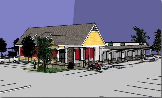
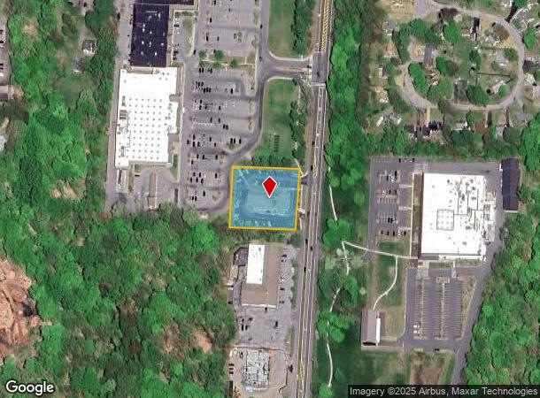
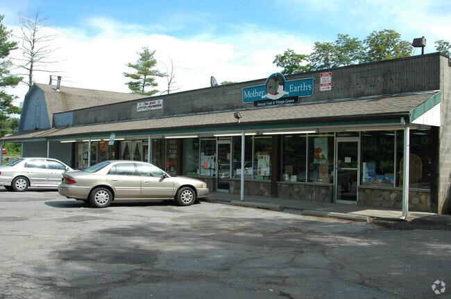
3979 Albany Post Rd
133200-6064-04-967222-0000
1.00 AC 1546 0654 1546 0651
Regionalshoppingcenterormallwithanchorstore
Dutchess
X
New York
36027C0268E
967
2025
1 AC
2024
Fishkill
070201
Westchester/So Connecticut
8,712 SF
Dutchess County-Putnam County, NY
DEMOGRAPHICS near 3979 Albany Post Rd
1 Mile
3 Mile
5 Mile
2024 Total Population
779
21,096
72,497
2029 Population
766
21,132
72,517
Pop Growth 2024-2029
(1.67%)
+ 0.17%
+ 0.03%
Average Age
42
38
40
2024 Total Households
351
6,804
27,746
HH Growth 2024-2029
(1.71%)
+ 0.16%
+ 0.11%
Median Household Inc
$42,812
$81,776
$62,322
Avg Household Size
2.00
2.30
2.30
2024 Avg HH Vehicles
1.00
2.00
2.00
Median Home Value
$255,913
$254,910
$259,657
Median Year Built
1967
1966
1965
Nearby Places
- Restaurants
- Banks
- Shops
- Fitness
- Groceries
PUBLIC TRANSPORTATION
COMMUTER RAIL
Poughkeepsie Station (Hudson Line - Metro-North Commuter Railroad Company (Metro-North))
DRIVE
WALK
Distance
Poughkeepsie Station (Hudson Line - Metro-North Commuter Railroad Company (Metro-North))
7 min
4.4 mi
AIRPORT
New York Stewart International
DRIVE
WALK
Distance
New York Stewart International
40 min
27.8 mi
Freight Ports
Albany, NY Port
DRIVE
WALK
Distance
Albany, NY Port
94 min
66.5 mi
Nearby Properties
Address
Land Use
TOTAL SIZE
Lot Size
Zoning
Address
Land Use
TOTAL SIZE
Lot Size
Zoning
539,228 SF
62.57 AC
IN
Address
Land Use
TOTAL SIZE
Lot Size
Zoning
4.99 AC
R2A
Address
Land Use
TOTAL SIZE
Lot Size
Zoning
246,913 SF
43.93 AC
IN
Address
Land Use
TOTAL SIZE
Lot Size
Zoning
181,295 SF
20.48 AC
IN
Address
Land Use
TOTAL SIZE
Lot Size
Zoning
317,644 SF
35.25 AC
CIA
Address
Land Use
TOTAL SIZE
Lot Size
Zoning
12,638 SF
159.73 AC
R2A
Address
Land Use
TOTAL SIZE
Lot Size
Zoning
218,118 SF
13.15 AC
FC
Address
Land Use
TOTAL SIZE
Lot Size
Zoning
103,108 SF
24.31 AC
HRDD
Address
Land Use
TOTAL SIZE
Lot Size
Zoning
82,739 SF
6.16 AC
IN
Address
Land Use
TOTAL SIZE
Lot Size
Zoning
59,499 SF
0.97 AC
IN
Address
Land Use
TOTAL SIZE
Lot Size
Zoning
82,000 SF
1.27 AC
IN
Address
Land Use
TOTAL SIZE
Lot Size
Zoning
15.50 AC
N
Address
Land Use
TOTAL SIZE
Lot Size
Zoning
123,218 SF
15.07 AC
FC
Address
Land Use
TOTAL SIZE
Lot Size
Zoning
33,614 SF
3.99 AC
IN
Address
Land Use
TOTAL SIZE
Lot Size
Zoning
26,461 SF
6.12 AC
IH
Address
Land Use
TOTAL SIZE
Lot Size
Zoning
120,508 SF
30.85 AC
IN
Address
Land Use
TOTAL SIZE
Lot Size
Zoning
61,987 SF
3.80 AC
IN
Address
Land Use
TOTAL SIZE
Lot Size
Zoning
830,000 SF
3.49 AC
Address
Land Use
TOTAL SIZE
Lot Size
Zoning
77,190 SF
9.71 AC
FC
Address
Land Use
TOTAL SIZE
Lot Size
Zoning
5,665 SF
510.60 AC
R40
Address
Land Use
TOTAL SIZE
Lot Size
Zoning
53,841 SF
195.70 AC
WF
Address
Land Use
TOTAL SIZE
Lot Size
Zoning
Address
Land Use
TOTAL SIZE
Lot Size
Zoning
26,000 SF
12.67 AC
IN
Address
Land Use
TOTAL SIZE
Lot Size
Zoning
169,527 SF
56.30 AC
N
Address
Land Use
TOTAL SIZE
Lot Size
Zoning
Address
Land Use
TOTAL SIZE
Lot Size
Zoning
59,792 SF
2.70 AC
CIA
Address
Land Use
TOTAL SIZE
Lot Size
Zoning
93,048 SF
2.58 AC
IN
Address
Land Use
TOTAL SIZE
Lot Size
Zoning
3.60 AC
R20
Address
Land Use
TOTAL SIZE
Lot Size
Zoning
59,424 SF
15.41 AC
TCHD
Address
Land Use
TOTAL SIZE
Lot Size
Zoning
48,285 SF
2.85 AC
IN
The World's #1 Commercial Real Estate Marketplace
Connect with us
© 2025 CoStar Group
The information above has been obtained from sources believed reliable. While we do not doubt its accuracy we have not verified it and make no guarantee, warranty or representation about it. It is your responsibility to independently confirm its accuracy and completeness. Any projections, opinions, assumptions, or estimates used are for example only and do not represent the current or future performance of the property. The value of this transaction to you depends on tax and other factors which should be evaluated by your tax, financial, and legal advisors. You and your advisors should conduct a careful, independent investigation of the property to determine to your satisfaction the suitability of the property for your needs.