Property Record
398 2Nd St, Somerville, TX 77879
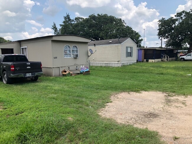


Property Detail
398 2Nd St
College Station-Bryan, TX
S2414 BRENHAM ADDITION BLK 18 LOT 81 & 82, .6887 ACRES
21589
BURLESON
Commercialnec
Texas
B and X Area of moderate flood hazard, usually the area between the limits of the 100-year and 500-year floods.
81,82
2025
0.69 AC
2025
Bryan & College Station
970501
Other Market Areas
1 SF
NEARBY LISTINGS FOR SALE OR LEASE
DEMOGRAPHICS near 398 2Nd St
1 mile
3 mile
5 mile
2025 Total Population
859
1,555
3,018
2030 Population
912
1,662
3,273
Pop Growth 2025-2030
+ 6.17%
+ 6.88%
+ 8.45%
Average Age
41
43
45
2025 Total Households
342
644
1,307
HH Growth 2025-2030
+ 6.43%
+ 7.61%
+ 9.41%
Median Household Inc
$65,640
$68,333
$73,215
Avg Household Size
2.50
2.40
2.30
2025 Avg HH Vehicles
2.00
2.00
2.00
Median Home Value
$179,213
$193,708
$207,475
Median Year Built
1976
1980
1983
Nearby Places
Map Layers
Map Styles
 Street
 Aerial
Layers
 Traffic
 Biking
Places
Listings with unknown addresses are not visible on the map
- Restaurants
- Banks
- Shops
- Fitness
- Groceries
PUBLIC TRANSPORTATION
AIRPORT
Easterwood Field
Drive
Walk
Distance
Easterwood Field
40 min
27.0 mi
Freight Ports
Port of Houston
Drive
Walk
Distance
Port of Houston
125 min
98.6 mi
SALE & LEASE HISTORY
LISTING DATE
SALE/LEASE

Aug 05, 2021
For Sale
Nearby Properties
Address
Land Use
TOTAL SIZE
Lot Size
Zoning
Address
Land Use
TOTAL SIZE
Lot Size
Zoning
72,820 SF
4.33 AC
Address
Land Use
TOTAL SIZE
Lot Size
Zoning
50,456 SF
0.83 AC
Address
Land Use
TOTAL SIZE
Lot Size
Zoning
7,101 SF
587.70 AC
Address
Land Use
TOTAL SIZE
Lot Size
Zoning
4,639 SF
261.47 AC
Address
Land Use
TOTAL SIZE
Lot Size
Zoning
656.95 AC
Address
Land Use
TOTAL SIZE
Lot Size
Zoning
3,212 SF
496.25 AC
Address
Land Use
TOTAL SIZE
Lot Size
Zoning
2,520 SF
484.43 AC
Address
Land Use
TOTAL SIZE
Lot Size
Zoning
1,836 SF
401.27 AC
Address
Land Use
TOTAL SIZE
Lot Size
Zoning
230.30 AC
Address
Land Use
TOTAL SIZE
Lot Size
Zoning
315.10 AC
Address
Land Use
TOTAL SIZE
Lot Size
Zoning
315.10 AC
Address
Land Use
TOTAL SIZE
Lot Size
Zoning
3,000 SF
83 AC
Address
Land Use
TOTAL SIZE
Lot Size
Zoning
3,750 SF
10 AC
Address
Land Use
TOTAL SIZE
Lot Size
Zoning
313.10 AC
Address
Land Use
TOTAL SIZE
Lot Size
Zoning
562.54 AC
Address
Land Use
TOTAL SIZE
Lot Size
Zoning
808 SF
89.64 AC
Address
Land Use
TOTAL SIZE
Lot Size
Zoning
55.35 AC
Address
Land Use
TOTAL SIZE
Lot Size
Zoning
649 SF
53.69 AC
Address
Land Use
TOTAL SIZE
Lot Size
Zoning
375 SF
83.39 AC
Address
Land Use
TOTAL SIZE
Lot Size
Zoning
52.27 AC
Address
Land Use
TOTAL SIZE
Lot Size
Zoning
2,775 SF
6.76 AC
Address
Land Use
TOTAL SIZE
Lot Size
Zoning
4,238 SF
343.15 AC
Address
Land Use
TOTAL SIZE
Lot Size
Zoning
1,924 SF
125.04 AC
Address
Land Use
TOTAL SIZE
Lot Size
Zoning
1,563 SF
35.99 AC
Address
Land Use
TOTAL SIZE
Lot Size
Zoning
485 SF
75 AC
Address
Land Use
TOTAL SIZE
Lot Size
Zoning
3,052 SF
110.15 AC
Address
Land Use
TOTAL SIZE
Lot Size
Zoning
2,401 SF
204.60 AC
Address
Land Use
TOTAL SIZE
Lot Size
Zoning
10,722 SF
1.11 AC
Address
Land Use
TOTAL SIZE
Lot Size
Zoning
3,500 SF
0.34 AC
Address
Land Use
TOTAL SIZE
Lot Size
Zoning
4,000 SF
0.22 AC
The World's #1 Commercial Real Estate Marketplace
Connect with us
© 2026 CoStar Group
The information above has been obtained from sources believed reliable. While we do not doubt its accuracy we have not verified it and make no guarantee, warranty or representation about it. It is your responsibility to independently confirm its accuracy and completeness. Any projections, opinions, assumptions, or estimates used are for example only and do not represent the current or future performance of the property. The value of this transaction to you depends on tax and other factors which should be evaluated by your tax, financial, and legal advisors. You and your advisors should conduct a careful, independent investigation of the property to determine to your satisfaction the suitability of the property for your needs.