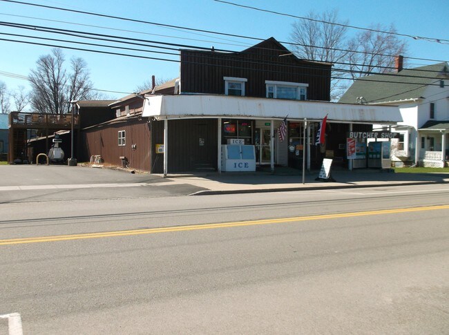
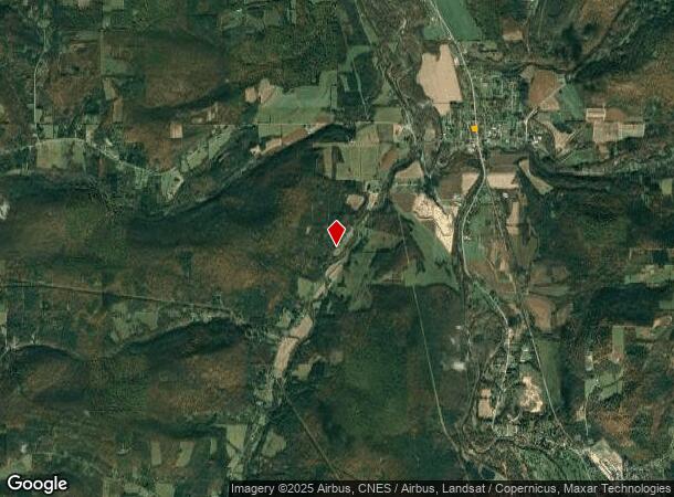
Property Record
3983 State Route 19, Scio, NY 14880
NEARBY LISTINGS FOR SALE OR LEASE
-
-
View all Scio listings for sale on LoopNet.com
Property Detail
3983 State Route 19
02660019918230
Allegany
Commercialofficeresidentialmixeduse
New York
2025
30.000
2024
1.19 AC
950600
New York West Area
7,676 SF
Other Market Areas
DEMOGRAPHICS near 3983 State Route 19
1 Mile
3 Mile
5 Mile
2024 Total Population
626
1,489
9,369
2029 Population
684
1,632
10,295
Pop Growth 2024-2029
+ 9.27%
+ 9.60%
+ 9.88%
Average Age
44
45
43
2024 Total Households
256
580
4,034
HH Growth 2024-2029
+ 9.77%
+ 10.00%
+ 10.39%
Median Household Inc
$51,739
$53,500
$54,777
Avg Household Size
2.40
2.30
2.20
2024 Avg HH Vehicles
2.00
2.00
2.00
Median Home Value
$92,104
$92,399
$79,564
Median Year Built
1957
1958
1953
Nearby Places
Map Layers
Map Styles
 Street
 Aerial
- Restaurants
- Banks
- Shops
- Fitness
- Groceries
SALE & LEASE HISTORY
LISTING DATE
SALE/LEASE

Sep 24, 2016
For Sale
Nearby Properties
Address
Land Use
TOTAL SIZE
Lot Size
Zoning
Address
Land Use
TOTAL SIZE
Lot Size
Zoning
92,082 SF
13.20 AC
01 - NOT Z
Address
Land Use
TOTAL SIZE
Lot Size
Zoning
22,601 SF
3.84 AC
01 - NOT Z
Address
Land Use
TOTAL SIZE
Lot Size
Zoning
87,666 SF
6.70 AC
01 - NOT Z
Address
Land Use
TOTAL SIZE
Lot Size
Zoning
45,731 SF
4.30 AC
05 - COMME
Address
Land Use
TOTAL SIZE
Lot Size
Zoning
6,408 SF
6.40 AC
05 - COMME
Address
Land Use
TOTAL SIZE
Lot Size
Zoning
94,077 SF
4.90 AC
Address
Land Use
TOTAL SIZE
Lot Size
Zoning
264,620 SF
98.90 AC
01 - NOT Z
Address
Land Use
TOTAL SIZE
Lot Size
Zoning
Address
Land Use
TOTAL SIZE
Lot Size
Zoning
30 AC
Address
Land Use
TOTAL SIZE
Lot Size
Zoning
8,192 SF
3.55 AC
01 - NOT Z
Address
Land Use
TOTAL SIZE
Lot Size
Zoning
15,120 SF
1.80 AC
03 - MULTI
Address
Land Use
TOTAL SIZE
Lot Size
Zoning
3,720 SF
0.40 AC
01 - NOT Z
Address
Land Use
TOTAL SIZE
Lot Size
Zoning
2,724 SF
0.89 AC
01 - NOT Z
Address
Land Use
TOTAL SIZE
Lot Size
Zoning
35.80 AC
01 - NOT Z
Address
Land Use
TOTAL SIZE
Lot Size
Zoning
572.34 AC
01 - NOT Z
Address
Land Use
TOTAL SIZE
Lot Size
Zoning
21,261 SF
1 AC
01 - NOT Z
Address
Land Use
TOTAL SIZE
Lot Size
Zoning
38,480 SF
7.84 AC
03 - MULTI
Address
Land Use
TOTAL SIZE
Lot Size
Zoning
6,908 SF
0.91 AC
05 - COMME
Address
Land Use
TOTAL SIZE
Lot Size
Zoning
14,850 SF
1.90 AC
05 - COMME
Address
Land Use
TOTAL SIZE
Lot Size
Zoning
8,240 SF
8.80 AC
01 - NOT Z
Address
Land Use
TOTAL SIZE
Lot Size
Zoning
8,199 SF
2 AC
05 - COMME
Address
Land Use
TOTAL SIZE
Lot Size
Zoning
4,478 SF
1.20 AC
05 - COMME
Address
Land Use
TOTAL SIZE
Lot Size
Zoning
13,200 SF
1.50 AC
05 - COMME
Address
Land Use
TOTAL SIZE
Lot Size
Zoning
4,500 SF
1 AC
01 - NOT Z
Address
Land Use
TOTAL SIZE
Lot Size
Zoning
75.18 AC
Address
Land Use
TOTAL SIZE
Lot Size
Zoning
27,552 SF
2.20 AC
01 - NOT Z
Address
Land Use
TOTAL SIZE
Lot Size
Zoning
2,520 SF
0.75 AC
01 - NOT Z
Address
Land Use
TOTAL SIZE
Lot Size
Zoning
3,950 SF
0.43 AC
01 - NOT Z
Address
Land Use
TOTAL SIZE
Lot Size
Zoning
20,120 SF
2.04 AC
01 - NOT Z
Address
Land Use
TOTAL SIZE
Lot Size
Zoning
2,825 SF
0.60 AC
01 - NOT Z
The World's #1 Commercial Real Estate Marketplace
Connect with us
© 2025 CoStar Group
The information above has been obtained from sources believed reliable. While we do not doubt its accuracy we have not verified it and make no guarantee, warranty or representation about it. It is your responsibility to independently confirm its accuracy and completeness. Any projections, opinions, assumptions, or estimates used are for example only and do not represent the current or future performance of the property. The value of this transaction to you depends on tax and other factors which should be evaluated by your tax, financial, and legal advisors. You and your advisors should conduct a careful, independent investigation of the property to determine to your satisfaction the suitability of the property for your needs.