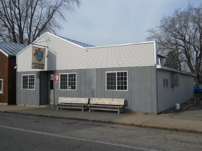
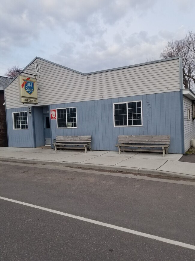
Property Record
3984 2Nd St, Amherst Junction, WI 54407

Property Detail
3984 2Nd St
Stevens Point-Plover, WI
LOT 3 - BLK 1 ORIGINAL PLAT EXCEPT THE NORTH 13' 881373
103-56-0103
Portage
Commercialnec
Wisconsin
B and X Area of moderate flood hazard, usually the area between the limits of the 100-year and 500-year floods.
3
2025
0.11 AC
2025
Wausau/Stevens Point
960600
Other Market Areas
NEARBY LISTINGS FOR SALE OR LEASE
-
-
View all Amherst Junction listings for sale on LoopNet.com
DEMOGRAPHICS near 3984 2Nd St
1 mile
3 mile
5 mile
2025 Total Population
432
2,701
4,499
2030 Population
437
2,737
4,551
Pop Growth 2025-2030
+ 1.16%
+ 1.33%
+ 1.16%
Average Age
42
42
43
2025 Total Households
165
1,065
1,780
HH Growth 2025-2030
+ 1.21%
+ 1.41%
+ 1.18%
Median Household Inc
$97,726
$78,418
$79,858
Avg Household Size
2.60
2.50
2.50
2025 Avg HH Vehicles
2.00
2.00
2.00
Median Home Value
$317,857
$279,077
$289,826
Median Year Built
1975
1975
1976
Nearby Places
Map Layers
Map Styles
 Street
 Aerial
Layers
 Traffic
 Biking
Places
Listings with unknown addresses are not visible on the map
- Restaurants
- Banks
- Shops
- Fitness
- Groceries
PUBLIC TRANSPORTATION
AIRPORT
Central Wisconsin
Drive
Walk
Distance
Central Wisconsin
42 min
32.3 mi
Freight Ports
Port Milwaukee
Drive
Walk
Distance
Port Milwaukee
167 min
142.8 mi
SALE & LEASE HISTORY
LISTING DATE
SALE/LEASE

Sep 24, 2016
For Sale
Apr 07, 2021
For Sale
Nearby Properties
Address
Land Use
TOTAL SIZE
Lot Size
Zoning
Address
Land Use
TOTAL SIZE
Lot Size
Zoning
5.66 AC
Address
Land Use
TOTAL SIZE
Lot Size
Zoning
23.03 AC
Address
Land Use
TOTAL SIZE
Lot Size
Zoning
48.20 AC
Address
Land Use
TOTAL SIZE
Lot Size
Zoning
30.16 AC
A3
Address
Land Use
TOTAL SIZE
Lot Size
Zoning
40.80 AC
A3
Address
Land Use
TOTAL SIZE
Lot Size
Zoning
Address
Land Use
TOTAL SIZE
Lot Size
Zoning
0.57 AC
Address
Land Use
TOTAL SIZE
Lot Size
Zoning
0.59 AC
Address
Land Use
TOTAL SIZE
Lot Size
Zoning
Address
Land Use
TOTAL SIZE
Lot Size
Zoning
1.53 AC
C4
Address
Land Use
TOTAL SIZE
Lot Size
Zoning
40.29 AC
A4
Address
Land Use
TOTAL SIZE
Lot Size
Zoning
Address
Land Use
TOTAL SIZE
Lot Size
Zoning
20.31 AC
A4
Address
Land Use
TOTAL SIZE
Lot Size
Zoning
1.85 AC
Address
Land Use
TOTAL SIZE
Lot Size
Zoning
0.28 AC
Address
Land Use
TOTAL SIZE
Lot Size
Zoning
0.50 AC
Address
Land Use
TOTAL SIZE
Lot Size
Zoning
3.40 AC
Address
Land Use
TOTAL SIZE
Lot Size
Zoning
3.82 AC
C4
Address
Land Use
TOTAL SIZE
Lot Size
Zoning
22.18 AC
C4
Address
Land Use
TOTAL SIZE
Lot Size
Zoning
0.59 AC
Address
Land Use
TOTAL SIZE
Lot Size
Zoning
0.59 AC
Address
Land Use
TOTAL SIZE
Lot Size
Zoning
39.41 AC
A3
Address
Land Use
TOTAL SIZE
Lot Size
Zoning
12.40 AC
Address
Land Use
TOTAL SIZE
Lot Size
Zoning
Address
Land Use
TOTAL SIZE
Lot Size
Zoning
1.09 AC
Address
Land Use
TOTAL SIZE
Lot Size
Zoning
Address
Land Use
TOTAL SIZE
Lot Size
Zoning
10 AC
A4
Address
Land Use
TOTAL SIZE
Lot Size
Zoning
33.89 AC
A3
Address
Land Use
TOTAL SIZE
Lot Size
Zoning
12.17 AC
Address
Land Use
TOTAL SIZE
Lot Size
Zoning
1.29 AC
The World's #1 Commercial Real Estate Marketplace
Connect with us
© 2026 CoStar Group
The information above has been obtained from sources believed reliable. While we do not doubt its accuracy we have not verified it and make no guarantee, warranty or representation about it. It is your responsibility to independently confirm its accuracy and completeness. Any projections, opinions, assumptions, or estimates used are for example only and do not represent the current or future performance of the property. The value of this transaction to you depends on tax and other factors which should be evaluated by your tax, financial, and legal advisors. You and your advisors should conduct a careful, independent investigation of the property to determine to your satisfaction the suitability of the property for your needs.