Property Record
3987 Rice St, Saint Paul, MN 55126


NEARBY LISTINGS FOR SALE OR LEASE
Property Detail
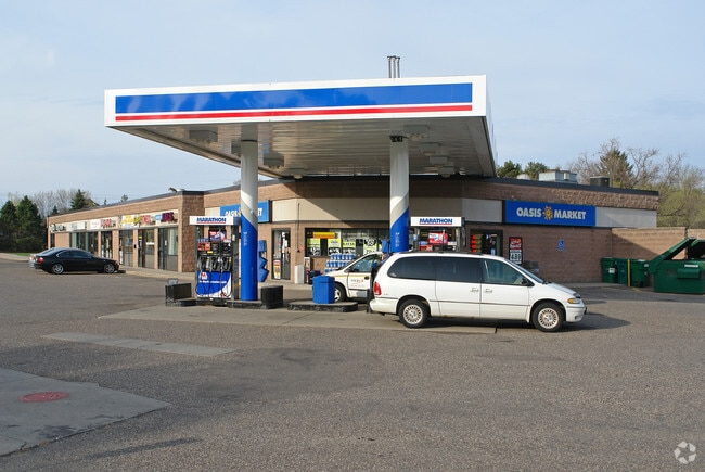
3987 Rice St
Minneapolis-St. Paul-Bloomington, MN-WI
Registered Land Survey 367
25-30-23-11-0190
REGISTERED LAND SURVEY 367 THE N 30 FT OF THE W 176.5 FT OF THE E ...IN SD RLS 367 SUB TO RD; TRACT D
Stripcommercialcenter
Ramsey
X
Minnesota
27003C0450E
tract
2024
2.17 AC
2025
Rosedale
040708
Minneapolis/St Paul
12,108 SF
DEMOGRAPHICS near 3987 Rice St
1 Mile
3 Mile
5 Mile
2024 Total Population
3,917
48,876
140,871
2029 Population
3,811
47,733
137,465
Pop Growth 2024-2029
(2.71%)
(2.34%)
(2.42%)
Average Age
42
43
42
2024 Total Households
1,453
20,300
57,596
HH Growth 2024-2029
(3.03%)
(2.56%)
(2.62%)
Median Household Inc
$148,025
$90,775
$85,730
Avg Household Size
2.60
2.30
2.40
2024 Avg HH Vehicles
2.00
2.00
2.00
Median Home Value
$435,131
$357,944
$329,657
Median Year Built
1982
1980
1977
Nearby Places
Map Layers
Map Styles
 Street
 Aerial
- Restaurants
- Banks
- Shops
- Fitness
- Groceries
PUBLIC TRANSPORTATION
COMMUTER RAIL
DRIVE
WALK
Distance
14 min
8.7 mi
Fridley Station (Northstar Corridor - Northstar Commuter Rail)
DRIVE
WALK
Distance
Fridley Station (Northstar Corridor - Northstar Commuter Rail)
15 min
9.8 mi
AIRPORT
Minneapolis-St Paul International/Wold-Chamberlain
DRIVE
WALK
Distance
Minneapolis-St Paul International/Wold-Chamberlain
28 min
17.3 mi
SALE & LEASE HISTORY
LISTING DATE
SALE/LEASE

Sep 25, 2016
For Lease
Aug 20, 2021
For Lease
Nearby Properties
Address
Land Use
TOTAL SIZE
Lot Size
Zoning
Address
Land Use
TOTAL SIZE
Lot Size
Zoning
70,115 SF
191.32 AC
Address
Land Use
TOTAL SIZE
Lot Size
Zoning
Address
Land Use
TOTAL SIZE
Lot Size
Zoning
9,320 SF
77.38 AC
Address
Land Use
TOTAL SIZE
Lot Size
Zoning
4.18 AC
Address
Land Use
TOTAL SIZE
Lot Size
Zoning
2.39 AC
Address
Land Use
TOTAL SIZE
Lot Size
Zoning
Address
Land Use
TOTAL SIZE
Lot Size
Zoning
13.44 AC
Address
Land Use
TOTAL SIZE
Lot Size
Zoning
4,800 SF
20.36 AC
Address
Land Use
TOTAL SIZE
Lot Size
Zoning
212,663 SF
3.50 AC
Address
Land Use
TOTAL SIZE
Lot Size
Zoning
159.37 AC
Address
Land Use
TOTAL SIZE
Lot Size
Zoning
150,034 SF
48.48 AC
Address
Land Use
TOTAL SIZE
Lot Size
Zoning
91,679 SF
35.89 AC
Address
Land Use
TOTAL SIZE
Lot Size
Zoning
Address
Land Use
TOTAL SIZE
Lot Size
Zoning
1.77 AC
Address
Land Use
TOTAL SIZE
Lot Size
Zoning
213,177 SF
17.86 AC
Address
Land Use
TOTAL SIZE
Lot Size
Zoning
129,278 SF
4.53 AC
Address
Land Use
TOTAL SIZE
Lot Size
Zoning
126,852 SF
11.86 AC
Address
Land Use
TOTAL SIZE
Lot Size
Zoning
67,693 SF
7.30 AC
Address
Land Use
TOTAL SIZE
Lot Size
Zoning
284,650 SF
16.60 AC
Address
Land Use
TOTAL SIZE
Lot Size
Zoning
209,830 SF
10.06 AC
Address
Land Use
TOTAL SIZE
Lot Size
Zoning
Address
Land Use
TOTAL SIZE
Lot Size
Zoning
138,655 SF
4.70 AC
Address
Land Use
TOTAL SIZE
Lot Size
Zoning
167,134 SF
6.70 AC
Address
Land Use
TOTAL SIZE
Lot Size
Zoning
123,360 SF
14.50 AC
Address
Land Use
TOTAL SIZE
Lot Size
Zoning
26,109 SF
167.19 AC
Address
Land Use
TOTAL SIZE
Lot Size
Zoning
230,592 SF
9.44 AC
Address
Land Use
TOTAL SIZE
Lot Size
Zoning
113,378 SF
13.36 AC
Address
Land Use
TOTAL SIZE
Lot Size
Zoning
147,019 SF
4.02 AC
Address
Land Use
TOTAL SIZE
Lot Size
Zoning
Address
Land Use
TOTAL SIZE
Lot Size
Zoning
The World's #1 Commercial Real Estate Marketplace
Connect with us
© 2025 CoStar Group
The information above has been obtained from sources believed reliable. While we do not doubt its accuracy we have not verified it and make no guarantee, warranty or representation about it. It is your responsibility to independently confirm its accuracy and completeness. Any projections, opinions, assumptions, or estimates used are for example only and do not represent the current or future performance of the property. The value of this transaction to you depends on tax and other factors which should be evaluated by your tax, financial, and legal advisors. You and your advisors should conduct a careful, independent investigation of the property to determine to your satisfaction the suitability of the property for your needs.