Property Record
Railroad Ave, Yuba City, CA 95991

Current Lease Availabilities
NEARBY LISTINGS FOR SALE OR LEASE
Property Detail
Railroad Ave
Sacramento
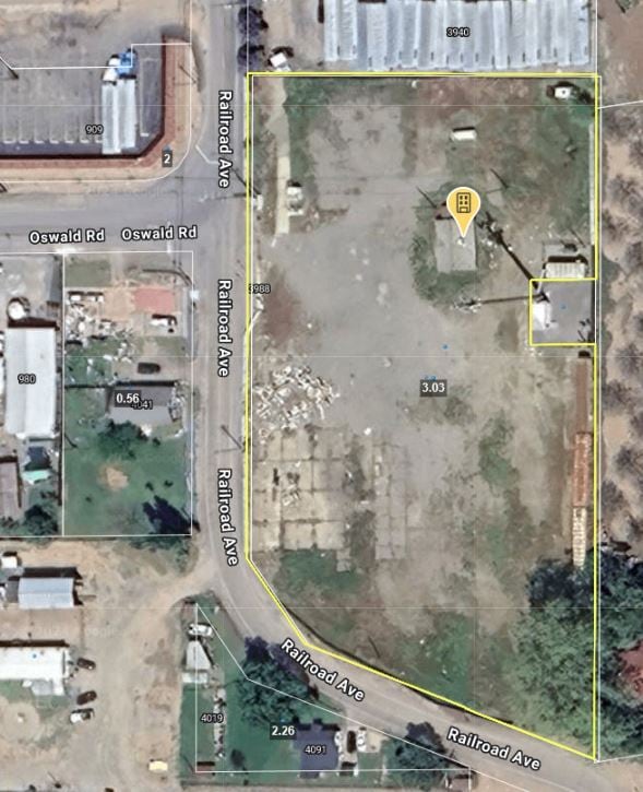
Enti Map
Yuba City, CA
FORMERLY 23-194-005-B
23-194-007
Sutter
Industrialacreage
California
2024
0.06 AC
2025
Marysville/Yuba City
050402
DEMOGRAPHICS near Railroad Ave
1 Mile
3 Mile
5 Mile
2024 Total Population
862
19,053
76,061
2029 Population
806
18,817
78,091
Pop Growth 2024-2029
(6.50%)
(1.24%)
+ 2.67%
Average Age
41
39
37
2024 Total Households
270
5,721
23,644
HH Growth 2024-2029
(6.30%)
(1.21%)
+ 2.74%
Median Household Inc
$82,639
$82,258
$64,927
Avg Household Size
3.10
3.20
3.10
2024 Avg HH Vehicles
3.00
2.00
2.00
Median Home Value
$639,380
$368,143
$332,256
Median Year Built
1965
1994
1983
Nearby Places
Map Layers
Map Styles
 Street
 Aerial
- Restaurants
- Banks
- Shops
- Fitness
- Groceries
PUBLIC TRANSPORTATION
AIRPORT
Sacramento International
DRIVE
WALK
Distance
Sacramento International
42 min
33.8 mi
Freight Ports
Port of Stockton
DRIVE
WALK
Distance
Port of Stockton
95 min
82.2 mi
Nearby Properties
Address
Land Use
TOTAL SIZE
Lot Size
Zoning
Address
Land Use
TOTAL SIZE
Lot Size
Zoning
150,742 SF
7.91 AC
R3
Address
Land Use
TOTAL SIZE
Lot Size
Zoning
30.13 AC
AI
Address
Land Use
TOTAL SIZE
Lot Size
Zoning
29,070 SF
6.84 AC
C2
Address
Land Use
TOTAL SIZE
Lot Size
Zoning
2,352 SF
4.70 AC
M1
Address
Land Use
TOTAL SIZE
Lot Size
Zoning
64,293 SF
3.32 AC
R3
Address
Land Use
TOTAL SIZE
Lot Size
Zoning
1,000 SF
215 AC
Address
Land Use
TOTAL SIZE
Lot Size
Zoning
1,440 SF
9.89 AC
AG
Address
Land Use
TOTAL SIZE
Lot Size
Zoning
33,002 SF
1 AC
C1
Address
Land Use
TOTAL SIZE
Lot Size
Zoning
61,497 SF
15 AC
M-1
Address
Land Use
TOTAL SIZE
Lot Size
Zoning
127.77 AC
AE-40
Address
Land Use
TOTAL SIZE
Lot Size
Zoning
58,502 SF
4.09 AC
CM
Address
Land Use
TOTAL SIZE
Lot Size
Zoning
1,800 SF
14.85 AC
AG
Address
Land Use
TOTAL SIZE
Lot Size
Zoning
10,800 SF
1.01 AC
Address
Land Use
TOTAL SIZE
Lot Size
Zoning
5,081 SF
10.80 AC
C2
Address
Land Use
TOTAL SIZE
Lot Size
Zoning
10,800 SF
1.05 AC
C2
Address
Land Use
TOTAL SIZE
Lot Size
Zoning
7,420 SF
1.52 AC
C2
Address
Land Use
TOTAL SIZE
Lot Size
Zoning
10,000 SF
1.43 AC
Address
Land Use
TOTAL SIZE
Lot Size
Zoning
77.50 AC
Address
Land Use
TOTAL SIZE
Lot Size
Zoning
18,403 SF
10 AC
AG
Address
Land Use
TOTAL SIZE
Lot Size
Zoning
9,102 SF
1 AC
CM
Address
Land Use
TOTAL SIZE
Lot Size
Zoning
4,640 SF
40.55 AC
AG
Address
Land Use
TOTAL SIZE
Lot Size
Zoning
78.50 AC
Address
Land Use
TOTAL SIZE
Lot Size
Zoning
2,201 SF
77.44 AC
AG
Address
Land Use
TOTAL SIZE
Lot Size
Zoning
16,608 SF
5.72 AC
AG
Address
Land Use
TOTAL SIZE
Lot Size
Zoning
36,812 SF
1.67 AC
M1
Address
Land Use
TOTAL SIZE
Lot Size
Zoning
3,000 SF
0.61 AC
C2
Address
Land Use
TOTAL SIZE
Lot Size
Zoning
1,062 SF
213.20 AC
AG
Address
Land Use
TOTAL SIZE
Lot Size
Zoning
968 SF
40.25 AC
Address
Land Use
TOTAL SIZE
Lot Size
Zoning
84.58 AC
Address
Land Use
TOTAL SIZE
Lot Size
Zoning
43,218 SF
2.49 AC
M2
The World's #1 Commercial Real Estate Marketplace
Connect with us
© 2026 CoStar Group
The information above has been obtained from sources believed reliable. While we do not doubt its accuracy we have not verified it and make no guarantee, warranty or representation about it. It is your responsibility to independently confirm its accuracy and completeness. Any projections, opinions, assumptions, or estimates used are for example only and do not represent the current or future performance of the property. The value of this transaction to you depends on tax and other factors which should be evaluated by your tax, financial, and legal advisors. You and your advisors should conduct a careful, independent investigation of the property to determine to your satisfaction the suitability of the property for your needs.