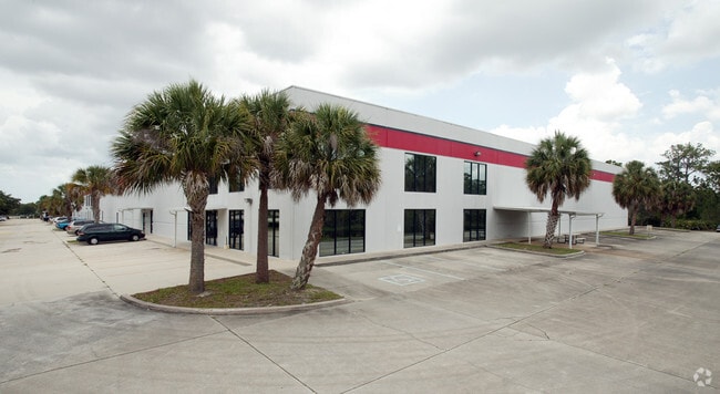
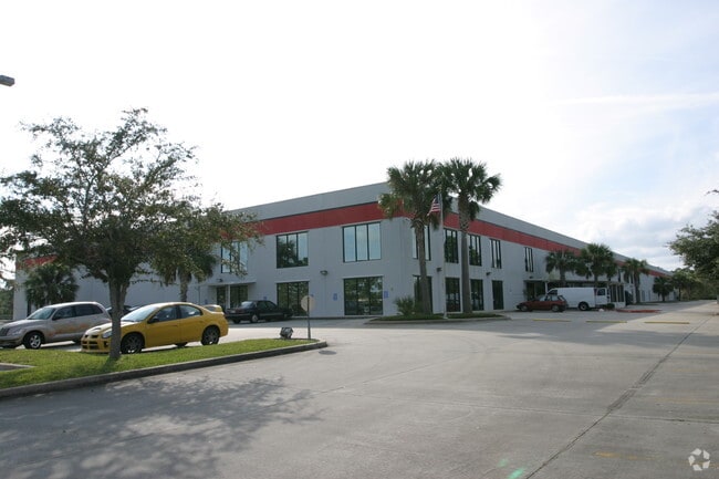
Property Record
3989 Pepsi Cola Dr, Melbourne, FL 32934

NEARBY LISTINGS FOR SALE OR LEASE
Property Detail
3989 Pepsi Cola Dr
27-36-23-00-00756.0-0000.00
PART OF N 1/2 OF SE 1/4 AS DES IN ORB 3012 PG 1803
Warehouse
Brevard
X
Florida
12009C0577G
6.88 AC
2024
Brevard County
2025
Orlando
064129
Palm Bay-Melbourne-Titusville, FL
119,111 SF
DEMOGRAPHICS near 3989 Pepsi Cola Dr
1 Mile
3 Mile
5 Mile
2024 Total Population
3,877
38,680
95,456
2029 Population
4,205
42,070
104,094
Pop Growth 2024-2029
+ 8.46%
+ 8.76%
+ 9.05%
Average Age
44
43
44
2024 Total Households
1,550
16,571
40,321
HH Growth 2024-2029
+ 8.39%
+ 8.50%
+ 8.83%
Median Household Inc
$63,000
$67,246
$68,504
Avg Household Size
2.40
2.20
2.30
2024 Avg HH Vehicles
2.00
2.00
2.00
Median Home Value
$242,837
$245,521
$263,300
Median Year Built
1993
1983
1985
Nearby Places
Map Layers
Map Styles
 Street
 Aerial
- Restaurants
- Banks
- Shops
- Fitness
- Groceries
PUBLIC TRANSPORTATION
AIRPORT
Melbourne Orlando International
DRIVE
WALK
Distance
Melbourne Orlando International
14 min
5.9 mi
Freight Ports
Port Canaveral
DRIVE
WALK
Distance
Port Canaveral
42 min
32.6 mi
SALE & LEASE HISTORY
LISTING DATE
SALE/LEASE

May 16, 2018
For Lease
Nearby Properties
Address
Land Use
TOTAL SIZE
Lot Size
Zoning
Address
Land Use
TOTAL SIZE
Lot Size
Zoning
438,381 SF
25.66 AC
R2
Address
Land Use
TOTAL SIZE
Lot Size
Zoning
433,669 SF
21.22 AC
AU
Address
Land Use
TOTAL SIZE
Lot Size
Zoning
425,167 SF
43.33 AC
Address
Land Use
TOTAL SIZE
Lot Size
Zoning
265,272 SF
21.17 AC
M1
Address
Land Use
TOTAL SIZE
Lot Size
Zoning
265,062 SF
14.75 AC
M1
Address
Land Use
TOTAL SIZE
Lot Size
Zoning
384,430 SF
33.07 AC
R2
Address
Land Use
TOTAL SIZE
Lot Size
Zoning
363,826 SF
25.61 AC
RA
Address
Land Use
TOTAL SIZE
Lot Size
Zoning
236,982 SF
39.26 AC
EU2
Address
Land Use
TOTAL SIZE
Lot Size
Zoning
261,552 SF
23.21 AC
R2
Address
Land Use
TOTAL SIZE
Lot Size
Zoning
328,357 SF
34.11 AC
I1
Address
Land Use
TOTAL SIZE
Lot Size
Zoning
296,436 SF
28.05 AC
Address
Land Use
TOTAL SIZE
Lot Size
Zoning
222,779 SF
22.58 AC
R2
Address
Land Use
TOTAL SIZE
Lot Size
Zoning
188,237 SF
13.97 AC
R2
Address
Land Use
TOTAL SIZE
Lot Size
Zoning
253,120 SF
16.02 AC
R2
Address
Land Use
TOTAL SIZE
Lot Size
Zoning
74,716 SF
366.45 AC
M1
Address
Land Use
TOTAL SIZE
Lot Size
Zoning
205,564 SF
14.56 AC
M1
Address
Land Use
TOTAL SIZE
Lot Size
Zoning
198,876 SF
64.32 AC
M1
Address
Land Use
TOTAL SIZE
Lot Size
Zoning
175,610 SF
10.01 AC
CCP(15)
Address
Land Use
TOTAL SIZE
Lot Size
Zoning
146,527 SF
42.12 AC
M-1
Address
Land Use
TOTAL SIZE
Lot Size
Zoning
131,585 SF
10 AC
R2
Address
Land Use
TOTAL SIZE
Lot Size
Zoning
200,878 SF
16.41 AC
R2
Address
Land Use
TOTAL SIZE
Lot Size
Zoning
132,340 SF
14.58 AC
R2
Address
Land Use
TOTAL SIZE
Lot Size
Zoning
239,767 SF
24.47 AC
M1
Address
Land Use
TOTAL SIZE
Lot Size
Zoning
142,230 SF
13.33 AC
C1
Address
Land Use
TOTAL SIZE
Lot Size
Zoning
81,720 SF
13.20 AC
Address
Land Use
TOTAL SIZE
Lot Size
Zoning
171,773 SF
8.02 AC
R2
Address
Land Use
TOTAL SIZE
Lot Size
Zoning
196,340 SF
20.46 AC
CP
Address
Land Use
TOTAL SIZE
Lot Size
Zoning
147,729 SF
9.32 AC
I1
Address
Land Use
TOTAL SIZE
Lot Size
Zoning
92,119 SF
14.64 AC
I1
Address
Land Use
TOTAL SIZE
Lot Size
Zoning
178,657 SF
19.46 AC
M1
The World's #1 Commercial Real Estate Marketplace
Connect with us
© 2026 CoStar Group
The information above has been obtained from sources believed reliable. While we do not doubt its accuracy we have not verified it and make no guarantee, warranty or representation about it. It is your responsibility to independently confirm its accuracy and completeness. Any projections, opinions, assumptions, or estimates used are for example only and do not represent the current or future performance of the property. The value of this transaction to you depends on tax and other factors which should be evaluated by your tax, financial, and legal advisors. You and your advisors should conduct a careful, independent investigation of the property to determine to your satisfaction the suitability of the property for your needs.