Property Record
399 S 2650 W, Salt Lake City, UT 84104

NEARBY LISTINGS FOR SALE OR LEASE
Property Detail
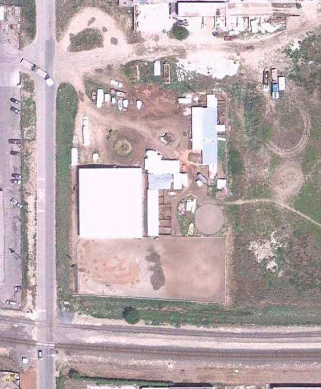
399 S 2650 W
Salt Lake City-Murray, UT
Brighton Farming Plat
15-04-402-013-0000
BEG N 40.2 RDS & E 60 FT FR SW COR OF LOT 1, BLK 29, BRIGHTON FARMING PLAT; N 33 FT; E 549.04 FT; S 382.56 FT; WLY ALG A 3739.83 FT RADIUS CURVE TO R 284.18 FT; N 328.31 FT; W 264.36 FT; N 23 FT TO BEG. 2.85 AC M OR L. 9114-2330,2335,2334 9126-5022
Industrialacreage
Salt Lake
X
Utah
49011C0525E
1
2024
2.85 AC
2025
West Valley/Lake Park
114500
Salt Lake City
DEMOGRAPHICS near 399 S 2650 W
1 Mile
3 Mile
5 Mile
2024 Total Population
2,339
62,383
189,346
2029 Population
2,371
63,427
192,570
Pop Growth 2024-2029
+ 1.37%
+ 1.67%
+ 1.70%
Average Age
34
35
36
2024 Total Households
991
22,395
77,485
HH Growth 2024-2029
+ 1.31%
+ 2.27%
+ 2.25%
Median Household Inc
$46,644
$56,651
$57,894
Avg Household Size
2.30
2.60
2.30
2024 Avg HH Vehicles
1.00
2.00
2.00
Median Home Value
$160,869
$309,913
$364,664
Median Year Built
1982
1979
1975
Nearby Places
Map Layers
Map Styles
 Street
 Aerial
- Restaurants
- Banks
- Shops
- Fitness
- Groceries
PUBLIC TRANSPORTATION
COMMUTER RAIL
North Temple Station (FrontRunner - Utah Transit Authority (UTA))
DRIVE
WALK
Distance
North Temple Station (FrontRunner - Utah Transit Authority (UTA))
13 min
4.5 mi
Warm Springs Relief Point (FrontRunner - Utah Transit Authority (UTA))
DRIVE
WALK
Distance
Warm Springs Relief Point (FrontRunner - Utah Transit Authority (UTA))
14 min
5.7 mi
AIRPORT
Salt Lake City International
DRIVE
WALK
Distance
Salt Lake City International
13 min
5.8 mi
Freight Ports
Port of Stockton
DRIVE
WALK
Distance
Port of Stockton
714 min
696.2 mi
Nearby Properties
Address
Land Use
TOTAL SIZE
Lot Size
Zoning
Address
Land Use
TOTAL SIZE
Lot Size
Zoning
427,316 SF
12.31 AC
AIRPRT
Address
Land Use
TOTAL SIZE
Lot Size
Zoning
1,523,947 SF
37.63 AC
AIR
Address
Land Use
TOTAL SIZE
Lot Size
Zoning
186,429 SF
101 AC
AIRPRT
Address
Land Use
TOTAL SIZE
Lot Size
Zoning
1,330,058 SF
5.02 AC
D2
Address
Land Use
TOTAL SIZE
Lot Size
Zoning
836,183 SF
5.89 AC
TSA-UC
Address
Land Use
TOTAL SIZE
Lot Size
Zoning
691,465 SF
18.57 AC
3000
Address
Land Use
TOTAL SIZE
Lot Size
Zoning
0.01 AC
D-4
Address
Land Use
TOTAL SIZE
Lot Size
Zoning
22,022 SF
308 AC
AIRPRT
Address
Land Use
TOTAL SIZE
Lot Size
Zoning
366,584 SF
1.95 AC
TSAUC
Address
Land Use
TOTAL SIZE
Lot Size
Zoning
617,901 SF
2.73 AC
TSA-UC
Address
Land Use
TOTAL SIZE
Lot Size
Zoning
248,345 SF
50 AC
PL
Address
Land Use
TOTAL SIZE
Lot Size
Zoning
252,420 SF
15.26 AC
TSA-MU
Address
Land Use
TOTAL SIZE
Lot Size
Zoning
210,623 SF
1.35 AC
TSAUCC
Address
Land Use
TOTAL SIZE
Lot Size
Zoning
472,757 SF
3.20 AC
GMU
Address
Land Use
TOTAL SIZE
Lot Size
Zoning
86,072 SF
240 AC
AIRPOR
Address
Land Use
TOTAL SIZE
Lot Size
Zoning
146,652 SF
16.63 AC
RMF-45
Address
Land Use
TOTAL SIZE
Lot Size
Zoning
322,076 SF
16.32 AC
PL
Address
Land Use
TOTAL SIZE
Lot Size
Zoning
434,985 SF
74.85 AC
AIRPOR
Address
Land Use
TOTAL SIZE
Lot Size
Zoning
243,202 SF
18.71 AC
BP
Address
Land Use
TOTAL SIZE
Lot Size
Zoning
171,839 SF
17.80 AC
CG
Address
Land Use
TOTAL SIZE
Lot Size
Zoning
77,693 SF
2.99 AC
TSA-MU
Address
Land Use
TOTAL SIZE
Lot Size
Zoning
429,554 SF
24.49 AC
M1
Address
Land Use
TOTAL SIZE
Lot Size
Zoning
127,348 SF
4.55 AC
BP
Address
Land Use
TOTAL SIZE
Lot Size
Zoning
7,180 SF
285.05 AC
AIRPRT
Address
Land Use
TOTAL SIZE
Lot Size
Zoning
1,932 SF
33.44 AC
TSAMUC
Address
Land Use
TOTAL SIZE
Lot Size
Zoning
505,800 SF
23.87 AC
M-1
Address
Land Use
TOTAL SIZE
Lot Size
Zoning
11,040 SF
175.57 AC
AIRPRT
Address
Land Use
TOTAL SIZE
Lot Size
Zoning
232,795 SF
2.57 AC
GMU
Address
Land Use
TOTAL SIZE
Lot Size
Zoning
319,914 SF
1.24 AC
GMU
Address
Land Use
TOTAL SIZE
Lot Size
Zoning
120 AC
AIRPOR
The World's #1 Commercial Real Estate Marketplace
Connect with us
© 2026 CoStar Group
The information above has been obtained from sources believed reliable. While we do not doubt its accuracy we have not verified it and make no guarantee, warranty or representation about it. It is your responsibility to independently confirm its accuracy and completeness. Any projections, opinions, assumptions, or estimates used are for example only and do not represent the current or future performance of the property. The value of this transaction to you depends on tax and other factors which should be evaluated by your tax, financial, and legal advisors. You and your advisors should conduct a careful, independent investigation of the property to determine to your satisfaction the suitability of the property for your needs.