Property Record
39901 Traditions Dr, Northville, MI 48168
NEARBY LISTINGS FOR SALE OR LEASE
-
-
View all Northville listings for sale on LoopNet.com
Property Detail
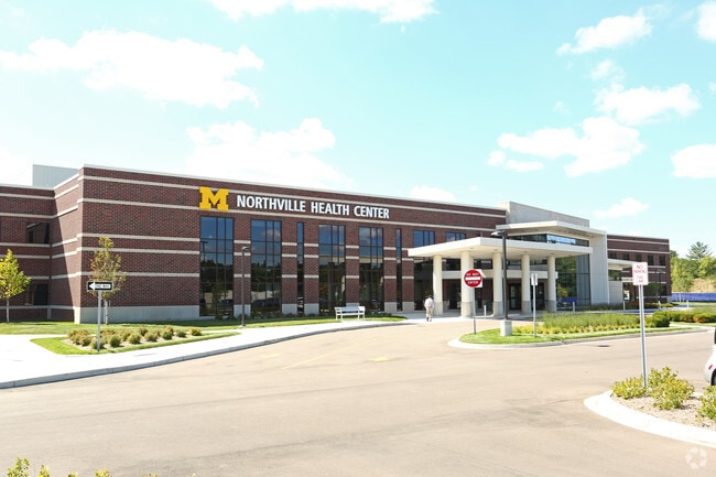
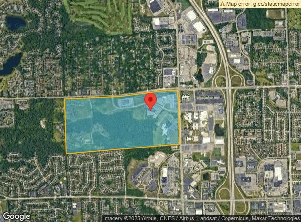
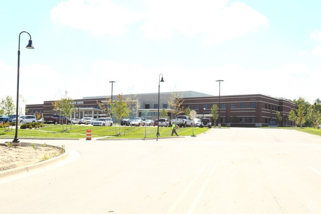
39901 Traditions Dr
Detroit-Warren-Dearborn, MI
Maple Hill
77-045-99-0001-705
PART OF THE NE 1/4 OF SEC 12, T. 1 S, R. 8 E, TWP OF NVILLE, WAYNE COUNTY, MI, DESC AS: COMMENCING AT THE E 1/4 COR OF SAID SEC 12; TH S86?51'00"W 1384.05 FT ALONG THE E-W 1/4 LINE OF SAID SEC 12; TH N01?40'17"E 942.92 FT; TH N36?50'06"E 414.06 FT TO
Medicalbuilding
Wayne
X
Michigan
26163C0037E
0001
2025
10.48 AC
2025
Southern I-275 Corridor
560300
Detroit
102,878 SF
DEMOGRAPHICS near 39901 Traditions Dr
1 Mile
3 Mile
5 Mile
2024 Total Population
4,009
68,275
176,031
2029 Population
3,852
66,061
170,593
Pop Growth 2024-2029
(3.92%)
(3.24%)
(3.09%)
Average Age
49
44
43
2024 Total Households
1,691
28,709
74,279
HH Growth 2024-2029
(3.84%)
(3.15%)
(3.07%)
Median Household Inc
$100,357
$107,397
$103,773
Avg Household Size
2.20
2.30
2.30
2024 Avg HH Vehicles
2.00
2.00
2.00
Median Home Value
$402,694
$331,088
$319,294
Median Year Built
1988
1978
1976
Nearby Places
Map Layers
Map Styles
 Street
 Aerial
- Restaurants
- Banks
- Shops
- Fitness
- Groceries
PUBLIC TRANSPORTATION
AIRPORT
Detroit Metro Wayne County
DRIVE
WALK
Distance
Detroit Metro Wayne County
27 min
21.6 mi
Windsor International
DRIVE
WALK
Distance
Windsor International
54 min
35.8 mi
Freight Ports
Port of Toledo
DRIVE
WALK
Distance
Port of Toledo
77 min
63.3 mi
Nearby Properties
Address
Land Use
TOTAL SIZE
Lot Size
Zoning
Address
Land Use
TOTAL SIZE
Lot Size
Zoning
234,403 SF
74.21 AC
OS
Address
Land Use
TOTAL SIZE
Lot Size
Zoning
250,699 SF
16.89 AC
SH
Address
Land Use
TOTAL SIZE
Lot Size
Zoning
182,121 SF
10.85 AC
HPUD
Address
Land Use
TOTAL SIZE
Lot Size
Zoning
42.06 AC
RM-1
Address
Land Use
TOTAL SIZE
Lot Size
Zoning
38 AC
RM-1
Address
Land Use
TOTAL SIZE
Lot Size
Zoning
325,281 SF
36.25 AC
AI
Address
Land Use
TOTAL SIZE
Lot Size
Zoning
327,206 SF
29.93 AC
AI
Address
Land Use
TOTAL SIZE
Lot Size
Zoning
192,478 SF
IND
Address
Land Use
TOTAL SIZE
Lot Size
Zoning
289,722 SF
7.34 AC
C-2
Address
Land Use
TOTAL SIZE
Lot Size
Zoning
334,346 SF
55.65 AC
TAR
Address
Land Use
TOTAL SIZE
Lot Size
Zoning
228,748 SF
25.06 AC
AI
Address
Land Use
TOTAL SIZE
Lot Size
Zoning
30.32 AC
RM-1
Address
Land Use
TOTAL SIZE
Lot Size
Zoning
5,339 SF
20.10 AC
R-3
Address
Land Use
TOTAL SIZE
Lot Size
Zoning
214,242 SF
22.40 AC
AI
Address
Land Use
TOTAL SIZE
Lot Size
Zoning
730,656 SF
13.73 AC
C-4
Address
Land Use
TOTAL SIZE
Lot Size
Zoning
206,496 SF
12.72 AC
PO
Address
Land Use
TOTAL SIZE
Lot Size
Zoning
283,710 SF
IND
Address
Land Use
TOTAL SIZE
Lot Size
Zoning
80,574 SF
19.95 AC
7MIPUD
Address
Land Use
TOTAL SIZE
Lot Size
Zoning
9,706 SF
40.41 AC
RM-1
Address
Land Use
TOTAL SIZE
Lot Size
Zoning
113,292 SF
15.79 AC
IND
Address
Land Use
TOTAL SIZE
Lot Size
Zoning
129,448 SF
9.37 AC
OSC
Address
Land Use
TOTAL SIZE
Lot Size
Zoning
110,220 SF
0.78 AC
CBD
Address
Land Use
TOTAL SIZE
Lot Size
Zoning
46.60 AC
R-3
Address
Land Use
TOTAL SIZE
Lot Size
Zoning
78,164 SF
5.51 AC
PUD
Address
Land Use
TOTAL SIZE
Lot Size
Zoning
66,109 SF
35.02 AC
PO
Address
Land Use
TOTAL SIZE
Lot Size
Zoning
976 SF
26.85 AC
RM-1
Address
Land Use
TOTAL SIZE
Lot Size
Zoning
Address
Land Use
TOTAL SIZE
Lot Size
Zoning
152,414 SF
13.91 AC
RM-1
Address
Land Use
TOTAL SIZE
Lot Size
Zoning
16.54 AC
RM-1
The World's #1 Commercial Real Estate Marketplace
Connect with us
© 2025 CoStar Group
The information above has been obtained from sources believed reliable. While we do not doubt its accuracy we have not verified it and make no guarantee, warranty or representation about it. It is your responsibility to independently confirm its accuracy and completeness. Any projections, opinions, assumptions, or estimates used are for example only and do not represent the current or future performance of the property. The value of this transaction to you depends on tax and other factors which should be evaluated by your tax, financial, and legal advisors. You and your advisors should conduct a careful, independent investigation of the property to determine to your satisfaction the suitability of the property for your needs.