Property Record
3991 Highway 78 W, Snellville, GA 30039


Property Detail
3991 Highway 78 W
6-054-276
L1 BA KILLIAN/78 COMMERCIAL #1
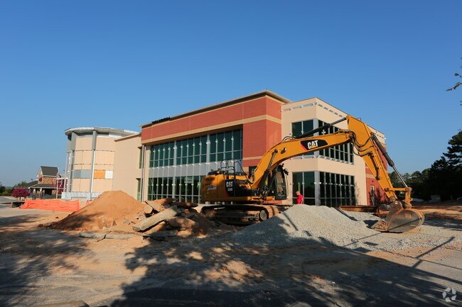
Medicalbuilding
Gwinnett
C2
Georgia
B and X Area of moderate flood hazard, usually the area between the limits of the 100-year and 500-year floods.
1
2025
2.71 AC
2025
Lawrenceville/Lilburn
050764
Atlanta
25,698 SF
Atlanta-Sandy Springs-Roswell, GA
NEARBY LISTINGS FOR SALE OR LEASE
DEMOGRAPHICS near 3991 Highway 78 W
1 mile
3 mile
5 mile
2025 Total Population
8,432
66,086
166,993
2030 Population
8,722
68,725
173,400
Pop Growth 2025-2030
+ 3.44%
+ 3.99%
+ 3.84%
Average Age
37
39
39
2025 Total Households
2,931
21,678
54,478
HH Growth 2025-2030
+ 3.58%
+ 4.10%
+ 3.88%
Median Household Inc
$86,436
$93,421
$97,037
Avg Household Size
2.80
3.00
3.00
2025 Avg HH Vehicles
2.00
2.00
2.00
Median Home Value
$331,250
$360,192
$371,908
Median Year Built
1987
1986
1987
Nearby Places
Map Layers
Map Styles
 Street
 Aerial
Layers
 Traffic
 Biking
Places
Listings with unknown addresses are not visible on the map
- Restaurants
- Banks
- Shops
- Fitness
- Groceries
PUBLIC TRANSPORTATION
AIRPORT
Hartsfield - Jackson Atlanta International
Drive
Walk
Distance
Hartsfield - Jackson Atlanta International
45 min
29.9 mi
SALE & LEASE HISTORY
LISTING DATE
SALE/LEASE

Sep 25, 2016
For Lease
Nearby Properties
Address
Land Use
TOTAL SIZE
Lot Size
Zoning
Address
Land Use
TOTAL SIZE
Lot Size
Zoning
301,646 SF
23.90 AC
RM13
Address
Land Use
TOTAL SIZE
Lot Size
Zoning
462,669 SF
102.65 AC
R100
Address
Land Use
TOTAL SIZE
Lot Size
Zoning
232,617 SF
19.61 AC
RM
Address
Land Use
TOTAL SIZE
Lot Size
Zoning
307,313 SF
15.60 AC
RM24
Address
Land Use
TOTAL SIZE
Lot Size
Zoning
278,756 SF
27.72 AC
RM
Address
Land Use
TOTAL SIZE
Lot Size
Zoning
175,045 SF
13.01 AC
RM
Address
Land Use
TOTAL SIZE
Lot Size
Zoning
113,100 SF
11.39 AC
C2
Address
Land Use
TOTAL SIZE
Lot Size
Zoning
38,438 SF
130.10 AC
R100
Address
Land Use
TOTAL SIZE
Lot Size
Zoning
139,448 SF
15.97 AC
RM
Address
Land Use
TOTAL SIZE
Lot Size
Zoning
217,730 SF
29.68 AC
C2
Address
Land Use
TOTAL SIZE
Lot Size
Zoning
120,113 SF
13 AC
BG
Address
Land Use
TOTAL SIZE
Lot Size
Zoning
99,280 SF
4.51 AC
C2
Address
Land Use
TOTAL SIZE
Lot Size
Zoning
106,114 SF
16.59 AC
C2
Address
Land Use
TOTAL SIZE
Lot Size
Zoning
97,411 SF
8.47 AC
BG
Address
Land Use
TOTAL SIZE
Lot Size
Zoning
89,686 SF
18.29 AC
C2
Address
Land Use
TOTAL SIZE
Lot Size
Zoning
103,821 SF
10.80 AC
M1
Address
Land Use
TOTAL SIZE
Lot Size
Zoning
48,985 SF
17.87 AC
C2
Address
Land Use
TOTAL SIZE
Lot Size
Zoning
57,322 SF
9.18 AC
C2
Address
Land Use
TOTAL SIZE
Lot Size
Zoning
80,310 SF
4.92 AC
C2
Address
Land Use
TOTAL SIZE
Lot Size
Zoning
91,096 SF
28.67 AC
OI
Address
Land Use
TOTAL SIZE
Lot Size
Zoning
100,000 SF
10.39 AC
C2
Address
Land Use
TOTAL SIZE
Lot Size
Zoning
99,893 SF
7.48 AC
OI
Address
Land Use
TOTAL SIZE
Lot Size
Zoning
52,262 SF
6.02 AC
C3
Address
Land Use
TOTAL SIZE
Lot Size
Zoning
83,316 SF
7 AC
R100
Address
Land Use
TOTAL SIZE
Lot Size
Zoning
103,700 SF
10.20 AC
C2
Address
Land Use
TOTAL SIZE
Lot Size
Zoning
90,000 SF
9.32 AC
M1
Address
Land Use
TOTAL SIZE
Lot Size
Zoning
88,110 SF
8.01 AC
C2
Address
Land Use
TOTAL SIZE
Lot Size
Zoning
98,336 SF
6.98 AC
C2
Address
Land Use
TOTAL SIZE
Lot Size
Zoning
140,226 SF
17.12 AC
C2
Address
Land Use
TOTAL SIZE
Lot Size
Zoning
62,377 SF
6.42 AC
OI
The World's #1 Commercial Real Estate Marketplace
Connect with us
© 2026 CoStar Group
The information above has been obtained from sources believed reliable. While we do not doubt its accuracy we have not verified it and make no guarantee, warranty or representation about it. It is your responsibility to independently confirm its accuracy and completeness. Any projections, opinions, assumptions, or estimates used are for example only and do not represent the current or future performance of the property. The value of this transaction to you depends on tax and other factors which should be evaluated by your tax, financial, and legal advisors. You and your advisors should conduct a careful, independent investigation of the property to determine to your satisfaction the suitability of the property for your needs.