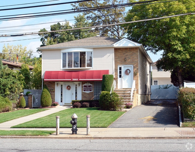
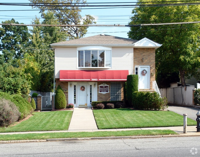
Property Record
3993 Richmond Ave, Staten Island, NY 10312
NEARBY LISTINGS FOR SALE OR LEASE
Property Detail
3993 Richmond Ave
05243-0031
Staten Island
Commercialofficeresidentialmixeduse
New York
X
31
3604970316F
0.13 AC
2024
Staten Island
2025
Long Island (New York)
015601
New York-Jersey City-White Plains, NY-NJ
2,500 SF
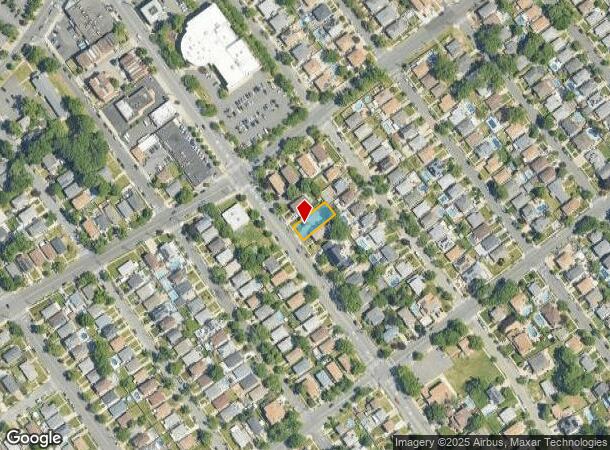
DEMOGRAPHICS near 3993 Richmond Ave
1 Mile
3 Mile
5 Mile
2024 Total Population
34,207
142,998
278,436
2029 Population
33,638
140,803
273,744
Pop Growth 2024-2029
(1.66%)
(1.53%)
(1.69%)
Average Age
43
43
42
2024 Total Households
12,402
51,770
98,267
HH Growth 2024-2029
(1.77%)
(1.61%)
(1.76%)
Median Household Inc
$118,014
$102,599
$96,140
Avg Household Size
2.70
2.70
2.80
2024 Avg HH Vehicles
2.00
2.00
2.00
Median Home Value
$710,626
$669,043
$662,085
Median Year Built
1972
1978
1977
Nearby Places
Map Layers
Map Styles
 Street
 Aerial
- Restaurants
- Banks
- Shops
- Fitness
- Groceries
PUBLIC TRANSPORTATION
TRANSIT/SUBWAY
Eltingville (Staten Island Railway - New York MTA Subway (The Subway))
DRIVE
WALK
Distance
Eltingville (Staten Island Railway - New York MTA Subway (The Subway))
1 min
6 min
0.3 mi
Great Kills (Staten Island Railway - New York MTA Subway (The Subway))
DRIVE
WALK
Distance
Great Kills (Staten Island Railway - New York MTA Subway (The Subway))
4 min
20 min
1.0 mi
COMMUTER RAIL
Eltingville (Staten Island Railway - New York MTA Subway (The Subway))
DRIVE
WALK
Distance
Eltingville (Staten Island Railway - New York MTA Subway (The Subway))
1 min
6 min
0.3 mi
Great Kills (Staten Island Railway - New York MTA Subway (The Subway))
DRIVE
WALK
Distance
Great Kills (Staten Island Railway - New York MTA Subway (The Subway))
4 min
1.1 mi
AIRPORT
Newark Liberty International
DRIVE
WALK
Distance
Newark Liberty International
30 min
17.3 mi
LaGuardia
DRIVE
WALK
Distance
LaGuardia
48 min
27.1 mi
John F Kennedy International
DRIVE
WALK
Distance
John F Kennedy International
47 min
29.8 mi
Freight Ports
New York Container Terminal
DRIVE
WALK
Distance
New York Container Terminal
16 min
7.7 mi
Nearby Properties
Address
Land Use
TOTAL SIZE
Lot Size
Zoning
Address
Land Use
TOTAL SIZE
Lot Size
Zoning
3,600 SF
731.18 AC
PARK
Address
Land Use
TOTAL SIZE
Lot Size
Zoning
237 AC
M1-1
Address
Land Use
TOTAL SIZE
Lot Size
Zoning
118 AC
M3-1
Address
Land Use
TOTAL SIZE
Lot Size
Zoning
1,258,042 SF
14.47 AC
C4-1
Address
Land Use
TOTAL SIZE
Lot Size
Zoning
146 AC
PARK
Address
Land Use
TOTAL SIZE
Lot Size
Zoning
411,000 SF
18.54 AC
R3X
Address
Land Use
TOTAL SIZE
Lot Size
Zoning
195,395 SF
12.04 AC
R3-2
Address
Land Use
TOTAL SIZE
Lot Size
Zoning
11,140 SF
170.60 AC
PARK
Address
Land Use
TOTAL SIZE
Lot Size
Zoning
220,240 SF
5.77 AC
R3X
Address
Land Use
TOTAL SIZE
Lot Size
Zoning
294,320 SF
15 AC
R3-2
Address
Land Use
TOTAL SIZE
Lot Size
Zoning
38.58 AC
PARK
Address
Land Use
TOTAL SIZE
Lot Size
Zoning
505,000 SF
3.79 AC
R3A
Address
Land Use
TOTAL SIZE
Lot Size
Zoning
33.36 AC
PARK
Address
Land Use
TOTAL SIZE
Lot Size
Zoning
377,678 SF
25.40 AC
C4-1
Address
Land Use
TOTAL SIZE
Lot Size
Zoning
28.97 AC
PARK
Address
Land Use
TOTAL SIZE
Lot Size
Zoning
26.08 AC
PARK
Address
Land Use
TOTAL SIZE
Lot Size
Zoning
180,000 SF
91.83 AC
M3-1
Address
Land Use
TOTAL SIZE
Lot Size
Zoning
192,000 SF
5.47 AC
R3X
Address
Land Use
TOTAL SIZE
Lot Size
Zoning
319,000 SF
18.76 AC
C4-1
Address
Land Use
TOTAL SIZE
Lot Size
Zoning
151,637 SF
7.41 AC
C4-1
Address
Land Use
TOTAL SIZE
Lot Size
Zoning
188,692 SF
9.66 AC
R3-2
Address
Land Use
TOTAL SIZE
Lot Size
Zoning
26.45 AC
PARK
Address
Land Use
TOTAL SIZE
Lot Size
Zoning
80,875 SF
283.97 AC
M3-1
Address
Land Use
TOTAL SIZE
Lot Size
Zoning
109,000 SF
3.38 AC
R3X
Address
Land Use
TOTAL SIZE
Lot Size
Zoning
180,000 SF
2.28 AC
R2
Address
Land Use
TOTAL SIZE
Lot Size
Zoning
126,000 SF
6.36 AC
R3-2
Address
Land Use
TOTAL SIZE
Lot Size
Zoning
27.90 AC
R3X
Address
Land Use
TOTAL SIZE
Lot Size
Zoning
24,000 SF
7.46 AC
C8-1
Address
Land Use
TOTAL SIZE
Lot Size
Zoning
2,750 SF
53.95 AC
R3-2
Address
Land Use
TOTAL SIZE
Lot Size
Zoning
100,780 SF
3.60 AC
R1-2
The World's #1 Commercial Real Estate Marketplace
Connect with us
© 2025 CoStar Group
The information above has been obtained from sources believed reliable. While we do not doubt its accuracy we have not verified it and make no guarantee, warranty or representation about it. It is your responsibility to independently confirm its accuracy and completeness. Any projections, opinions, assumptions, or estimates used are for example only and do not represent the current or future performance of the property. The value of this transaction to you depends on tax and other factors which should be evaluated by your tax, financial, and legal advisors. You and your advisors should conduct a careful, independent investigation of the property to determine to your satisfaction the suitability of the property for your needs.