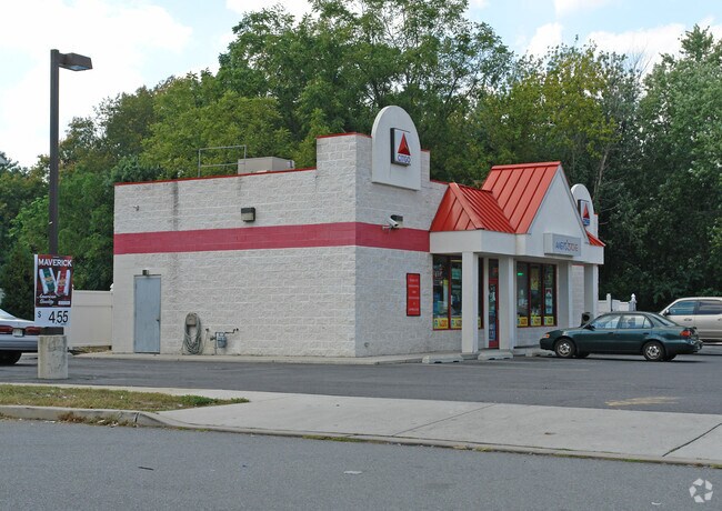
Property Record
4 Broadway, Laurel Springs, NJ 08021

NEARBY LISTINGS FOR SALE OR LEASE
Property Detail
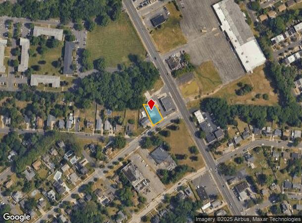
4 Broadway
20-00008-0000-00041-02
Camden
Vacantlandnec
New Jersey
X
41.2
34007C0128F
0.22 AC
2024
South Camden County
2025
Philadelphia
607900
Philadelphia-Camden-Wilmington, PA-NJ-DE-MD
DEMOGRAPHICS near 4 Broadway
1 Mile
3 Mile
5 Mile
2024 Total Population
12,851
93,048
217,888
2029 Population
12,650
92,616
217,409
Pop Growth 2024-2029
(1.56%)
(0.46%)
(0.22%)
Average Age
39
40
41
2024 Total Households
4,991
37,808
85,219
HH Growth 2024-2029
(1.68%)
(0.48%)
(0.23%)
Median Household Inc
$73,297
$73,109
$88,297
Avg Household Size
2.50
2.40
2.50
2024 Avg HH Vehicles
2.00
2.00
2.00
Median Home Value
$188,755
$225,238
$256,952
Median Year Built
1965
1973
1973
Nearby Places
Map Layers
Map Styles
 Street
 Aerial
- Restaurants
- Banks
- Shops
- Fitness
- Groceries
PUBLIC TRANSPORTATION
COMMUTER RAIL
Lindenwold (NJT) (Atlantic City Line - NJ Transit Commuter Rail (NJ Transit))
DRIVE
WALK
Distance
Lindenwold (NJT) (Atlantic City Line - NJ Transit Commuter Rail (NJ Transit))
2 min
0.7 mi
Atco (Atlantic City Line - NJ Transit Commuter Rail (NJ Transit))
DRIVE
WALK
Distance
Atco (Atlantic City Line - NJ Transit Commuter Rail (NJ Transit))
10 min
6.9 mi
AIRPORT
Philadelphia International
DRIVE
WALK
Distance
Philadelphia International
32 min
19.4 mi
Atlantic City International
DRIVE
WALK
Distance
Atlantic City International
68 min
38.5 mi
Trenton Mercer
DRIVE
WALK
Distance
Trenton Mercer
59 min
42.3 mi
Freight Ports
Broadway Terminal - Pier 5
DRIVE
WALK
Distance
Broadway Terminal - Pier 5
16 min
10.8 mi
Nearby Properties
Address
Land Use
TOTAL SIZE
Lot Size
Zoning
Address
Land Use
TOTAL SIZE
Lot Size
Zoning
79.35 AC
CP
Address
Land Use
TOTAL SIZE
Lot Size
Zoning
Address
Land Use
TOTAL SIZE
Lot Size
Zoning
61.94 AC
R3
Address
Land Use
TOTAL SIZE
Lot Size
Zoning
46,360 SF
8.07 AC
Address
Land Use
TOTAL SIZE
Lot Size
Zoning
16.61 AC
SH
Address
Land Use
TOTAL SIZE
Lot Size
Zoning
232,026 SF
24.41 AC
B
Address
Land Use
TOTAL SIZE
Lot Size
Zoning
168,264 SF
30.98 AC
TC
Address
Land Use
TOTAL SIZE
Lot Size
Zoning
258,896 SF
11.25 AC
TC
Address
Land Use
TOTAL SIZE
Lot Size
Zoning
4,177 SF
32.42 AC
SH
Address
Land Use
TOTAL SIZE
Lot Size
Zoning
244,640 SF
11.04 AC
TC
Address
Land Use
TOTAL SIZE
Lot Size
Zoning
414,080 SF
15.75 AC
TC
Address
Land Use
TOTAL SIZE
Lot Size
Zoning
147,136 SF
9.55 AC
TC
Address
Land Use
TOTAL SIZE
Lot Size
Zoning
36.17 AC
Address
Land Use
TOTAL SIZE
Lot Size
Zoning
185,936 SF
11.30 AC
TC
Address
Land Use
TOTAL SIZE
Lot Size
Zoning
40,116 SF
2.84 AC
TC
Address
Land Use
TOTAL SIZE
Lot Size
Zoning
Address
Land Use
TOTAL SIZE
Lot Size
Zoning
28.40 AC
Address
Land Use
TOTAL SIZE
Lot Size
Zoning
29.87 AC
R-3
Address
Land Use
TOTAL SIZE
Lot Size
Zoning
332,344 SF
11.99 AC
R10
Address
Land Use
TOTAL SIZE
Lot Size
Zoning
Address
Land Use
TOTAL SIZE
Lot Size
Zoning
31.80 AC
Address
Land Use
TOTAL SIZE
Lot Size
Zoning
128,662 SF
15.87 AC
TC-1
Address
Land Use
TOTAL SIZE
Lot Size
Zoning
28.93 AC
Address
Land Use
TOTAL SIZE
Lot Size
Zoning
222,056 SF
25.98 AC
O3
Address
Land Use
TOTAL SIZE
Lot Size
Zoning
126,080 SF
TC-1
Address
Land Use
TOTAL SIZE
Lot Size
Zoning
42,648 SF
4.36 AC
RR
Address
Land Use
TOTAL SIZE
Lot Size
Zoning
5.29 AC
Address
Land Use
TOTAL SIZE
Lot Size
Zoning
17.27 AC
Address
Land Use
TOTAL SIZE
Lot Size
Zoning
18.57 AC
RA
Address
Land Use
TOTAL SIZE
Lot Size
Zoning
24.84 AC
The World's #1 Commercial Real Estate Marketplace
Connect with us
© 2026 CoStar Group
The information above has been obtained from sources believed reliable. While we do not doubt its accuracy we have not verified it and make no guarantee, warranty or representation about it. It is your responsibility to independently confirm its accuracy and completeness. Any projections, opinions, assumptions, or estimates used are for example only and do not represent the current or future performance of the property. The value of this transaction to you depends on tax and other factors which should be evaluated by your tax, financial, and legal advisors. You and your advisors should conduct a careful, independent investigation of the property to determine to your satisfaction the suitability of the property for your needs.