Property Record
4 E V L, Osceola, IN 46561

NEARBY LISTINGS FOR SALE OR LEASE
Property Detail
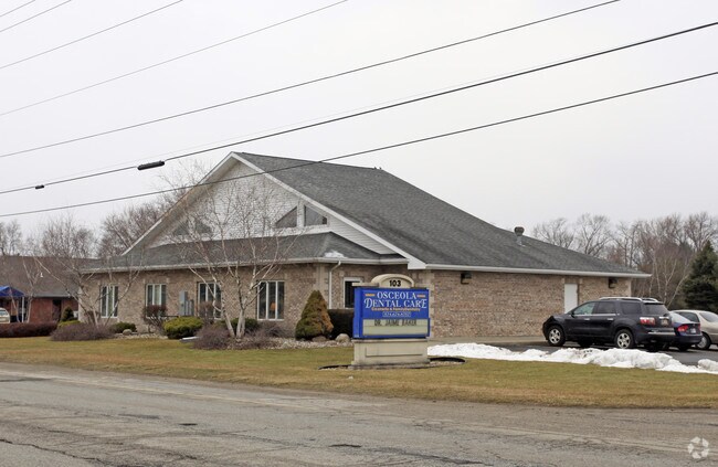
4 E V L
South Bend-Mishawaka, IN-MI
Old School Place
71-10-16-131-007.000-030
LOT 6 OLD SCHOOL PLACE SEC TWO REPLATTED & SPLIT NP7568 10/94
Medicalbuilding
St Joseph
X
Indiana
18141C0237E
6
2023
0.57 AC
2024
Outlying St Joseph County
011602
South Bend/Mishawaka
DEMOGRAPHICS near 4 E V L
1 Mile
3 Mile
5 Mile
2024 Total Population
4,034
27,376
65,463
2029 Population
3,983
27,068
65,018
Pop Growth 2024-2029
(1.26%)
(1.13%)
(0.68%)
Average Age
40
40
39
2024 Total Households
1,556
10,163
24,617
HH Growth 2024-2029
(1.41%)
(1.21%)
(0.76%)
Median Household Inc
$61,630
$75,649
$64,613
Avg Household Size
2.60
2.60
2.60
2024 Avg HH Vehicles
2.00
2.00
2.00
Median Home Value
$167,922
$181,063
$165,837
Median Year Built
1964
1975
1973
Nearby Places
Map Layers
Map Styles
 Street
 Aerial
- Restaurants
- Banks
- Shops
- Fitness
- Groceries
PUBLIC TRANSPORTATION
COMMUTER RAIL
Elkhart Amtrak Station (Capitol Limited - Amtrak, Lake Shore Limited - Amtrak)
DRIVE
WALK
Distance
Elkhart Amtrak Station (Capitol Limited - Amtrak, Lake Shore Limited - Amtrak)
10 min
5.7 mi
AIRPORT
South Bend International
DRIVE
WALK
Distance
South Bend International
33 min
16.0 mi
Freight Ports
Port Milwaukee
DRIVE
WALK
Distance
Port Milwaukee
230 min
191.9 mi
Nearby Properties
Address
Land Use
TOTAL SIZE
Lot Size
Zoning
Address
Land Use
TOTAL SIZE
Lot Size
Zoning
2,584,820 SF
32.18 AC
Address
Land Use
TOTAL SIZE
Lot Size
Zoning
377,169 SF
23.85 AC
ZO01
Address
Land Use
TOTAL SIZE
Lot Size
Zoning
184,212 SF
23.71 AC
ZO01
Address
Land Use
TOTAL SIZE
Lot Size
Zoning
36,851 SF
22.72 AC
Address
Land Use
TOTAL SIZE
Lot Size
Zoning
3,692,640 SF
0.01 AC
Address
Land Use
TOTAL SIZE
Lot Size
Zoning
316,658 SF
27.46 AC
Address
Land Use
TOTAL SIZE
Lot Size
Zoning
144,550 SF
30.99 AC
ZO01
Address
Land Use
TOTAL SIZE
Lot Size
Zoning
188,176 SF
13.90 AC
ZO01
Address
Land Use
TOTAL SIZE
Lot Size
Zoning
123,595 SF
7.92 AC
Address
Land Use
TOTAL SIZE
Lot Size
Zoning
115,990 SF
11.91 AC
Address
Land Use
TOTAL SIZE
Lot Size
Zoning
81,185 SF
23.42 AC
Address
Land Use
TOTAL SIZE
Lot Size
Zoning
279,230 SF
27.20 AC
Address
Land Use
TOTAL SIZE
Lot Size
Zoning
159,677 SF
6.67 AC
Address
Land Use
TOTAL SIZE
Lot Size
Zoning
225,200 SF
25.73 AC
Address
Land Use
TOTAL SIZE
Lot Size
Zoning
182,018 SF
30.91 AC
ZO01
Address
Land Use
TOTAL SIZE
Lot Size
Zoning
49,293 SF
87 SF
Address
Land Use
TOTAL SIZE
Lot Size
Zoning
50,250 SF
16.70 AC
ZO01
Address
Land Use
TOTAL SIZE
Lot Size
Zoning
30,470 SF
20 AC
Address
Land Use
TOTAL SIZE
Lot Size
Zoning
47,240 SF
6.66 AC
Address
Land Use
TOTAL SIZE
Lot Size
Zoning
42,500 SF
1.93 AC
Address
Land Use
TOTAL SIZE
Lot Size
Zoning
69,518 SF
33.38 AC
ZO01
Address
Land Use
TOTAL SIZE
Lot Size
Zoning
55,428 SF
44 SF
Address
Land Use
TOTAL SIZE
Lot Size
Zoning
90,000 SF
5.04 AC
ZO01
Address
Land Use
TOTAL SIZE
Lot Size
Zoning
50,057 SF
10 AC
ZO01
Address
Land Use
TOTAL SIZE
Lot Size
Zoning
64,175 SF
5.58 AC
Address
Land Use
TOTAL SIZE
Lot Size
Zoning
30,344 SF
7.94 AC
Address
Land Use
TOTAL SIZE
Lot Size
Zoning
113,890 SF
22 AC
ZO01
Address
Land Use
TOTAL SIZE
Lot Size
Zoning
84,240 SF
10.66 AC
ZO01
Address
Land Use
TOTAL SIZE
Lot Size
Zoning
104,728 SF
4 AC
Address
Land Use
TOTAL SIZE
Lot Size
Zoning
90,212 SF
9.86 AC
The World's #1 Commercial Real Estate Marketplace
Connect with us
© 2025 CoStar Group
The information above has been obtained from sources believed reliable. While we do not doubt its accuracy we have not verified it and make no guarantee, warranty or representation about it. It is your responsibility to independently confirm its accuracy and completeness. Any projections, opinions, assumptions, or estimates used are for example only and do not represent the current or future performance of the property. The value of this transaction to you depends on tax and other factors which should be evaluated by your tax, financial, and legal advisors. You and your advisors should conduct a careful, independent investigation of the property to determine to your satisfaction the suitability of the property for your needs.