Property Record
4 Erial Rd, Sicklerville, NJ 08081


NEARBY LISTINGS FOR SALE OR LEASE
Property Detail
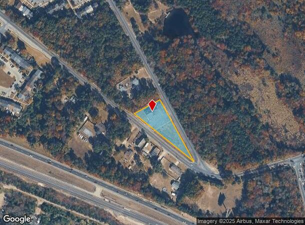
4 Erial Rd
36-04306-0000-00005-01
FACILITY NAME: STORE-H&H TIRE CTR
Commercialnec
Camden
X
New Jersey
34015C0229E
5.1
2024
1.95 AC
2025
South Camden County
609206
Philadelphia
3,276 SF
Philadelphia-Camden-Wilmington, PA-NJ-DE-MD
DEMOGRAPHICS near 4 Erial Rd
1 Mile
3 Mile
5 Mile
2024 Total Population
3,881
30,162
81,076
2029 Population
3,917
30,698
82,421
Pop Growth 2024-2029
+ 0.93%
+ 1.78%
+ 1.66%
Average Age
36
40
41
2024 Total Households
1,314
10,990
29,385
HH Growth 2024-2029
+ 1.07%
+ 1.81%
+ 1.74%
Median Household Inc
$62,931
$82,623
$92,026
Avg Household Size
2.90
2.70
2.70
2024 Avg HH Vehicles
2.00
2.00
2.00
Median Home Value
$181,389
$232,478
$248,780
Median Year Built
1979
1984
1985
Nearby Places
Map Layers
Map Styles
 Street
 Aerial
- Restaurants
- Banks
- Shops
- Fitness
- Groceries
PUBLIC TRANSPORTATION
COMMUTER RAIL
Atco (Atlantic City Line - NJ Transit Commuter Rail (NJ Transit))
DRIVE
WALK
Distance
Atco (Atlantic City Line - NJ Transit Commuter Rail (NJ Transit))
11 min
7.6 mi
Hammonton (Atlantic City Line - NJ Transit Commuter Rail (NJ Transit))
DRIVE
WALK
Distance
Hammonton (Atlantic City Line - NJ Transit Commuter Rail (NJ Transit))
19 min
9.6 mi
AIRPORT
Philadelphia International
DRIVE
WALK
Distance
Philadelphia International
43 min
28.2 mi
Atlantic City International
DRIVE
WALK
Distance
Atlantic City International
62 min
32.4 mi
Freight Ports
Broadway Terminal - Pier 5
DRIVE
WALK
Distance
Broadway Terminal - Pier 5
28 min
19.7 mi
SALE & LEASE HISTORY
LISTING DATE
SALE/LEASE

Jun 19, 2023
For Sale
Nearby Properties
Address
Land Use
TOTAL SIZE
Lot Size
Zoning
Address
Land Use
TOTAL SIZE
Lot Size
Zoning
25.89 AC
RGPR
Address
Land Use
TOTAL SIZE
Lot Size
Zoning
19.53 AC
R2
Address
Land Use
TOTAL SIZE
Lot Size
Zoning
1 SF
19.71 AC
CC
Address
Land Use
TOTAL SIZE
Lot Size
Zoning
29.50 AC
FD10
Address
Land Use
TOTAL SIZE
Lot Size
Zoning
30.01 AC
PR2
Address
Land Use
TOTAL SIZE
Lot Size
Zoning
3.44 AC
RM
Address
Land Use
TOTAL SIZE
Lot Size
Zoning
13.03 AC
RL
Address
Land Use
TOTAL SIZE
Lot Size
Zoning
10.98 AC
RGPR
Address
Land Use
TOTAL SIZE
Lot Size
Zoning
11.46 AC
RGPR
Address
Land Use
TOTAL SIZE
Lot Size
Zoning
12.13 AC
P
Address
Land Use
TOTAL SIZE
Lot Size
Zoning
6.51 AC
C
Address
Land Use
TOTAL SIZE
Lot Size
Zoning
0.92 AC
RGTC
Address
Land Use
TOTAL SIZE
Lot Size
Zoning
17.26 AC
P
Address
Land Use
TOTAL SIZE
Lot Size
Zoning
Address
Land Use
TOTAL SIZE
Lot Size
Zoning
8.76 AC
RL
Address
Land Use
TOTAL SIZE
Lot Size
Zoning
5.30 AC
RGPR
Address
Land Use
TOTAL SIZE
Lot Size
Zoning
2.13 AC
RGTC
Address
Land Use
TOTAL SIZE
Lot Size
Zoning
30 AC
PR2
Address
Land Use
TOTAL SIZE
Lot Size
Zoning
Address
Land Use
TOTAL SIZE
Lot Size
Zoning
4,200 SF
13.22 AC
PC1
Address
Land Use
TOTAL SIZE
Lot Size
Zoning
6.63 AC
RM
Address
Land Use
TOTAL SIZE
Lot Size
Zoning
11.82 AC
RM
Address
Land Use
TOTAL SIZE
Lot Size
Zoning
4.33 AC
C
Address
Land Use
TOTAL SIZE
Lot Size
Zoning
8.41 AC
CM
Address
Land Use
TOTAL SIZE
Lot Size
Zoning
5,464 SF
3.46 AC
C
Address
Land Use
TOTAL SIZE
Lot Size
Zoning
10.62 AC
FD10
Address
Land Use
TOTAL SIZE
Lot Size
Zoning
4.56 AC
C
Address
Land Use
TOTAL SIZE
Lot Size
Zoning
7.51 AC
RGPR
Address
Land Use
TOTAL SIZE
Lot Size
Zoning
37.24 AC
CM
Address
Land Use
TOTAL SIZE
Lot Size
Zoning
15.94 AC
C
The World's #1 Commercial Real Estate Marketplace
Connect with us
© 2025 CoStar Group
The information above has been obtained from sources believed reliable. While we do not doubt its accuracy we have not verified it and make no guarantee, warranty or representation about it. It is your responsibility to independently confirm its accuracy and completeness. Any projections, opinions, assumptions, or estimates used are for example only and do not represent the current or future performance of the property. The value of this transaction to you depends on tax and other factors which should be evaluated by your tax, financial, and legal advisors. You and your advisors should conduct a careful, independent investigation of the property to determine to your satisfaction the suitability of the property for your needs.