Property Record
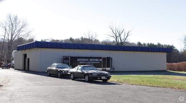
4 Holmes Rd, Lenox, MA 01240


Property Detail
4 Holmes Rd
LENO-000049-000015
BERKSHIRE
Commercialnec
Massachusetts
C-1A
1.70 AC
2020
Massachusetts North/West Area
2025
Other Market Areas
913100
Pittsfield, MA
NEARBY LISTINGS FOR SALE OR LEASE
-
-
View all Lenox listings for sale on LoopNet.com
DEMOGRAPHICS near 4 Holmes Rd
1 mile
3 mile
5 mile
2025 Total Population
1,808
8,842
40,207
2030 Population
1,839
8,735
39,273
Pop Growth 2025-2030
+ 1.71%
(1.21%)
(2.32%)
Average Age
50
49
45
2025 Total Households
783
3,851
18,063
HH Growth 2025-2030
+ 2.04%
(1.14%)
(2.25%)
Median Household Inc
$110,810
$99,502
$73,249
Avg Household Size
2.10
2.10
2.10
2025 Avg HH Vehicles
2.00
2.00
1.00
Median Home Value
$480,536
$391,559
$285,586
Median Year Built
1974
1959
1949
Nearby Places
Map Layers
Map Styles
 Street
 Aerial
Transit
 Traffic
 Biking
Places
Listings with unknown addresses are not visible on the map
- Restaurants
- Banks
- Shops
- Fitness
- Groceries
PUBLIC TRANSPORTATION
COMMUTER RAIL
Drive
Walk
Distance
8 min
3.8 mi
AIRPORT
Albany International
Drive
Walk
Distance
Albany International
76 min
46.4 mi
Freight Ports
Albany, NY Port
Drive
Walk
Distance
Albany, NY Port
66 min
41.0 mi
Nearby Properties
Address
Land Use
TOTAL SIZE
Lot Size
Zoning
Address
Land Use
TOTAL SIZE
Lot Size
Zoning
34.68 AC
C-1A
Address
Land Use
TOTAL SIZE
Lot Size
Zoning
21 AC
R12
Address
Land Use
TOTAL SIZE
Lot Size
Zoning
75.30 AC
R43
Address
Land Use
TOTAL SIZE
Lot Size
Zoning
1.95 AC
C-3A
Address
Land Use
TOTAL SIZE
Lot Size
Zoning
88,685 SF
10.67 AC
R20
Address
Land Use
TOTAL SIZE
Lot Size
Zoning
57,676 SF
6.68 AC
C-3A
Address
Land Use
TOTAL SIZE
Lot Size
Zoning
286 AC
LDI
Address
Land Use
TOTAL SIZE
Lot Size
Zoning
17.26 AC
BG
Address
Land Use
TOTAL SIZE
Lot Size
Zoning
49,209 SF
2.66 AC
RM
Address
Land Use
TOTAL SIZE
Lot Size
Zoning
587.20 AC
R-3A
Address
Land Use
TOTAL SIZE
Lot Size
Zoning
469 AC
R-3A
Address
Land Use
TOTAL SIZE
Lot Size
Zoning
41.41 AC
R43
Address
Land Use
TOTAL SIZE
Lot Size
Zoning
79,785 SF
2.29 AC
BG
Address
Land Use
TOTAL SIZE
Lot Size
Zoning
44,912 SF
6.55 AC
C-1A
Address
Land Use
TOTAL SIZE
Lot Size
Zoning
64,836 SF
11.05 AC
C-3A
Address
Land Use
TOTAL SIZE
Lot Size
Zoning
142,802 SF
13.74 AC
IL
Address
Land Use
TOTAL SIZE
Lot Size
Zoning
12.96 AC
BG
Address
Land Use
TOTAL SIZE
Lot Size
Zoning
340.40 AC
R-3A
Address
Land Use
TOTAL SIZE
Lot Size
Zoning
27,569 SF
10.40 AC
C-3A
Address
Land Use
TOTAL SIZE
Lot Size
Zoning
38,500 SF
4.80 AC
R-15
Address
Land Use
TOTAL SIZE
Lot Size
Zoning
7.79 AC
R-30
Address
Land Use
TOTAL SIZE
Lot Size
Zoning
18.74 AC
R-1A
Address
Land Use
TOTAL SIZE
Lot Size
Zoning
7,136 SF
31.10 AC
C-3A
Address
Land Use
TOTAL SIZE
Lot Size
Zoning
312.94 AC
R-1A
Address
Land Use
TOTAL SIZE
Lot Size
Zoning
122.70 AC
R43
Address
Land Use
TOTAL SIZE
Lot Size
Zoning
19.24 AC
C-1A
Address
Land Use
TOTAL SIZE
Lot Size
Zoning
4,785 SF
20 AC
R1
Address
Land Use
TOTAL SIZE
Lot Size
Zoning
5.97 AC
C-3A
Address
Land Use
TOTAL SIZE
Lot Size
Zoning
3.60 AC
R-1A
Address
Land Use
TOTAL SIZE
Lot Size
Zoning
24,938 SF
2.95 AC
C-3A
The World's #1 Commercial Real Estate Marketplace
Connect with us
© 2026 CoStar Group
The information above has been obtained from sources believed reliable. While we do not doubt its accuracy we have not verified it and make no guarantee, warranty or representation about it. It is your responsibility to independently confirm its accuracy and completeness. Any projections, opinions, assumptions, or estimates used are for example only and do not represent the current or future performance of the property. The value of this transaction to you depends on tax and other factors which should be evaluated by your tax, financial, and legal advisors. You and your advisors should conduct a careful, independent investigation of the property to determine to your satisfaction the suitability of the property for your needs.