Property Record
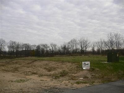
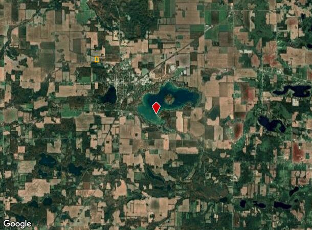
60279 M 62 Dr, Cassopolis, MI 49031
NEARBY LISTINGS FOR SALE OR LEASE
-
-
View all Cassopolis listings for sale on LoopNet.com
Property Detail
60279 M 62 Dr
14-040-026-003-00
416-1187 337A BEG IN HWY M-62 S 87 DEG 30'E 797.44 FT FRM PT ON W LN SEC N 0 DEG 38'50W 1135.5 FT FRM W 1/4 POST, TH N 0 DEG
Commercialnec
Cass
X
Michigan
26027C0142C
19.60 AC
0
Cass County
2025
South Bend/Mishawaka
0021002026
South Bend-Mishawaka, IN-MI
DEMOGRAPHICS near 60279 M 62 Dr
1 Mile
3 Mile
5 Mile
2024 Total Population
642
3,725
6,651
2029 Population
638
3,776
6,722
Pop Growth 2024-2029
(0.62%)
+ 1.37%
+ 1.07%
Average Age
42
42
43
2024 Total Households
277
1,512
2,643
HH Growth 2024-2029
(0.72%)
+ 1.26%
+ 0.95%
Median Household Inc
$34,242
$54,444
$56,123
Avg Household Size
2.20
2.30
2.30
2024 Avg HH Vehicles
2.00
2.00
2.00
Median Home Value
$85,881
$167,788
$189,695
Median Year Built
1966
1966
1973
Nearby Places
Map Layers
Map Styles
 Street
 Aerial
- Restaurants
- Banks
- Shops
- Fitness
- Groceries
PUBLIC TRANSPORTATION
AIRPORT
South Bend International
DRIVE
WALK
Distance
South Bend International
59 min
32.2 mi
Freight Ports
Port Milwaukee
DRIVE
WALK
Distance
Port Milwaukee
254 min
201.7 mi
Nearby Properties
Address
Land Use
TOTAL SIZE
Lot Size
Zoning
Address
Land Use
TOTAL SIZE
Lot Size
Zoning
155,224 SF
Address
Land Use
TOTAL SIZE
Lot Size
Zoning
151.41 AC
Address
Land Use
TOTAL SIZE
Lot Size
Zoning
374,347 SF
64.39 AC
Address
Land Use
TOTAL SIZE
Lot Size
Zoning
157,588 SF
10.60 AC
Address
Land Use
TOTAL SIZE
Lot Size
Zoning
30,495 SF
15.63 AC
Address
Land Use
TOTAL SIZE
Lot Size
Zoning
26,968 SF
5.55 AC
Address
Land Use
TOTAL SIZE
Lot Size
Zoning
15.24 AC
Address
Land Use
TOTAL SIZE
Lot Size
Zoning
52,500 SF
Address
Land Use
TOTAL SIZE
Lot Size
Zoning
14,100 SF
1.25 AC
Address
Land Use
TOTAL SIZE
Lot Size
Zoning
63,600 SF
4.04 AC
Address
Land Use
TOTAL SIZE
Lot Size
Zoning
15,738 SF
0.26 AC
Address
Land Use
TOTAL SIZE
Lot Size
Zoning
15,632 SF
5 AC
Address
Land Use
TOTAL SIZE
Lot Size
Zoning
213.75 AC
Address
Land Use
TOTAL SIZE
Lot Size
Zoning
157.75 AC
Address
Land Use
TOTAL SIZE
Lot Size
Zoning
Address
Land Use
TOTAL SIZE
Lot Size
Zoning
116,668 SF
15.25 AC
Address
Land Use
TOTAL SIZE
Lot Size
Zoning
0.19 AC
Address
Land Use
TOTAL SIZE
Lot Size
Zoning
Address
Land Use
TOTAL SIZE
Lot Size
Zoning
Address
Land Use
TOTAL SIZE
Lot Size
Zoning
Address
Land Use
TOTAL SIZE
Lot Size
Zoning
Address
Land Use
TOTAL SIZE
Lot Size
Zoning
0.55 AC
Address
Land Use
TOTAL SIZE
Lot Size
Zoning
33,180 SF
4.45 AC
Address
Land Use
TOTAL SIZE
Lot Size
Zoning
139 AC
Address
Land Use
TOTAL SIZE
Lot Size
Zoning
Address
Land Use
TOTAL SIZE
Lot Size
Zoning
140.35 AC
Address
Land Use
TOTAL SIZE
Lot Size
Zoning
1.53 AC
Address
Land Use
TOTAL SIZE
Lot Size
Zoning
179.50 AC
Address
Land Use
TOTAL SIZE
Lot Size
Zoning
3,364 SF
0.45 AC
The World's #1 Commercial Real Estate Marketplace
Connect with us
© 2025 CoStar Group
The information above has been obtained from sources believed reliable. While we do not doubt its accuracy we have not verified it and make no guarantee, warranty or representation about it. It is your responsibility to independently confirm its accuracy and completeness. Any projections, opinions, assumptions, or estimates used are for example only and do not represent the current or future performance of the property. The value of this transaction to you depends on tax and other factors which should be evaluated by your tax, financial, and legal advisors. You and your advisors should conduct a careful, independent investigation of the property to determine to your satisfaction the suitability of the property for your needs.