Property Record
4 Maloy Rd, Griffin, GA 30224
Save to a Folder
{{folder.Name}}
{{folder.ListingIds.length}} Properties
{{folder.ListingIds.length}} Property
Create a New Folder
Property Detail
4 Maloy Rd
Atlanta-Sandy Springs-Roswell, GA
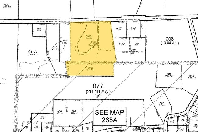
3.43AC MALOY RD PB 14/355
268A-01-079
SPALDING
Residentialacreage
Georgia
B and X Area of moderate flood hazard, usually the area between the limits of the 100-year and 500-year floods.
b
2025
3.43 AC
2025
Spalding County
160702
Atlanta
NEARBY LISTINGS FOR SALE OR LEASE
DEMOGRAPHICS near 4 Maloy Rd
1 mile
3 mile
5 mile
2025 Total Population
472
7,083
33,066
2030 Population
489
7,329
34,559
Pop Growth 2025-2030
+ 3.60%
+ 3.47%
+ 4.52%
Average Age
40
38
39
2025 Total Households
171
2,592
12,374
HH Growth 2025-2030
+ 4.09%
+ 3.51%
+ 4.57%
Median Household Inc
$87,291
$77,417
$57,632
Avg Household Size
2.70
2.60
2.60
2025 Avg HH Vehicles
3.00
2.00
2.00
Median Home Value
$212,903
$236,285
$227,367
Median Year Built
1992
1991
1984
Nearby Places
Map Layers
Map Styles
 Street
 Aerial
Layers
 Traffic
 Biking
Places
Listings with unknown addresses are not visible on the map
- Restaurants
- Banks
- Shops
- Fitness
- Groceries
PUBLIC TRANSPORTATION
AIRPORT
Hartsfield - Jackson Atlanta International
Drive
Walk
Distance
Hartsfield - Jackson Atlanta International
53 min
34.2 mi
Freight Ports
Georgia Ports - Savannah
Drive
Walk
Distance
Georgia Ports - Savannah
253 min
222.7 mi
Nearby Properties
Address
Land Use
TOTAL SIZE
Lot Size
Zoning
Address
Land Use
TOTAL SIZE
Lot Size
Zoning
46,074 SF
30.36 AC
OI
Address
Land Use
TOTAL SIZE
Lot Size
Zoning
89.45 AC
INST
Address
Land Use
TOTAL SIZE
Lot Size
Zoning
3,069 SF
15 AC
HDR-B
Address
Land Use
TOTAL SIZE
Lot Size
Zoning
57,929 SF
11.90 AC
Address
Land Use
TOTAL SIZE
Lot Size
Zoning
43,440 SF
23.20 AC
AR-1
Address
Land Use
TOTAL SIZE
Lot Size
Zoning
5,640 SF
86.60 AC
C2
Address
Land Use
TOTAL SIZE
Lot Size
Zoning
16,519 SF
6.02 AC
Address
Land Use
TOTAL SIZE
Lot Size
Zoning
36,751 SF
101.99 AC
Address
Land Use
TOTAL SIZE
Lot Size
Zoning
483.12 AC
RESIDENTIA
Address
Land Use
TOTAL SIZE
Lot Size
Zoning
12,480 SF
2.44 AC
C1
Address
Land Use
TOTAL SIZE
Lot Size
Zoning
7,228 SF
3.68 AC
Address
Land Use
TOTAL SIZE
Lot Size
Zoning
33,601 SF
5.18 AC
Address
Land Use
TOTAL SIZE
Lot Size
Zoning
22,000 SF
3.27 AC
C-2
Address
Land Use
TOTAL SIZE
Lot Size
Zoning
1,842 SF
312.37 AC
AR1
Address
Land Use
TOTAL SIZE
Lot Size
Zoning
9,100 SF
1.55 AC
PCD
Address
Land Use
TOTAL SIZE
Lot Size
Zoning
12,800 SF
2.06 AC
PCD
Address
Land Use
TOTAL SIZE
Lot Size
Zoning
8,114 SF
230.66 AC
LDRA
Address
Land Use
TOTAL SIZE
Lot Size
Zoning
1,872 SF
155.59 AC
AR1
Address
Land Use
TOTAL SIZE
Lot Size
Zoning
245.17 AC
Address
Land Use
TOTAL SIZE
Lot Size
Zoning
10,860 SF
1.70 AC
PCD
Address
Land Use
TOTAL SIZE
Lot Size
Zoning
239.45 AC
AR1
Address
Land Use
TOTAL SIZE
Lot Size
Zoning
11,392 SF
2.10 AC
LDRB
Address
Land Use
TOTAL SIZE
Lot Size
Zoning
19,087 SF
4.92 AC
PCD
Address
Land Use
TOTAL SIZE
Lot Size
Zoning
219.67 AC
Address
Land Use
TOTAL SIZE
Lot Size
Zoning
10,000 SF
2.20 AC
PCD
Address
Land Use
TOTAL SIZE
Lot Size
Zoning
238.52 AC
Address
Land Use
TOTAL SIZE
Lot Size
Zoning
3,299 SF
9.92 AC
Address
Land Use
TOTAL SIZE
Lot Size
Zoning
104.35 AC
Address
Land Use
TOTAL SIZE
Lot Size
Zoning
107.43 AC
Address
Land Use
TOTAL SIZE
Lot Size
Zoning
103.26 AC
The World's #1 Commercial Real Estate Marketplace
Connect with us
© 2026 CoStar Group
The information above has been obtained from sources believed reliable. While we do not doubt its accuracy we have not verified it and make no guarantee, warranty or representation about it. It is your responsibility to independently confirm its accuracy and completeness. Any projections, opinions, assumptions, or estimates used are for example only and do not represent the current or future performance of the property. The value of this transaction to you depends on tax and other factors which should be evaluated by your tax, financial, and legal advisors. You and your advisors should conduct a careful, independent investigation of the property to determine to your satisfaction the suitability of the property for your needs.