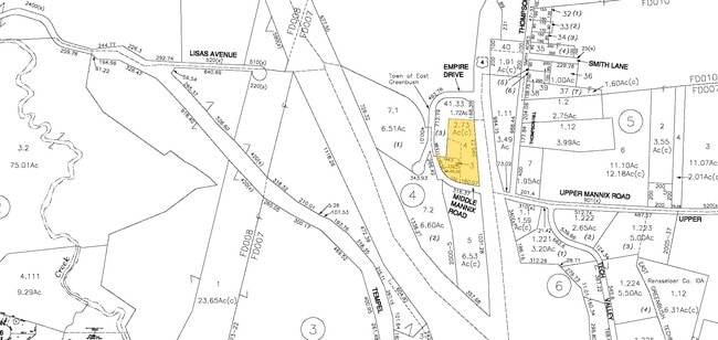
Property Record
4 Mannix Rd, Rensselaer, NY 12144

Property Detail
4 Mannix Rd
Albany-Schenectady-Troy, NY
#4 BENNIGAN'S RESTAURANT
2400-155-4-3
Rensselaer
Professionalbldglegalinsurancerealestateetc
New York
OC
3.000
2025
0.33 AC
2025
Outer Rensselaer County
052402
Albany/Schenectady/Troy
6,193 SF
NEARBY LISTINGS FOR SALE OR LEASE
DEMOGRAPHICS near 4 Mannix Rd
1 mile
3 mile
5 mile
2025 Total Population
1,016
31,999
114,978
2030 Population
1,022
32,147
115,758
Pop Growth 2025-2030
+ 0.59%
+ 0.46%
+ 0.68%
Average Age
46
42
39
2025 Total Households
388
14,509
50,162
HH Growth 2025-2030
+ 0.52%
+ 0.61%
+ 0.79%
Median Household Inc
$108,231
$79,370
$68,988
Avg Household Size
2.40
2.10
2.10
2025 Avg HH Vehicles
2.00
2.00
1.00
Median Home Value
$389,062
$268,656
$255,902
Median Year Built
1989
1970
1958
Nearby Places
Map Layers
Map Styles
 Street
 Aerial
Layers
 Traffic
 Biking
Places
Listings with unknown addresses are not visible on the map
- Restaurants
- Banks
- Shops
- Fitness
- Groceries
PUBLIC TRANSPORTATION
COMMUTER RAIL
Drive
Walk
Distance
8 min
3.8 mi
AIRPORT
Albany International
Drive
Walk
Distance
Albany International
23 min
13.1 mi
Freight Ports
Albany, NY Port
Drive
Walk
Distance
Albany, NY Port
13 min
7.2 mi
Nearby Properties
Address
Land Use
TOTAL SIZE
Lot Size
Zoning
Address
Land Use
TOTAL SIZE
Lot Size
Zoning
33.88 AC
I2
Address
Land Use
TOTAL SIZE
Lot Size
Zoning
1.42 AC
C3
Address
Land Use
TOTAL SIZE
Lot Size
Zoning
179,713 SF
126.43 AC
OC
Address
Land Use
TOTAL SIZE
Lot Size
Zoning
541,564 SF
7.40 AC
C3
Address
Land Use
TOTAL SIZE
Lot Size
Zoning
207.50 AC
CM
Address
Land Use
TOTAL SIZE
Lot Size
Zoning
316,634 SF
27.82 AC
OI
Address
Land Use
TOTAL SIZE
Lot Size
Zoning
177,030 SF
0.06 AC
C3
Address
Land Use
TOTAL SIZE
Lot Size
Zoning
296,914 SF
68.73 AC
PDD
Address
Land Use
TOTAL SIZE
Lot Size
Zoning
104,077 SF
6.64 AC
B-2
Address
Land Use
TOTAL SIZE
Lot Size
Zoning
161,972 SF
26.62 AC
OI
Address
Land Use
TOTAL SIZE
Lot Size
Zoning
428,555 SF
1.20 AC
C3
Address
Land Use
TOTAL SIZE
Lot Size
Zoning
171,096 SF
18.04 AC
B-2
Address
Land Use
TOTAL SIZE
Lot Size
Zoning
62,714 SF
8.74 AC
OI
Address
Land Use
TOTAL SIZE
Lot Size
Zoning
470,768 SF
2.20 AC
C3
Address
Land Use
TOTAL SIZE
Lot Size
Zoning
87,000 SF
0.28 AC
C3
Address
Land Use
TOTAL SIZE
Lot Size
Zoning
204,692 SF
30.97 AC
OC
Address
Land Use
TOTAL SIZE
Lot Size
Zoning
2.25 AC
Address
Land Use
TOTAL SIZE
Lot Size
Zoning
170,387 SF
0.54 AC
C3
Address
Land Use
TOTAL SIZE
Lot Size
Zoning
99,223 SF
15.47 AC
R-B
Address
Land Use
TOTAL SIZE
Lot Size
Zoning
88,040 SF
1.80 AC
C3
Address
Land Use
TOTAL SIZE
Lot Size
Zoning
5,776 SF
90.90 AC
M1
Address
Land Use
TOTAL SIZE
Lot Size
Zoning
100,664 SF
0.91 AC
C3
Address
Land Use
TOTAL SIZE
Lot Size
Zoning
45,782 SF
0.84 AC
C3
Address
Land Use
TOTAL SIZE
Lot Size
Zoning
6,720 SF
15.68 AC
R-3
Address
Land Use
TOTAL SIZE
Lot Size
Zoning
194,018 SF
73.71 AC
R-B
Address
Land Use
TOTAL SIZE
Lot Size
Zoning
222,459 SF
1.20 AC
C3
Address
Land Use
TOTAL SIZE
Lot Size
Zoning
177,492 SF
52.63 AC
R-B
Address
Land Use
TOTAL SIZE
Lot Size
Zoning
62,039 SF
5.02 AC
O
Address
Land Use
TOTAL SIZE
Lot Size
Zoning
130,876 SF
26.03 AC
R-2
Address
Land Use
TOTAL SIZE
Lot Size
Zoning
100,176 SF
3.23 AC
C1
The World's #1 Commercial Real Estate Marketplace
Connect with us
© 2026 CoStar Group
The information above has been obtained from sources believed reliable. While we do not doubt its accuracy we have not verified it and make no guarantee, warranty or representation about it. It is your responsibility to independently confirm its accuracy and completeness. Any projections, opinions, assumptions, or estimates used are for example only and do not represent the current or future performance of the property. The value of this transaction to you depends on tax and other factors which should be evaluated by your tax, financial, and legal advisors. You and your advisors should conduct a careful, independent investigation of the property to determine to your satisfaction the suitability of the property for your needs.