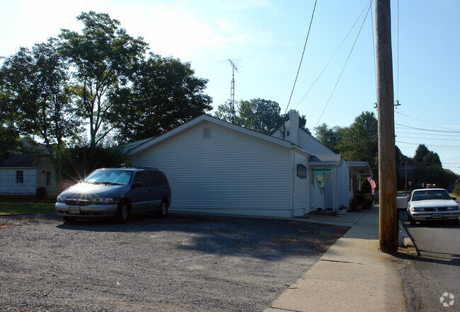
Property Record
4 Maple Ave, Walkersville, MD 21793

NEARBY LISTINGS FOR SALE OR LEASE
-
-
View all Walkersville listings for sale on LoopNet.com
Property Detail
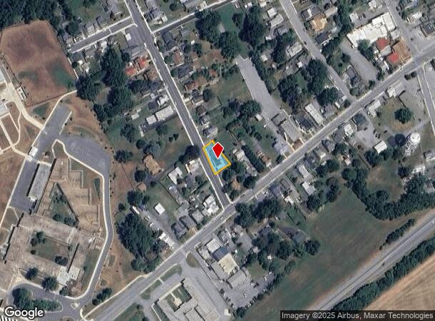
4 Maple Ave
26-491134
Walkersville
Commercialacreage
0.1752 ACRES 8 MAPLE AVE. WALKERSVILLE
X
Frederick
24021C0301E
Maryland
2024
0.18 AC
2025
Frederick
740200
Washington, DC
2,231 SF
Washington-Arlington-Alexandria, DC-VA-MD-WV
DEMOGRAPHICS near 4 Maple Ave
1 Mile
3 Mile
5 Mile
2024 Total Population
5,998
20,777
58,362
2029 Population
6,781
23,449
66,362
Pop Growth 2024-2029
+ 13.05%
+ 12.86%
+ 13.71%
Average Age
40
43
41
2024 Total Households
2,098
7,895
21,936
HH Growth 2024-2029
+ 13.44%
+ 13.39%
+ 14.18%
Median Household Inc
$117,145
$112,646
$109,490
Avg Household Size
2.70
2.50
2.60
2024 Avg HH Vehicles
2.00
2.00
2.00
Median Home Value
$389,387
$382,618
$386,305
Median Year Built
1985
1993
1991
Nearby Places
Map Layers
Map Styles
 Street
 Aerial
- Restaurants
- Banks
- Shops
- Fitness
- Groceries
PUBLIC TRANSPORTATION
COMMUTER RAIL
Frederick (Brunswick Line - Maryland Area Regional Commuter Trains (The MARC))
DRIVE
WALK
Distance
Frederick (Brunswick Line - Maryland Area Regional Commuter Trains (The MARC))
18 min
6.8 mi
SALE & LEASE HISTORY
LISTING DATE
SALE/LEASE

Sep 24, 2016
For Sale
Nearby Properties
Address
Land Use
TOTAL SIZE
Lot Size
Zoning
Address
Land Use
TOTAL SIZE
Lot Size
Zoning
336,506 SF
31.96 AC
MXE
Address
Land Use
TOTAL SIZE
Lot Size
Zoning
209,943 SF
27.51 AC
OS
Address
Land Use
TOTAL SIZE
Lot Size
Zoning
259,206 SF
11.80 AC
LI
Address
Land Use
TOTAL SIZE
Lot Size
Zoning
114,879 SF
12.11 AC
GC
Address
Land Use
TOTAL SIZE
Lot Size
Zoning
191,104 SF
49.27 AC
OS
Address
Land Use
TOTAL SIZE
Lot Size
Zoning
190,547 SF
18.63 AC
Address
Land Use
TOTAL SIZE
Lot Size
Zoning
383,394 SF
83.88 AC
MU1
Address
Land Use
TOTAL SIZE
Lot Size
Zoning
87,024 SF
0.98 AC
Address
Land Use
TOTAL SIZE
Lot Size
Zoning
108,100 SF
7.14 AC
Address
Land Use
TOTAL SIZE
Lot Size
Zoning
71,028 SF
10.84 AC
I
Address
Land Use
TOTAL SIZE
Lot Size
Zoning
219,104 SF
28.93 AC
LI
Address
Land Use
TOTAL SIZE
Lot Size
Zoning
50,840 SF
6.80 AC
BO
Address
Land Use
TOTAL SIZE
Lot Size
Zoning
74,551 SF
6.21 AC
B2 TO
Address
Land Use
TOTAL SIZE
Lot Size
Zoning
77,580 SF
1.38 AC
Address
Land Use
TOTAL SIZE
Lot Size
Zoning
52,315 SF
6.37 AC
PUD
Address
Land Use
TOTAL SIZE
Lot Size
Zoning
64,083 SF
1.48 AC
Address
Land Use
TOTAL SIZE
Lot Size
Zoning
43,100 SF
0.99 AC
Address
Land Use
TOTAL SIZE
Lot Size
Zoning
35,077 SF
9.69 AC
A
Address
Land Use
TOTAL SIZE
Lot Size
Zoning
92,064 SF
4.57 AC
Address
Land Use
TOTAL SIZE
Lot Size
Zoning
39,000 SF
0.99 AC
Address
Land Use
TOTAL SIZE
Lot Size
Zoning
30,187 SF
10.98 AC
A
Address
Land Use
TOTAL SIZE
Lot Size
Zoning
21,081 SF
11.58 AC
A
Address
Land Use
TOTAL SIZE
Lot Size
Zoning
10,107 SF
1.09 AC
GC
Address
Land Use
TOTAL SIZE
Lot Size
Zoning
15,376 SF
1.80 AC
Address
Land Use
TOTAL SIZE
Lot Size
Zoning
9,221 SF
85.26 AC
A
Address
Land Use
TOTAL SIZE
Lot Size
Zoning
48.19 AC
MXE
Address
Land Use
TOTAL SIZE
Lot Size
Zoning
7,696 SF
4.07 AC
B2 TO
Address
Land Use
TOTAL SIZE
Lot Size
Zoning
16,946 SF
4.28 AC
R4
Address
Land Use
TOTAL SIZE
Lot Size
Zoning
38,342 SF
26.79 AC
R1
Address
Land Use
TOTAL SIZE
Lot Size
Zoning
3,478 SF
0.91 AC
PUD
The World's #1 Commercial Real Estate Marketplace
Connect with us
© 2025 CoStar Group
The information above has been obtained from sources believed reliable. While we do not doubt its accuracy we have not verified it and make no guarantee, warranty or representation about it. It is your responsibility to independently confirm its accuracy and completeness. Any projections, opinions, assumptions, or estimates used are for example only and do not represent the current or future performance of the property. The value of this transaction to you depends on tax and other factors which should be evaluated by your tax, financial, and legal advisors. You and your advisors should conduct a careful, independent investigation of the property to determine to your satisfaction the suitability of the property for your needs.