Property Record
4 Middle St, West Newbury, MA 01985


Current Lease Availabilities
NEARBY LISTINGS FOR SALE OR LEASE
-
-
View all West Newbury listings for lease on LoopNet.com
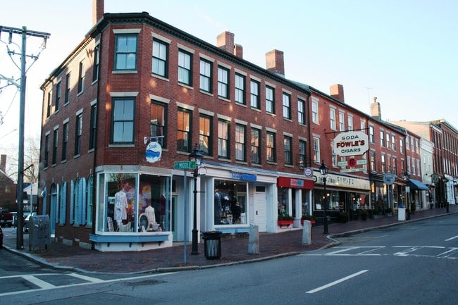
Property Detail
4 Middle St
Boston-Cambridge-Newton, MA-NH
Norwood Ave
WNEW-000003-000000-000013K
Essex
Sfr
Massachusetts
X
1.85 AC
25009C0113G
Amesbury/Ipswich
3,302 SF
Boston
DEMOGRAPHICS near 4 Middle St
1 Mile
3 Mile
5 Mile
2024 Total Population
10,103
26,441
51,053
2029 Population
10,209
26,489
51,308
Pop Growth 2024-2029
+ 1.05%
+ 0.18%
+ 0.50%
Average Age
48
46
46
2024 Total Households
4,776
11,512
22,192
HH Growth 2024-2029
+ 0.67%
(0.05%)
+ 0.38%
Median Household Inc
$119,171
$113,903
$103,490
Avg Household Size
2.00
2.20
2.20
2024 Avg HH Vehicles
2.00
2.00
2.00
Median Home Value
$730,322
$697,148
$608,517
Median Year Built
1947
1956
1965
Nearby Places
Map Layers
Map Styles
 Street
 Aerial
- Restaurants
- Banks
- Shops
- Fitness
- Groceries
PUBLIC TRANSPORTATION
COMMUTER RAIL
Haverhill (Haverhill Line - Massachusetts Bay Transportation Authority Commuter Rail (Purple Line))
DRIVE
WALK
Distance
Haverhill (Haverhill Line - Massachusetts Bay Transportation Authority Commuter Rail (Purple Line))
14 min
6.1 mi
Bradford (Haverhill Line - Massachusetts Bay Transportation Authority Commuter Rail (Purple Line))
DRIVE
WALK
Distance
Bradford (Haverhill Line - Massachusetts Bay Transportation Authority Commuter Rail (Purple Line))
15 min
6.6 mi
AIRPORT
Portsmouth International at Pease
DRIVE
WALK
Distance
Portsmouth International at Pease
42 min
27.9 mi
General Edward Lawrence Logan International
DRIVE
WALK
Distance
General Edward Lawrence Logan International
53 min
34.5 mi
Manchester Boston Regional
DRIVE
WALK
Distance
Manchester Boston Regional
60 min
37.1 mi
Freight Ports
Port of Boston
DRIVE
WALK
Distance
Port of Boston
56 min
37.4 mi
Nearby Properties
Address
Land Use
TOTAL SIZE
Lot Size
Zoning
Address
Land Use
TOTAL SIZE
Lot Size
Zoning
38 AC
RB
Address
Land Use
TOTAL SIZE
Lot Size
Zoning
225,253 SF
35.59 AC
RC
Address
Land Use
TOTAL SIZE
Lot Size
Zoning
53.50 AC
C
Address
Land Use
TOTAL SIZE
Lot Size
Zoning
92,931 SF
24.53 AC
RB
Address
Land Use
TOTAL SIZE
Lot Size
Zoning
159,058 SF
7.46 AC
Address
Land Use
TOTAL SIZE
Lot Size
Zoning
4,818 SF
12.90 AC
Address
Land Use
TOTAL SIZE
Lot Size
Zoning
19.90 AC
RB
Address
Land Use
TOTAL SIZE
Lot Size
Zoning
53,620 SF
14.40 AC
RB
Address
Land Use
TOTAL SIZE
Lot Size
Zoning
6.94 AC
Address
Land Use
TOTAL SIZE
Lot Size
Zoning
29,014 SF
4.45 AC
RB
Address
Land Use
TOTAL SIZE
Lot Size
Zoning
5 AC
RB
Address
Land Use
TOTAL SIZE
Lot Size
Zoning
64,898 SF
1.48 AC
Address
Land Use
TOTAL SIZE
Lot Size
Zoning
8.23 AC
Address
Land Use
TOTAL SIZE
Lot Size
Zoning
120,500 SF
10.19 AC
COM
Address
Land Use
TOTAL SIZE
Lot Size
Zoning
13 AC
RB
Address
Land Use
TOTAL SIZE
Lot Size
Zoning
198.60 AC
Address
Land Use
TOTAL SIZE
Lot Size
Zoning
119,779 SF
15.50 AC
RB
Address
Land Use
TOTAL SIZE
Lot Size
Zoning
240 AC
RA
Address
Land Use
TOTAL SIZE
Lot Size
Zoning
476.30 AC
RA
Address
Land Use
TOTAL SIZE
Lot Size
Zoning
43,384 SF
3.67 AC
Address
Land Use
TOTAL SIZE
Lot Size
Zoning
93,248 SF
10.37 AC
Address
Land Use
TOTAL SIZE
Lot Size
Zoning
220.90 AC
RA
Address
Land Use
TOTAL SIZE
Lot Size
Zoning
2.80 AC
RB
Address
Land Use
TOTAL SIZE
Lot Size
Zoning
37,615 SF
5.03 AC
Address
Land Use
TOTAL SIZE
Lot Size
Zoning
15,271 SF
3.70 AC
Address
Land Use
TOTAL SIZE
Lot Size
Zoning
18,478 SF
4.39 AC
RC
Address
Land Use
TOTAL SIZE
Lot Size
Zoning
1.25 AC
Address
Land Use
TOTAL SIZE
Lot Size
Zoning
12.23 AC
RA
Address
Land Use
TOTAL SIZE
Lot Size
Zoning
13,238 SF
0.92 AC
Address
Land Use
TOTAL SIZE
Lot Size
Zoning
13,794 SF
1.41 AC
RC
The World's #1 Commercial Real Estate Marketplace
Connect with us
© 2025 CoStar Group
The information above has been obtained from sources believed reliable. While we do not doubt its accuracy we have not verified it and make no guarantee, warranty or representation about it. It is your responsibility to independently confirm its accuracy and completeness. Any projections, opinions, assumptions, or estimates used are for example only and do not represent the current or future performance of the property. The value of this transaction to you depends on tax and other factors which should be evaluated by your tax, financial, and legal advisors. You and your advisors should conduct a careful, independent investigation of the property to determine to your satisfaction the suitability of the property for your needs.