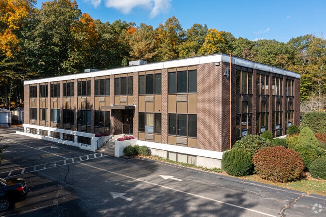
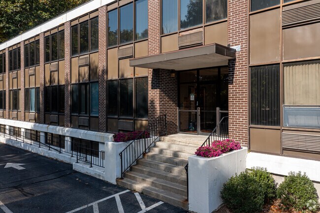
Property Record
4 Militia Dr, Lexington, MA 02421


Property Detail
4 Militia Dr
LEXI-000057-000000-000133A
Middlesex
Officebuilding
Massachusetts
CL
133a
B and X Area of moderate flood hazard, usually the area between the limits of the 100-year and 500-year floods.
1.45 AC
2025
Lexington/Arlington
2025
Boston
358600
Boston-Cambridge-Newton, MA-NH
14,400 SF
NEARBY LISTINGS FOR SALE OR LEASE
DEMOGRAPHICS near 4 Militia Dr
1 mile
3 mile
5 mile
2025 Total Population
9,654
54,936
183,691
2030 Population
10,060
57,475
191,235
Pop Growth 2025-2030
+ 4.21%
+ 4.62%
+ 4.11%
Average Age
43
43
42
2025 Total Households
3,303
19,641
68,354
HH Growth 2025-2030
+ 4.24%
+ 4.70%
+ 4.26%
Median Household Inc
$206,334
$185,954
$154,281
Avg Household Size
2.90
2.70
2.60
2025 Avg HH Vehicles
2.00
2.00
2.00
Median Home Value
$1,093,386
$1,027,880
$911,605
Median Year Built
1957
1967
1964
Nearby Places
Map Layers
Map Styles
 Street
 Aerial
Layers
 Traffic
 Biking
Places
Listings with unknown addresses are not visible on the map
- Restaurants
- Banks
- Shops
- Fitness
- Groceries
PUBLIC TRANSPORTATION
COMMUTER RAIL
Waverley (Fitchburg/South Acton Line - Massachusetts Bay Transportation Authority Commuter Rail (Purple Line))
Drive
Walk
Distance
Waverley (Fitchburg/South Acton Line - Massachusetts Bay Transportation Authority Commuter Rail (Purple Line))
13 min
5.9 mi
Belmont Center (Fitchburg/South Acton Line - Massachusetts Bay Transportation Authority Commuter Rail (Purple Line))
Drive
Walk
Distance
Belmont Center (Fitchburg/South Acton Line - Massachusetts Bay Transportation Authority Commuter Rail (Purple Line))
12 min
5.9 mi
AIRPORT
General Edward Lawrence Logan International
Drive
Walk
Distance
General Edward Lawrence Logan International
31 min
15.9 mi
Manchester Boston Regional
Drive
Walk
Distance
Manchester Boston Regional
65 min
43.6 mi
Freight Ports
Port of Boston
Drive
Walk
Distance
Port of Boston
31 min
17.2 mi
SALE & LEASE HISTORY
LISTING DATE
SALE/LEASE

Jan 30, 2019
For Lease
Feb 04, 2019
For Sale
Nearby Properties
Address
Land Use
TOTAL SIZE
Lot Size
Zoning
Address
Land Use
TOTAL SIZE
Lot Size
Zoning
561,437 SF
33.53 AC
Address
Land Use
TOTAL SIZE
Lot Size
Zoning
190,308 SF
17.46 AC
CD
Address
Land Use
TOTAL SIZE
Lot Size
Zoning
198,051 SF
11.56 AC
CR
Address
Land Use
TOTAL SIZE
Lot Size
Zoning
135,300 SF
30.85 AC
PD
Address
Land Use
TOTAL SIZE
Lot Size
Zoning
25,000 SF
25.73 AC
RD
Address
Land Use
TOTAL SIZE
Lot Size
Zoning
37.77 AC
PD
Address
Land Use
TOTAL SIZE
Lot Size
Zoning
23.91 AC
IG
Address
Land Use
TOTAL SIZE
Lot Size
Zoning
262,278 SF
3.80 AC
PD
Address
Land Use
TOTAL SIZE
Lot Size
Zoning
292,150 SF
17.76 AC
Address
Land Use
TOTAL SIZE
Lot Size
Zoning
342,677 SF
56.46 AC
ND
Address
Land Use
TOTAL SIZE
Lot Size
Zoning
11.25 AC
PD-6
Address
Land Use
TOTAL SIZE
Lot Size
Zoning
11.70 AC
BG
Address
Land Use
TOTAL SIZE
Lot Size
Zoning
120,704 SF
15.03 AC
CD
Address
Land Use
TOTAL SIZE
Lot Size
Zoning
25.50 AC
BG
Address
Land Use
TOTAL SIZE
Lot Size
Zoning
100,271 SF
13.25 AC
CM
Address
Land Use
TOTAL SIZE
Lot Size
Zoning
11.25 AC
CR
Address
Land Use
TOTAL SIZE
Lot Size
Zoning
6.69 AC
PD
Address
Land Use
TOTAL SIZE
Lot Size
Zoning
276,000 SF
16.90 AC
RO
Address
Land Use
TOTAL SIZE
Lot Size
Zoning
9.82 AC
PD
Address
Land Use
TOTAL SIZE
Lot Size
Zoning
216,224 SF
5.71 AC
NPD
Address
Land Use
TOTAL SIZE
Lot Size
Zoning
134,932 SF
8.69 AC
ND
Address
Land Use
TOTAL SIZE
Lot Size
Zoning
28.03 AC
IR
Address
Land Use
TOTAL SIZE
Lot Size
Zoning
242,454 SF
4.28 AC
IG
Address
Land Use
TOTAL SIZE
Lot Size
Zoning
160,722 SF
15.63 AC
ND
Address
Land Use
TOTAL SIZE
Lot Size
Zoning
300,720 SF
16.16 AC
IG
Address
Land Use
TOTAL SIZE
Lot Size
Zoning
71.34 AC
R-1
Address
Land Use
TOTAL SIZE
Lot Size
Zoning
145,298 SF
20 AC
RS
Address
Land Use
TOTAL SIZE
Lot Size
Zoning
297,389 SF
16 AC
ND
Address
Land Use
TOTAL SIZE
Lot Size
Zoning
229,982 SF
24.97 AC
CR
Address
Land Use
TOTAL SIZE
Lot Size
Zoning
177,125 SF
11.26 AC
IG
The World's #1 Commercial Real Estate Marketplace
Connect with us
© 2026 CoStar Group
The information above has been obtained from sources believed reliable. While we do not doubt its accuracy we have not verified it and make no guarantee, warranty or representation about it. It is your responsibility to independently confirm its accuracy and completeness. Any projections, opinions, assumptions, or estimates used are for example only and do not represent the current or future performance of the property. The value of this transaction to you depends on tax and other factors which should be evaluated by your tax, financial, and legal advisors. You and your advisors should conduct a careful, independent investigation of the property to determine to your satisfaction the suitability of the property for your needs.