Property Record
4 Schalks Crossing Rd, Plainsboro, NJ 08536
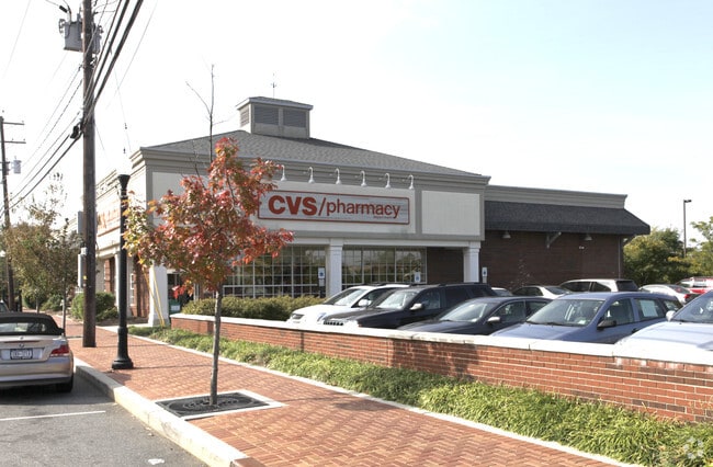


Property Detail
4 Schalks Crossing Rd
18-01602-0000-00007
1.006 AC
Regionalshoppingcenterormallwithanchorstore
Middlesex
GB
New Jersey
B and X Area of moderate flood hazard, usually the area between the limits of the 100-year and 500-year floods.
7
2024
1.01 AC
2025
Brunswick West
008602
Northern New Jersey
12,150 SF
Lakewood-New Brunswick, NJ
NEARBY LISTINGS FOR SALE OR LEASE
DEMOGRAPHICS near 4 Schalks Crossing Rd
1 mile
3 mile
5 mile
2025 Total Population
4,735
43,311
121,684
2030 Population
4,948
45,355
126,951
Pop Growth 2025-2030
+ 4.50%
+ 4.72%
+ 4.33%
Average Age
40
40
41
2025 Total Households
1,896
16,382
45,233
HH Growth 2025-2030
+ 4.69%
+ 4.83%
+ 4.53%
Median Household Inc
$127,310
$147,270
$143,140
Avg Household Size
2.40
2.60
2.60
2025 Avg HH Vehicles
2.00
2.00
2.00
Median Home Value
$767,387
$730,311
$722,442
Median Year Built
1983
1984
1985
Nearby Places
Map Layers
Map Styles
 Street
 Aerial
Layers
 Traffic
 Biking
Places
Listings with unknown addresses are not visible on the map
- Restaurants
- Banks
- Shops
- Fitness
- Groceries
PUBLIC TRANSPORTATION
COMMUTER RAIL
Princeton Junction (Northeast Corridor Line - NJ Transit Commuter Rail (NJ Transit), Princeton Branch - NJ Transit Commuter Rail (NJ Transit))
Drive
Walk
Distance
Princeton Junction (Northeast Corridor Line - NJ Transit Commuter Rail (NJ Transit), Princeton Branch - NJ Transit Commuter Rail (NJ Transit))
11 min
4.9 mi
Princeton (Princeton Branch - NJ Transit Commuter Rail (NJ Transit))
Drive
Walk
Distance
Princeton (Princeton Branch - NJ Transit Commuter Rail (NJ Transit))
11 min
5.2 mi
AIRPORT
Trenton Mercer
Drive
Walk
Distance
Trenton Mercer
26 min
16.0 mi
Newark Liberty International
Drive
Walk
Distance
Newark Liberty International
56 min
41.6 mi
Freight Ports
New York Container Terminal
Drive
Walk
Distance
New York Container Terminal
50 min
34.4 mi
Nearby Properties
Address
Land Use
TOTAL SIZE
Lot Size
Zoning
Address
Land Use
TOTAL SIZE
Lot Size
Zoning
636,000 SF
60.76 AC
PHCR
Address
Land Use
TOTAL SIZE
Lot Size
Zoning
58.63 AC
PMUD
Address
Land Use
TOTAL SIZE
Lot Size
Zoning
51.70 AC
PCD
Address
Land Use
TOTAL SIZE
Lot Size
Zoning
52.74 AC
PCD
Address
Land Use
TOTAL SIZE
Lot Size
Zoning
492,110 SF
58.48 AC
I100
Address
Land Use
TOTAL SIZE
Lot Size
Zoning
46.23 AC
PCD
Address
Land Use
TOTAL SIZE
Lot Size
Zoning
40.69 AC
PCD
Address
Land Use
TOTAL SIZE
Lot Size
Zoning
30.62 AC
E
Address
Land Use
TOTAL SIZE
Lot Size
Zoning
24.85 AC
E
Address
Land Use
TOTAL SIZE
Lot Size
Zoning
50.08 AC
PMUD
Address
Land Use
TOTAL SIZE
Lot Size
Zoning
34.97 AC
PMUD
Address
Land Use
TOTAL SIZE
Lot Size
Zoning
23.64 AC
PMUD
Address
Land Use
TOTAL SIZE
Lot Size
Zoning
23.63 AC
PCD
Address
Land Use
TOTAL SIZE
Lot Size
Zoning
24.38 AC
ROM2
Address
Land Use
TOTAL SIZE
Lot Size
Zoning
25.66 AC
PHCR
Address
Land Use
TOTAL SIZE
Lot Size
Zoning
17.17 AC
PMN
Address
Land Use
TOTAL SIZE
Lot Size
Zoning
89.76 AC
R100
Address
Land Use
TOTAL SIZE
Lot Size
Zoning
18.52 AC
ROM2
Address
Land Use
TOTAL SIZE
Lot Size
Zoning
66.62 AC
PMUD
Address
Land Use
TOTAL SIZE
Lot Size
Zoning
225,407 SF
22 AC
PMUD
Address
Land Use
TOTAL SIZE
Lot Size
Zoning
0.78 AC
PHCR
Address
Land Use
TOTAL SIZE
Lot Size
Zoning
11.75 AC
PMUD
Address
Land Use
TOTAL SIZE
Lot Size
Zoning
8.27 AC
PMUD
Address
Land Use
TOTAL SIZE
Lot Size
Zoning
264,792 SF
23.62 AC
PMUD
Address
Land Use
TOTAL SIZE
Lot Size
Zoning
49.96 AC
R24
Address
Land Use
TOTAL SIZE
Lot Size
Zoning
80,568 SF
17.67 AC
PMUD
Address
Land Use
TOTAL SIZE
Lot Size
Zoning
33.96 AC
PCD
Address
Land Use
TOTAL SIZE
Lot Size
Zoning
228,132 SF
21.36 AC
PMUD
Address
Land Use
TOTAL SIZE
Lot Size
Zoning
154,150 SF
16.75 AC
PMUD
Address
Land Use
TOTAL SIZE
Lot Size
Zoning
9.73 AC
PMUD
The World's #1 Commercial Real Estate Marketplace
Connect with us
© 2026 CoStar Group
The information above has been obtained from sources believed reliable. While we do not doubt its accuracy we have not verified it and make no guarantee, warranty or representation about it. It is your responsibility to independently confirm its accuracy and completeness. Any projections, opinions, assumptions, or estimates used are for example only and do not represent the current or future performance of the property. The value of this transaction to you depends on tax and other factors which should be evaluated by your tax, financial, and legal advisors. You and your advisors should conduct a careful, independent investigation of the property to determine to your satisfaction the suitability of the property for your needs.