Property Record
4 Silverwood Dr, Taunton, MA 02780


NEARBY LISTINGS FOR SALE OR LEASE
Property Detail
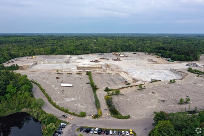
4 Silverwood Dr
TAUN-000118-000041
Bristol
Commercialnec
Massachusetts
X
41
25005C0117F
41.66 AC
2024
Attleboro/New Bedford
2025
Boston
613800
Providence-Warwick, RI-MA
103,233 SF
DEMOGRAPHICS near 4 Silverwood Dr
1 Mile
3 Mile
5 Mile
2024 Total Population
1,021
24,695
70,664
2029 Population
1,014
24,549
70,103
Pop Growth 2024-2029
(0.69%)
(0.59%)
(0.79%)
Average Age
40
40
41
2024 Total Households
356
9,344
27,384
HH Growth 2024-2029
(0.56%)
(0.63%)
(0.86%)
Median Household Inc
$94,387
$78,109
$74,546
Avg Household Size
2.80
2.60
2.50
2024 Avg HH Vehicles
2.00
2.00
2.00
Median Home Value
$382,352
$365,136
$383,774
Median Year Built
1987
1980
1971
Nearby Places
Map Layers
Map Styles
 Street
 Aerial
- Restaurants
- Banks
- Shops
- Fitness
- Groceries
PUBLIC TRANSPORTATION
COMMUTER RAIL
Middleborough/Lakeville (Middleborough/Lakeville Line - Massachusetts Bay Transportation Authority Commuter Rail (Purple Line))
DRIVE
WALK
Distance
Middleborough/Lakeville (Middleborough/Lakeville Line - Massachusetts Bay Transportation Authority Commuter Rail (Purple Line))
15 min
8.5 mi
AIRPORT
Rhode Island Tf Green International
DRIVE
WALK
Distance
Rhode Island Tf Green International
51 min
29.4 mi
Freight Ports
Port of New Bedford Harbor
DRIVE
WALK
Distance
Port of New Bedford Harbor
26 min
19.4 mi
SALE & LEASE HISTORY
LISTING DATE
SALE/LEASE

Sep 24, 2016
For Lease
Sep 24, 2016
For Sale
Sep 24, 2016
For Sale
May 06, 2019
For Sale
Jun 19, 2019
For Lease
Nearby Properties
Address
Land Use
TOTAL SIZE
Lot Size
Zoning
Address
Land Use
TOTAL SIZE
Lot Size
Zoning
850,008 SF
172.89 AC
INDUST
Address
Land Use
TOTAL SIZE
Lot Size
Zoning
133,652 SF
2 AC
Address
Land Use
TOTAL SIZE
Lot Size
Zoning
Address
Land Use
TOTAL SIZE
Lot Size
Zoning
174,000 SF
62.88 AC
R1
Address
Land Use
TOTAL SIZE
Lot Size
Zoning
117,752 SF
22.37 AC
Address
Land Use
TOTAL SIZE
Lot Size
Zoning
217,011 SF
73.55 AC
OPSPAC
Address
Land Use
TOTAL SIZE
Lot Size
Zoning
27 AC
INDUST
Address
Land Use
TOTAL SIZE
Lot Size
Zoning
136,122 SF
49.49 AC
Address
Land Use
TOTAL SIZE
Lot Size
Zoning
67,588 SF
18.81 AC
SUBRES
Address
Land Use
TOTAL SIZE
Lot Size
Zoning
14.43 AC
Address
Land Use
TOTAL SIZE
Lot Size
Zoning
351,320 SF
42 AC
INDUST
Address
Land Use
TOTAL SIZE
Lot Size
Zoning
52,042 SF
59.53 AC
OPSPAC
Address
Land Use
TOTAL SIZE
Lot Size
Zoning
127,092 SF
9.37 AC
INDUST
Address
Land Use
TOTAL SIZE
Lot Size
Zoning
6.53 AC
URBRES
Address
Land Use
TOTAL SIZE
Lot Size
Zoning
45,786 SF
16 AC
URBRES
Address
Land Use
TOTAL SIZE
Lot Size
Zoning
10,680 SF
79.73 AC
Address
Land Use
TOTAL SIZE
Lot Size
Zoning
206,139 SF
21.55 AC
Address
Land Use
TOTAL SIZE
Lot Size
Zoning
16 AC
URBRES
Address
Land Use
TOTAL SIZE
Lot Size
Zoning
124,465 SF
15.08 AC
INDUST
Address
Land Use
TOTAL SIZE
Lot Size
Zoning
1,783 SF
9.29 AC
Address
Land Use
TOTAL SIZE
Lot Size
Zoning
107,794 SF
12.51 AC
Address
Land Use
TOTAL SIZE
Lot Size
Zoning
13 AC
HIWABZ
Address
Land Use
TOTAL SIZE
Lot Size
Zoning
108,692 SF
10.80 AC
R1
Address
Land Use
TOTAL SIZE
Lot Size
Zoning
137,952 SF
20.99 AC
INDUST
Address
Land Use
TOTAL SIZE
Lot Size
Zoning
5.60 AC
INDUST
Address
Land Use
TOTAL SIZE
Lot Size
Zoning
86,176 SF
7.14 AC
INDUST
Address
Land Use
TOTAL SIZE
Lot Size
Zoning
12.38 AC
INDUST
Address
Land Use
TOTAL SIZE
Lot Size
Zoning
106,052 SF
50.09 AC
HIWABZ
Address
Land Use
TOTAL SIZE
Lot Size
Zoning
11.82 AC
URBRES
The World's #1 Commercial Real Estate Marketplace
Connect with us
© 2025 CoStar Group
The information above has been obtained from sources believed reliable. While we do not doubt its accuracy we have not verified it and make no guarantee, warranty or representation about it. It is your responsibility to independently confirm its accuracy and completeness. Any projections, opinions, assumptions, or estimates used are for example only and do not represent the current or future performance of the property. The value of this transaction to you depends on tax and other factors which should be evaluated by your tax, financial, and legal advisors. You and your advisors should conduct a careful, independent investigation of the property to determine to your satisfaction the suitability of the property for your needs.