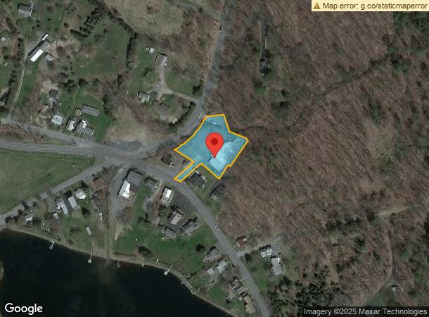
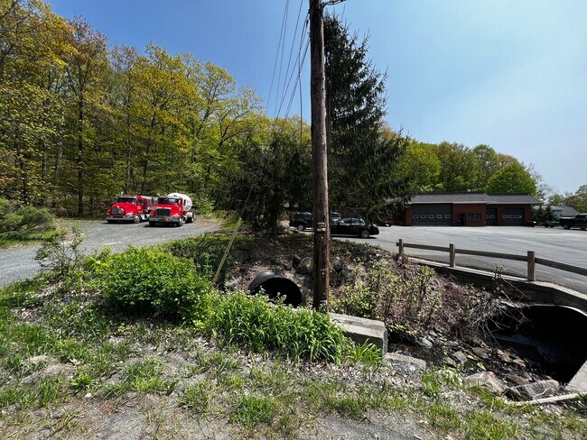
Property Record
4 Teal Rd, Averill Park, NY 12018
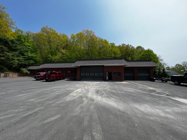
This Property Is For Sale
NEARBY LISTINGS FOR SALE OR LEASE
-
-
View all Averill Park listings for sale on LoopNet.com
Property Detail
4 Teal Rd
4000-159.2-2-12
(2061 YR) 3RD REF: 92/681-685
Gasolinefuelbulkstorage
Rensselaer
ARE
New York
36083C0270D
12.000
2025
0.90 AC
2024
Outer Rensselaer County
052203
Albany/Schenectady/Troy
7,647 SF
Albany-Schenectady-Troy, NY
DEMOGRAPHICS near 4 Teal Rd
1 Mile
3 Mile
5 Mile
2024 Total Population
610
5,491
12,223
2029 Population
600
5,414
12,028
Pop Growth 2024-2029
(1.64%)
(1.40%)
(1.60%)
Average Age
46
45
44
2024 Total Households
259
2,275
4,957
HH Growth 2024-2029
(1.93%)
(1.54%)
(1.69%)
Median Household Inc
$112,152
$110,029
$106,816
Avg Household Size
2.30
2.40
2.40
2024 Avg HH Vehicles
2.00
2.00
2.00
Median Home Value
$291,817
$283,064
$267,963
Median Year Built
1949
1962
1966
Nearby Places
- Restaurants
- Banks
- Shops
- Fitness
- Groceries
PUBLIC TRANSPORTATION
AIRPORT
Albany International
DRIVE
WALK
Distance
Albany International
33 min
19.3 mi
Freight Ports
Albany, NY Port
DRIVE
WALK
Distance
Albany, NY Port
28 min
15.6 mi
Nearby Properties
Address
Land Use
TOTAL SIZE
Lot Size
Zoning
Address
Land Use
TOTAL SIZE
Lot Size
Zoning
105,636 SF
65.38 AC
Address
Land Use
TOTAL SIZE
Lot Size
Zoning
60,975 SF
11.70 AC
Address
Land Use
TOTAL SIZE
Lot Size
Zoning
18,210 SF
25.48 AC
Address
Land Use
TOTAL SIZE
Lot Size
Zoning
15,276 SF
3.76 AC
Address
Land Use
TOTAL SIZE
Lot Size
Zoning
912 SF
24.84 AC
Address
Land Use
TOTAL SIZE
Lot Size
Zoning
6,359 SF
1.99 AC
R
Address
Land Use
TOTAL SIZE
Lot Size
Zoning
12,360 SF
5.07 AC
R
Address
Land Use
TOTAL SIZE
Lot Size
Zoning
4,470 SF
2.26 AC
Address
Land Use
TOTAL SIZE
Lot Size
Zoning
15,712 SF
3.66 AC
Address
Land Use
TOTAL SIZE
Lot Size
Zoning
10,040 SF
0.35 AC
Address
Land Use
TOTAL SIZE
Lot Size
Zoning
4,919 SF
12.88 AC
Address
Land Use
TOTAL SIZE
Lot Size
Zoning
5,080 SF
0.60 AC
Address
Land Use
TOTAL SIZE
Lot Size
Zoning
10,099 SF
0.32 AC
Address
Land Use
TOTAL SIZE
Lot Size
Zoning
1,996 SF
46.59 AC
RR2
Address
Land Use
TOTAL SIZE
Lot Size
Zoning
13,005 SF
4 AC
Address
Land Use
TOTAL SIZE
Lot Size
Zoning
23,480 SF
3.08 AC
Address
Land Use
TOTAL SIZE
Lot Size
Zoning
2,107 SF
1.06 AC
R
Address
Land Use
TOTAL SIZE
Lot Size
Zoning
4,926 SF
136.16 AC
RR
Address
Land Use
TOTAL SIZE
Lot Size
Zoning
2,996 SF
1.48 AC
Address
Land Use
TOTAL SIZE
Lot Size
Zoning
7,863 SF
1.35 AC
Address
Land Use
TOTAL SIZE
Lot Size
Zoning
7,863 SF
1.34 AC
Address
Land Use
TOTAL SIZE
Lot Size
Zoning
7,863 SF
0.93 AC
Address
Land Use
TOTAL SIZE
Lot Size
Zoning
7,863 SF
0.86 AC
Address
Land Use
TOTAL SIZE
Lot Size
Zoning
1,654 SF
1.90 AC
Address
Land Use
TOTAL SIZE
Lot Size
Zoning
3,291 SF
1.66 AC
Address
Land Use
TOTAL SIZE
Lot Size
Zoning
7,864 SF
3.26 AC
Address
Land Use
TOTAL SIZE
Lot Size
Zoning
2,193 SF
40.77 AC
R
Address
Land Use
TOTAL SIZE
Lot Size
Zoning
6,848 SF
9.78 AC
Address
Land Use
TOTAL SIZE
Lot Size
Zoning
1,219 SF
10.37 AC
Address
Land Use
TOTAL SIZE
Lot Size
Zoning
4,200 SF
2.10 AC
HMU
The World's #1 Commercial Real Estate Marketplace
Connect with us
© 2025 CoStar Group
The information above has been obtained from sources believed reliable. While we do not doubt its accuracy we have not verified it and make no guarantee, warranty or representation about it. It is your responsibility to independently confirm its accuracy and completeness. Any projections, opinions, assumptions, or estimates used are for example only and do not represent the current or future performance of the property. The value of this transaction to you depends on tax and other factors which should be evaluated by your tax, financial, and legal advisors. You and your advisors should conduct a careful, independent investigation of the property to determine to your satisfaction the suitability of the property for your needs.