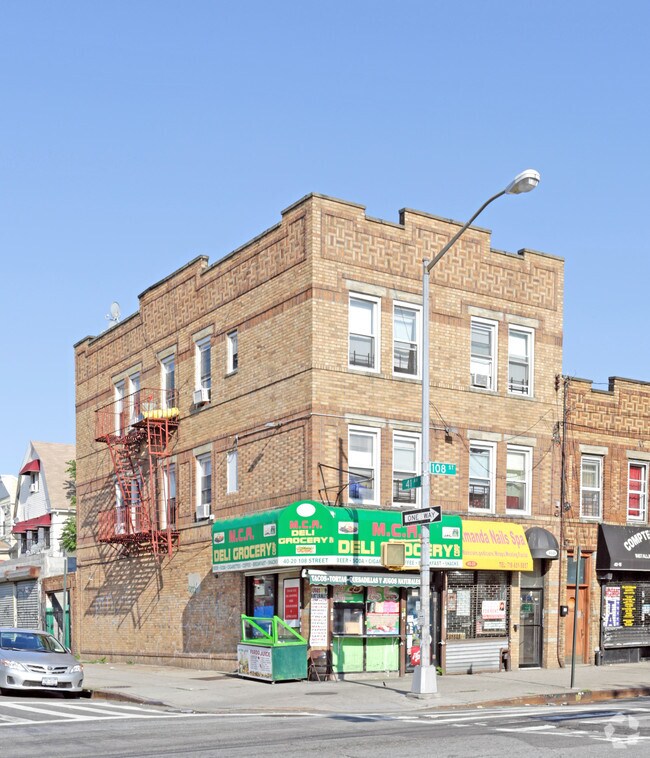
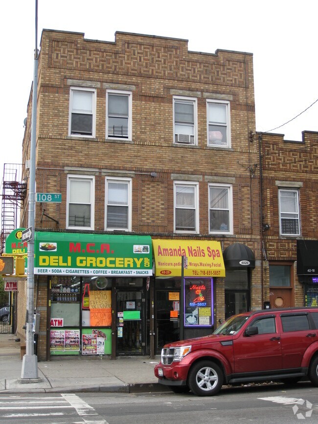
Property Record
4020 108Th St, Corona, NY 11368

NEARBY LISTINGS FOR SALE OR LEASE
Property Detail
4020 108Th St
01984-0043
Queens
Commercialofficeresidentialmixeduse
New York
X
43
3604970113F
0.06 AC
2024
Northeast Queens
2025
Long Island (New York)
040301
New York-Jersey City-White Plains, NY-NJ
2,910 SF
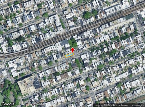
DEMOGRAPHICS near 4020 108Th St
1 Mile
3 Mile
5 Mile
2024 Total Population
144,269
838,979
1,834,600
2029 Population
131,896
786,937
1,715,215
Pop Growth 2024-2029
(8.58%)
(6.20%)
(6.51%)
Average Age
37
42
41
2024 Total Households
39,641
294,660
660,817
HH Growth 2024-2029
(8.88%)
(6.28%)
(6.61%)
Median Household Inc
$61,482
$66,643
$71,533
Avg Household Size
3.50
2.70
2.70
2024 Avg HH Vehicles
1.00
1.00
1.00
Median Home Value
$706,112
$659,227
$707,359
Median Year Built
1956
1954
1952
Nearby Places
Map Layers
Map Styles
 Street
 Aerial
- Restaurants
- Banks
- Shops
- Fitness
- Groceries
PUBLIC TRANSPORTATION
TRANSIT/SUBWAY
111 Street (7 Line) (7 - New York MTA Subway (The Subway))
DRIVE
WALK
Distance
111 Street (7 Line) (7 - New York MTA Subway (The Subway))
0 min
4 min
0.2 mi
103 Street-Corona Plaza (7 - New York MTA Subway (The Subway))
DRIVE
WALK
Distance
103 Street-Corona Plaza (7 - New York MTA Subway (The Subway))
0 min
4 min
0.2 mi
Junction Boulevard (7 - New York MTA Subway (The Subway))
DRIVE
WALK
Distance
Junction Boulevard (7 - New York MTA Subway (The Subway))
1 min
12 min
0.6 mi
Mets-Willets Point (7 - New York MTA Subway (The Subway))
DRIVE
WALK
Distance
Mets-Willets Point (7 - New York MTA Subway (The Subway))
1 min
15 min
0.8 mi
90 Street-Elmhurst Avenue (7 - New York MTA Subway (The Subway))
DRIVE
WALK
Distance
90 Street-Elmhurst Avenue (7 - New York MTA Subway (The Subway))
2 min
19 min
1.0 mi
COMMUTER RAIL
Mets-Willets Point Station (Port Washington Branch - Long Island Rail Road)
DRIVE
WALK
Distance
Mets-Willets Point Station (Port Washington Branch - Long Island Rail Road)
5 min
18 min
1.0 mi
Flushing-Main Street Station (Port Washington Branch - Long Island Rail Road)
DRIVE
WALK
Distance
Flushing-Main Street Station (Port Washington Branch - Long Island Rail Road)
4 min
1.8 mi
AIRPORT
LaGuardia
DRIVE
WALK
Distance
LaGuardia
6 min
2.3 mi
John F Kennedy International
DRIVE
WALK
Distance
John F Kennedy International
14 min
9.9 mi
Newark Liberty International
DRIVE
WALK
Distance
Newark Liberty International
35 min
22.1 mi
Freight Ports
NY - Red Hook Container Terminal
DRIVE
WALK
Distance
NY - Red Hook Container Terminal
20 min
10.9 mi
SALE & LEASE HISTORY
LISTING DATE
SALE/LEASE

Jun 25, 2021
For Sale
Feb 09, 2017
For Sale
Nearby Properties
Address
Land Use
TOTAL SIZE
Lot Size
Zoning
Address
Land Use
TOTAL SIZE
Lot Size
Zoning
2,078,606 SF
58.93 AC
R4
Address
Land Use
TOTAL SIZE
Lot Size
Zoning
1,258,350 SF
410.24 AC
PARK
Address
Land Use
TOTAL SIZE
Lot Size
Zoning
1,502,532 SF
6.35 AC
R7B
Address
Land Use
TOTAL SIZE
Lot Size
Zoning
772,163 SF
5.24 AC
C4-5X
Address
Land Use
TOTAL SIZE
Lot Size
Zoning
1,292,074 SF
C4-2F
Address
Land Use
TOTAL SIZE
Lot Size
Zoning
234,891 SF
3.17 AC
C4-5X
Address
Land Use
TOTAL SIZE
Lot Size
Zoning
1,516,458 SF
5.97 AC
R7-1
Address
Land Use
TOTAL SIZE
Lot Size
Zoning
15,000 SF
255.27 AC
PARK
Address
Land Use
TOTAL SIZE
Lot Size
Zoning
1,000 SF
210.07 AC
R3-2
Address
Land Use
TOTAL SIZE
Lot Size
Zoning
332,266 SF
12.57 AC
M2-1
Address
Land Use
TOTAL SIZE
Lot Size
Zoning
344,116 SF
0.92 AC
R7-1
Address
Land Use
TOTAL SIZE
Lot Size
Zoning
577,654 SF
5.38 AC
R6
Address
Land Use
TOTAL SIZE
Lot Size
Zoning
521,944 SF
16.68 AC
R4
Address
Land Use
TOTAL SIZE
Lot Size
Zoning
360,000 SF
5.88 AC
C4-2
Address
Land Use
TOTAL SIZE
Lot Size
Zoning
307,038 SF
7.84 AC
M1-1
Address
Land Use
TOTAL SIZE
Lot Size
Zoning
490,600 SF
12.01 AC
M1-1
Address
Land Use
TOTAL SIZE
Lot Size
Zoning
480,000 SF
16.98 AC
M1-1
Address
Land Use
TOTAL SIZE
Lot Size
Zoning
248,200 SF
1.25 AC
R6
Address
Land Use
TOTAL SIZE
Lot Size
Zoning
250,577 SF
23.17 AC
M2-1
Address
Land Use
TOTAL SIZE
Lot Size
Zoning
266,195 SF
4.59 AC
C4-2
Address
Land Use
TOTAL SIZE
Lot Size
Zoning
272,081 SF
4.59 AC
C4-2
Address
Land Use
TOTAL SIZE
Lot Size
Zoning
240,000 SF
2.09 AC
R6
Address
Land Use
TOTAL SIZE
Lot Size
Zoning
281,416 SF
2.57 AC
C4-2
Address
Land Use
TOTAL SIZE
Lot Size
Zoning
2,828 SF
78.05 AC
PARK
Address
Land Use
TOTAL SIZE
Lot Size
Zoning
192,200 SF
9.70 AC
R4
Address
Land Use
TOTAL SIZE
Lot Size
Zoning
454,631 SF
24.61 AC
M1-1
Address
Land Use
TOTAL SIZE
Lot Size
Zoning
4,279,575 SF
144.16 AC
PARK
Address
Land Use
TOTAL SIZE
Lot Size
Zoning
443,492 SF
27.75 AC
M1-1
Address
Land Use
TOTAL SIZE
Lot Size
Zoning
207,407 SF
3.73 AC
R6B
Address
Land Use
TOTAL SIZE
Lot Size
Zoning
454,645 SF
0.95 AC
C4-4
The World's #1 Commercial Real Estate Marketplace
Connect with us
© 2026 CoStar Group
The information above has been obtained from sources believed reliable. While we do not doubt its accuracy we have not verified it and make no guarantee, warranty or representation about it. It is your responsibility to independently confirm its accuracy and completeness. Any projections, opinions, assumptions, or estimates used are for example only and do not represent the current or future performance of the property. The value of this transaction to you depends on tax and other factors which should be evaluated by your tax, financial, and legal advisors. You and your advisors should conduct a careful, independent investigation of the property to determine to your satisfaction the suitability of the property for your needs.