Property Record
40 Blue Stream Way, Inlet Beach, FL 32461
NEARBY LISTINGS FOR SALE OR LEASE
-
-
View all Inlet Beach listings for sale on LoopNet.com
Property Detail
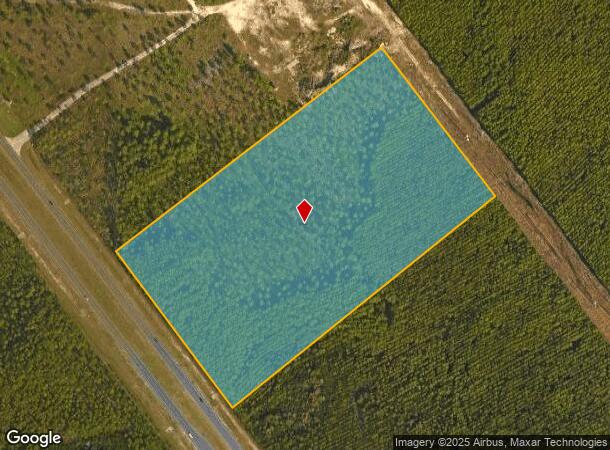
40 Blue Stream Way
26-3S-18-16000-001-0060
COM SE/COR OF NE1/4 SEC 26-3S- 18W,N 72 DEG 2654W 2727.35 FT TO N ROW US HWY 98 FOR POB, N 36 DEG 4109W ALONG ROW 656.79 FT,DPRT ROW N 53 DEG 2731E 1131.28 FT,S 36 DEG 4205E 633.69 FT,S 52 DEG 17 20W 1131.63 FT TO POB. OR 3105-662 OR 3105-3703
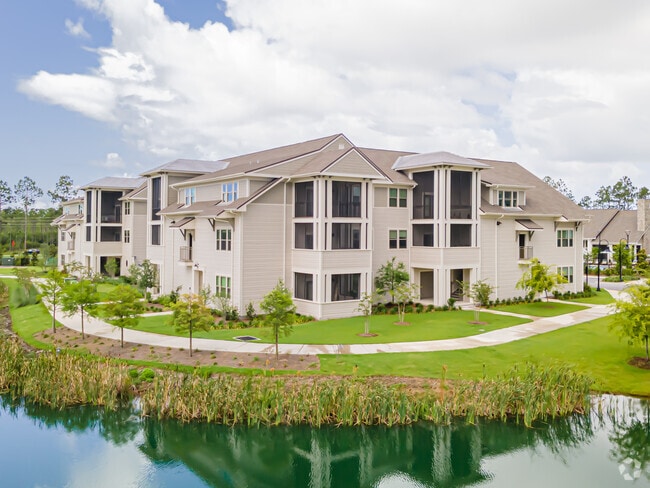
Multifamilydwelling
Walton
X
Florida
12131C0717H
60
2025
16.76 AC
2025
Panama City
950610
Other Market Areas
174,672 SF
Crestview-Fort Walton Beach-Destin, FL
DEMOGRAPHICS near 40 Blue Stream Way
1 Mile
3 Mile
5 Mile
2024 Total Population
3,544
8,850
14,820
2029 Population
4,800
11,831
19,017
Pop Growth 2024-2029
+ 35.44%
+ 33.68%
+ 28.32%
Average Age
47
46
47
2024 Total Households
1,531
3,774
6,546
HH Growth 2024-2029
+ 36.12%
+ 34.39%
+ 28.61%
Median Household Inc
$103,020
$106,815
$95,575
Avg Household Size
2.30
2.30
2.20
2024 Avg HH Vehicles
2.00
2.00
2.00
Median Home Value
$866,498
$791,310
$593,614
Median Year Built
2007
2007
2003
Nearby Places
- Restaurants
- Banks
- Shops
- Fitness
- Groceries
PUBLIC TRANSPORTATION
AIRPORT
Northwest Florida Beaches International
DRIVE
WALK
Distance
Northwest Florida Beaches International
34 min
22.1 mi
Freight Ports
Port of Panama City
DRIVE
WALK
Distance
Port of Panama City
34 min
20.5 mi
Nearby Properties
Address
Land Use
TOTAL SIZE
Lot Size
Zoning
Address
Land Use
TOTAL SIZE
Lot Size
Zoning
1,008 SF
16.89 AC
GULFFR
Address
Land Use
TOTAL SIZE
Lot Size
Zoning
182,091 SF
56.07 AC
HWY 98
Address
Land Use
TOTAL SIZE
Lot Size
Zoning
61,800 SF
0.52 AC
RP
Address
Land Use
TOTAL SIZE
Lot Size
Zoning
18,509 SF
198.98 AC
BC23
Address
Land Use
TOTAL SIZE
Lot Size
Zoning
248,023 SF
8.68 AC
Address
Land Use
TOTAL SIZE
Lot Size
Zoning
41,373 SF
10.50 AC
GULFFR
Address
Land Use
TOTAL SIZE
Lot Size
Zoning
50,715 SF
22.04 AC
TND
Address
Land Use
TOTAL SIZE
Lot Size
Zoning
162,093 SF
6.86 AC
HWY 98
Address
Land Use
TOTAL SIZE
Lot Size
Zoning
17,026 SF
38.47 AC
Address
Land Use
TOTAL SIZE
Lot Size
Zoning
108,026 SF
27.65 AC
Address
Land Use
TOTAL SIZE
Lot Size
Zoning
135,120 SF
9.69 AC
Address
Land Use
TOTAL SIZE
Lot Size
Zoning
1,864 SF
287.23 AC
Address
Land Use
TOTAL SIZE
Lot Size
Zoning
19,148 SF
292.51 AC
RP
Address
Land Use
TOTAL SIZE
Lot Size
Zoning
1.63 AC
GULFFR
Address
Land Use
TOTAL SIZE
Lot Size
Zoning
38,024 SF
2.39 AC
Address
Land Use
TOTAL SIZE
Lot Size
Zoning
8,062 SF
0.38 AC
GULFFR
Address
Land Use
TOTAL SIZE
Lot Size
Zoning
0.12 AC
GULF
Address
Land Use
TOTAL SIZE
Lot Size
Zoning
0.44 AC
GULFFR
Address
Land Use
TOTAL SIZE
Lot Size
Zoning
0.45 AC
GULFFR
Address
Land Use
TOTAL SIZE
Lot Size
Zoning
37,619 SF
2.39 AC
Address
Land Use
TOTAL SIZE
Lot Size
Zoning
0.55 AC
GULFFR
Address
Land Use
TOTAL SIZE
Lot Size
Zoning
0.15 AC
GULF
Address
Land Use
TOTAL SIZE
Lot Size
Zoning
0.19 AC
GULF
Address
Land Use
TOTAL SIZE
Lot Size
Zoning
18.50 AC
BC22
Address
Land Use
TOTAL SIZE
Lot Size
Zoning
0.14 AC
GULF
Address
Land Use
TOTAL SIZE
Lot Size
Zoning
122.59 AC
HWY 98
Address
Land Use
TOTAL SIZE
Lot Size
Zoning
0.13 AC
GULF
Address
Land Use
TOTAL SIZE
Lot Size
Zoning
0.13 AC
GULF
Address
Land Use
TOTAL SIZE
Lot Size
Zoning
0.16 AC
GULF
The World's #1 Commercial Real Estate Marketplace
Connect with us
© 2025 CoStar Group
The information above has been obtained from sources believed reliable. While we do not doubt its accuracy we have not verified it and make no guarantee, warranty or representation about it. It is your responsibility to independently confirm its accuracy and completeness. Any projections, opinions, assumptions, or estimates used are for example only and do not represent the current or future performance of the property. The value of this transaction to you depends on tax and other factors which should be evaluated by your tax, financial, and legal advisors. You and your advisors should conduct a careful, independent investigation of the property to determine to your satisfaction the suitability of the property for your needs.