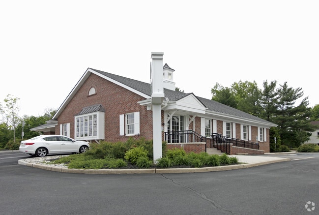
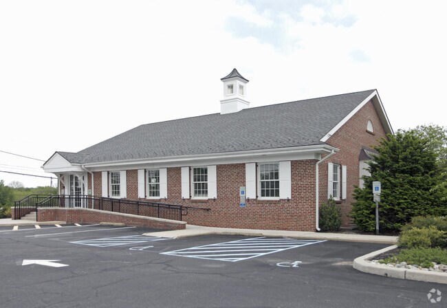
Property Record
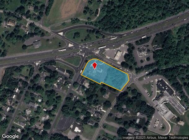
40 Broad St, Stockton, NJ 08559
NEARBY LISTINGS FOR SALE OR LEASE
Property Detail
40 Broad St
22-00089-0000-00001
ADDITIONAL LOTS: 3000-SF
Officebuilding
Hunterdon
X
New Jersey
34019C0268F
1
2024
2.25 AC
2025
Hunterdon
011600
Northern New Jersey
3,120 SF
Newark, NJ-PA
DEMOGRAPHICS near 40 Broad St
1 Mile
3 Mile
5 Mile
2024 Total Population
1,144
14,110
41,792
2029 Population
1,148
14,359
42,372
Pop Growth 2024-2029
+ 0.35%
+ 1.76%
+ 1.39%
Average Age
45
44
43
2024 Total Households
523
5,242
15,542
HH Growth 2024-2029
+ 0.76%
+ 1.83%
+ 1.42%
Median Household Inc
$114,615
$149,084
$135,543
Avg Household Size
2.10
2.60
2.60
2024 Avg HH Vehicles
2.00
2.00
2.00
Median Home Value
$417,969
$487,434
$480,206
Median Year Built
1984
1984
1982
Nearby Places
Map Layers
Map Styles
 Street
 Aerial
- Restaurants
- Banks
- Shops
- Fitness
- Groceries
PUBLIC TRANSPORTATION
COMMUTER RAIL
North Branch (Raritan Valley Line - NJ Transit Commuter Rail (NJ Transit))
DRIVE
WALK
Distance
North Branch (Raritan Valley Line - NJ Transit Commuter Rail (NJ Transit))
17 min
8.6 mi
Raritan (Raritan Valley Line - NJ Transit Commuter Rail (NJ Transit))
DRIVE
WALK
Distance
Raritan (Raritan Valley Line - NJ Transit Commuter Rail (NJ Transit))
15 min
9.6 mi
AIRPORT
Trenton Mercer
DRIVE
WALK
Distance
Trenton Mercer
39 min
21.9 mi
Newark Liberty International
DRIVE
WALK
Distance
Newark Liberty International
56 min
43.7 mi
Lehigh Valley International
DRIVE
WALK
Distance
Lehigh Valley International
66 min
46.6 mi
Freight Ports
New York Container Terminal
DRIVE
WALK
Distance
New York Container Terminal
57 min
42.8 mi
SALE & LEASE HISTORY
LISTING DATE
SALE/LEASE

Aug 13, 2024
For Sale
Nearby Properties
Address
Land Use
TOTAL SIZE
Lot Size
Zoning
Address
Land Use
TOTAL SIZE
Lot Size
Zoning
68.38 AC
P
Address
Land Use
TOTAL SIZE
Lot Size
Zoning
39.32 AC
P
Address
Land Use
TOTAL SIZE
Lot Size
Zoning
26.03 AC
I-2
Address
Land Use
TOTAL SIZE
Lot Size
Zoning
108.22 AC
I-2
Address
Land Use
TOTAL SIZE
Lot Size
Zoning
1,418 SF
19.67 AC
P
Address
Land Use
TOTAL SIZE
Lot Size
Zoning
16.01 AC
I-2
Address
Land Use
TOTAL SIZE
Lot Size
Zoning
8.07 AC
I-2
Address
Land Use
TOTAL SIZE
Lot Size
Zoning
38.30 AC
O-2
Address
Land Use
TOTAL SIZE
Lot Size
Zoning
2,360 SF
36.04 AC
I-2
Address
Land Use
TOTAL SIZE
Lot Size
Zoning
17.88 AC
O-2
Address
Land Use
TOTAL SIZE
Lot Size
Zoning
14.32 AC
AG
Address
Land Use
TOTAL SIZE
Lot Size
Zoning
28.68 AC
I-2
Address
Land Use
TOTAL SIZE
Lot Size
Zoning
7.69 AC
I-2
Address
Land Use
TOTAL SIZE
Lot Size
Zoning
7.14 AC
PCOS
Address
Land Use
TOTAL SIZE
Lot Size
Zoning
6.46 AC
I-2
Address
Land Use
TOTAL SIZE
Lot Size
Zoning
8.50 AC
VR
Address
Land Use
TOTAL SIZE
Lot Size
Zoning
8.74 AC
I-2
Address
Land Use
TOTAL SIZE
Lot Size
Zoning
3.17 AC
P
Address
Land Use
TOTAL SIZE
Lot Size
Zoning
7.26 AC
I-2
Address
Land Use
TOTAL SIZE
Lot Size
Zoning
18.76 AC
I-2
Address
Land Use
TOTAL SIZE
Lot Size
Zoning
1,305 SF
9.50 AC
O-2
Address
Land Use
TOTAL SIZE
Lot Size
Zoning
14.77 AC
I-2
Address
Land Use
TOTAL SIZE
Lot Size
Zoning
5.07 AC
I-2
Address
Land Use
TOTAL SIZE
Lot Size
Zoning
Address
Land Use
TOTAL SIZE
Lot Size
Zoning
8.57 AC
I-2
Address
Land Use
TOTAL SIZE
Lot Size
Zoning
964 SF
8.62 AC
AR
Address
Land Use
TOTAL SIZE
Lot Size
Zoning
10.47 AC
I-1
Address
Land Use
TOTAL SIZE
Lot Size
Zoning
22.53 AC
I-2
Address
Land Use
TOTAL SIZE
Lot Size
Zoning
2.86 AC
I-2
Address
Land Use
TOTAL SIZE
Lot Size
Zoning
2.28 AC
I-2
The World's #1 Commercial Real Estate Marketplace
Connect with us
© 2025 CoStar Group
The information above has been obtained from sources believed reliable. While we do not doubt its accuracy we have not verified it and make no guarantee, warranty or representation about it. It is your responsibility to independently confirm its accuracy and completeness. Any projections, opinions, assumptions, or estimates used are for example only and do not represent the current or future performance of the property. The value of this transaction to you depends on tax and other factors which should be evaluated by your tax, financial, and legal advisors. You and your advisors should conduct a careful, independent investigation of the property to determine to your satisfaction the suitability of the property for your needs.