Property Record
40 E Rossi St, Salinas, CA 93901


Property Detail
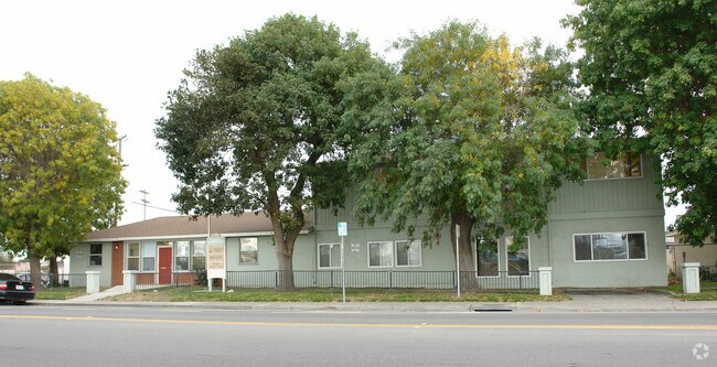
40 E Rossi St
Salinas, CA
ASSRS MAP OF SALINAS, PORTION OF LOT 62 & SUB A OF LOT 62 AS DESCRIBED IN DOC# 2017008107 1.5 AC APPROX
003-131-019-000
MONTEREY
Apartment
California
AH Areas with a 1% annual chance of shallow flooding, usually in the form of a pond, withan average depth ranging from 1 to 3 feet. These areas have a 26% chance of flooding over the life of a 30-year mortgage.
62
2024
1.50 AC
2025
Salinas
001802
Salinas
75,000 SF
NEARBY LISTINGS FOR SALE OR LEASE
DEMOGRAPHICS near 40 E Rossi St
1 mile
3 mile
5 mile
2025 Total Population
22,569
142,986
167,593
2030 Population
22,393
141,645
165,983
Pop Growth 2025-2030
(0.78%)
(0.94%)
(0.96%)
Average Age
36
35
35
2025 Total Households
6,792
37,657
44,089
HH Growth 2025-2030
(1.09%)
(1.18%)
(1.19%)
Median Household Inc
$75,520
$84,323
$86,841
Avg Household Size
3.10
3.60
3.60
2025 Avg HH Vehicles
2.00
2.00
2.00
Median Home Value
$673,611
$680,007
$682,584
Median Year Built
1973
1974
1976
Nearby Places
Map Layers
Map Styles
 Street
 Aerial
Layers
 Traffic
 Biking
Places
Listings with unknown addresses are not visible on the map
- Restaurants
- Banks
- Shops
- Fitness
- Groceries
PUBLIC TRANSPORTATION
COMMUTER RAIL
Salinas (Coast Starlight - Amtrak)
Drive
Walk
Distance
Salinas (Coast Starlight - Amtrak)
2 min
10 min
0.5 mi
AIRPORT
Monterey Regional
Drive
Walk
Distance
Monterey Regional
23 min
16.1 mi
Freight Ports
Port of Redwood City
Drive
Walk
Distance
Port of Redwood City
96 min
80.9 mi
Nearby Properties
Address
Land Use
TOTAL SIZE
Lot Size
Zoning
Address
Land Use
TOTAL SIZE
Lot Size
Zoning
1.28 AC
Address
Land Use
TOTAL SIZE
Lot Size
Zoning
230,236 SF
15.57 AC
Address
Land Use
TOTAL SIZE
Lot Size
Zoning
1.21 AC
Address
Land Use
TOTAL SIZE
Lot Size
Zoning
32.88 AC
Address
Land Use
TOTAL SIZE
Lot Size
Zoning
4.37 AC
Address
Land Use
TOTAL SIZE
Lot Size
Zoning
13.86 AC
Address
Land Use
TOTAL SIZE
Lot Size
Zoning
156,370 SF
58.55 AC
Address
Land Use
TOTAL SIZE
Lot Size
Zoning
115,480 SF
12.31 AC
Address
Land Use
TOTAL SIZE
Lot Size
Zoning
326,236 SF
28.41 AC
Address
Land Use
TOTAL SIZE
Lot Size
Zoning
154,360 SF
19.96 AC
Address
Land Use
TOTAL SIZE
Lot Size
Zoning
303,260 SF
30.31 AC
Address
Land Use
TOTAL SIZE
Lot Size
Zoning
181,089 SF
11 AC
Address
Land Use
TOTAL SIZE
Lot Size
Zoning
75,772 SF
2.04 AC
Address
Land Use
TOTAL SIZE
Lot Size
Zoning
13.86 AC
Address
Land Use
TOTAL SIZE
Lot Size
Zoning
0.09 AC
Address
Land Use
TOTAL SIZE
Lot Size
Zoning
14,960 SF
16.02 AC
Address
Land Use
TOTAL SIZE
Lot Size
Zoning
192,296 SF
15.59 AC
Address
Land Use
TOTAL SIZE
Lot Size
Zoning
66,004 SF
12.03 AC
Address
Land Use
TOTAL SIZE
Lot Size
Zoning
193,480 SF
16.27 AC
Address
Land Use
TOTAL SIZE
Lot Size
Zoning
1.37 AC
Address
Land Use
TOTAL SIZE
Lot Size
Zoning
76,737 SF
3.36 AC
Address
Land Use
TOTAL SIZE
Lot Size
Zoning
1.97 AC
Address
Land Use
TOTAL SIZE
Lot Size
Zoning
89,770 SF
10 AC
Address
Land Use
TOTAL SIZE
Lot Size
Zoning
9.80 AC
Address
Land Use
TOTAL SIZE
Lot Size
Zoning
162,297 SF
12 AC
Address
Land Use
TOTAL SIZE
Lot Size
Zoning
112,816 SF
9.91 AC
Address
Land Use
TOTAL SIZE
Lot Size
Zoning
8.10 AC
Address
Land Use
TOTAL SIZE
Lot Size
Zoning
9.22 AC
Address
Land Use
TOTAL SIZE
Lot Size
Zoning
The World's #1 Commercial Real Estate Marketplace
Connect with us
© 2026 CoStar Group
The information above has been obtained from sources believed reliable. While we do not doubt its accuracy we have not verified it and make no guarantee, warranty or representation about it. It is your responsibility to independently confirm its accuracy and completeness. Any projections, opinions, assumptions, or estimates used are for example only and do not represent the current or future performance of the property. The value of this transaction to you depends on tax and other factors which should be evaluated by your tax, financial, and legal advisors. You and your advisors should conduct a careful, independent investigation of the property to determine to your satisfaction the suitability of the property for your needs.