Property Record
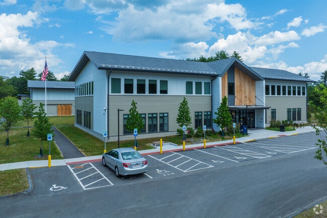
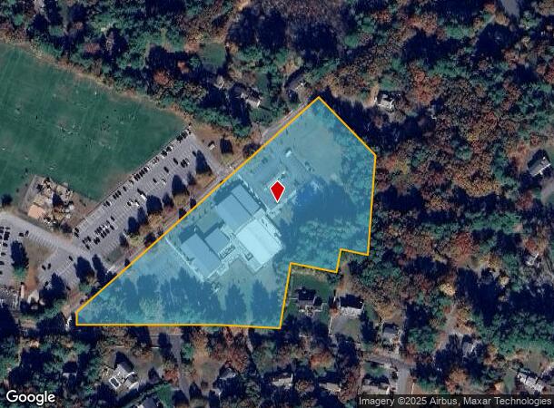
40 Fairbank Rd, Sudbury, MA 01776
NEARBY LISTINGS FOR SALE OR LEASE
Property Detail
40 Fairbank Rd
Governmentalpublicusegeneral
Middlesex
X
Massachusetts
25017C0364F
8.05 AC
0
Concord/Maynard
2025
Boston
365100
Boston-Cambridge-Newton, MA-NH
28,601 SF
SUDB-000006F-000000-000001
DEMOGRAPHICS near 40 Fairbank Rd
1 Mile
3 Mile
5 Mile
2024 Total Population
4,099
25,711
73,846
2029 Population
4,049
25,597
73,467
Pop Growth 2024-2029
(1.22%)
(0.44%)
(0.51%)
Average Age
40
42
43
2024 Total Households
1,288
9,365
28,128
HH Growth 2024-2029
(1.32%)
(0.58%)
(0.59%)
Median Household Inc
$252,124
$187,040
$148,599
Avg Household Size
3.10
2.70
2.60
2024 Avg HH Vehicles
2.00
2.00
2.00
Median Home Value
$808,741
$758,696
$684,622
Median Year Built
1969
1972
1973
Nearby Places
Map Layers
Map Styles
 Street
 Aerial
- Restaurants
- Banks
- Shops
- Fitness
- Groceries
PUBLIC TRANSPORTATION
COMMUTER RAIL
South Acton (Fitchburg/South Acton Line - Massachusetts Bay Transportation Authority Commuter Rail (Purple Line))
DRIVE
WALK
Distance
South Acton (Fitchburg/South Acton Line - Massachusetts Bay Transportation Authority Commuter Rail (Purple Line))
11 min
5.6 mi
West Concord (Fitchburg/South Acton Line - Massachusetts Bay Transportation Authority Commuter Rail (Purple Line))
DRIVE
WALK
Distance
West Concord (Fitchburg/South Acton Line - Massachusetts Bay Transportation Authority Commuter Rail (Purple Line))
13 min
6.8 mi
AIRPORT
General Edward Lawrence Logan International
DRIVE
WALK
Distance
General Edward Lawrence Logan International
44 min
27.3 mi
Worcester Regional
DRIVE
WALK
Distance
Worcester Regional
47 min
28.0 mi
Freight Ports
Port of Boston
DRIVE
WALK
Distance
Port of Boston
43 min
25.7 mi
Nearby Properties
Address
Land Use
TOTAL SIZE
Lot Size
Zoning
Address
Land Use
TOTAL SIZE
Lot Size
Zoning
24.78 AC
LID
Address
Land Use
TOTAL SIZE
Lot Size
Zoning
160 SF
R1
Address
Land Use
TOTAL SIZE
Lot Size
Zoning
225,181 SF
93.94 AC
RESA
Address
Land Use
TOTAL SIZE
Lot Size
Zoning
326,464 SF
19.52 AC
I
Address
Land Use
TOTAL SIZE
Lot Size
Zoning
51,504 SF
18.87 AC
C
Address
Land Use
TOTAL SIZE
Lot Size
Zoning
46.82 AC
RC
Address
Land Use
TOTAL SIZE
Lot Size
Zoning
162,704 SF
26.50 AC
RESA
Address
Land Use
TOTAL SIZE
Lot Size
Zoning
155,339 SF
24 AC
R1
Address
Land Use
TOTAL SIZE
Lot Size
Zoning
35.99 AC
HI
Address
Land Use
TOTAL SIZE
Lot Size
Zoning
26.16 AC
LID
Address
Land Use
TOTAL SIZE
Lot Size
Zoning
27.16 AC
RESA
Address
Land Use
TOTAL SIZE
Lot Size
Zoning
815 AC
OS
Address
Land Use
TOTAL SIZE
Lot Size
Zoning
9.26 AC
LBD
Address
Land Use
TOTAL SIZE
Lot Size
Zoning
9.66 AC
LBD
Address
Land Use
TOTAL SIZE
Lot Size
Zoning
990.40 AC
RC
Address
Land Use
TOTAL SIZE
Lot Size
Zoning
122.98 AC
SA8
Address
Land Use
TOTAL SIZE
Lot Size
Zoning
159,720 SF
16.05 AC
M6
Address
Land Use
TOTAL SIZE
Lot Size
Zoning
8.28 AC
LID
Address
Land Use
TOTAL SIZE
Lot Size
Zoning
43,302 SF
4.70 AC
LID
Address
Land Use
TOTAL SIZE
Lot Size
Zoning
22.61 AC
RESC
Address
Land Use
TOTAL SIZE
Lot Size
Zoning
59,681 SF
21.26 AC
RESC
Address
Land Use
TOTAL SIZE
Lot Size
Zoning
6.30 AC
VBD
Address
Land Use
TOTAL SIZE
Lot Size
Zoning
85,000 SF
18.77 AC
R1
Address
Land Use
TOTAL SIZE
Lot Size
Zoning
2,520 SF
3.10 AC
RESA
Address
Land Use
TOTAL SIZE
Lot Size
Zoning
65.15 AC
WI
Address
Land Use
TOTAL SIZE
Lot Size
Zoning
8.10 AC
LBD
Address
Land Use
TOTAL SIZE
Lot Size
Zoning
107,264 SF
9.08 AC
LID
Address
Land Use
TOTAL SIZE
Lot Size
Zoning
2.82 AC
LBD
Address
Land Use
TOTAL SIZE
Lot Size
Zoning
8.06 AC
R1
Address
Land Use
TOTAL SIZE
Lot Size
Zoning
2.63 AC
LID
The World's #1 Commercial Real Estate Marketplace
Connect with us
© 2025 CoStar Group
The information above has been obtained from sources believed reliable. While we do not doubt its accuracy we have not verified it and make no guarantee, warranty or representation about it. It is your responsibility to independently confirm its accuracy and completeness. Any projections, opinions, assumptions, or estimates used are for example only and do not represent the current or future performance of the property. The value of this transaction to you depends on tax and other factors which should be evaluated by your tax, financial, and legal advisors. You and your advisors should conduct a careful, independent investigation of the property to determine to your satisfaction the suitability of the property for your needs.