Property Record
40 Highway 128, Geyserville, CA 95441
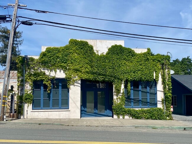


Property Detail
40 Highway 128
140-100-007
UNINCORP COUNTY CA
Officebuilding
Sonoma
R26UA
California
B and X Area of moderate flood hazard, usually the area between the limits of the 100-year and 500-year floods.
0.09 AC
2025
Healdsburg/Cloverdale
2025
North Bay/Santa Rosa
154100
Santa Rosa-Petaluma, CA
2,470 SF
NEARBY LISTINGS FOR SALE OR LEASE
DEMOGRAPHICS near 40 Highway 128
1 mile
3 mile
5 mile
2025 Total Population
748
1,498
3,208
2030 Population
710
1,442
3,124
Pop Growth 2025-2030
(5.08%)
(3.74%)
(2.62%)
Average Age
46
48
49
2025 Total Households
262
552
1,227
HH Growth 2025-2030
(5.34%)
(3.62%)
(2.61%)
Median Household Inc
$129,276
$130,303
$136,431
Avg Household Size
2.50
2.50
2.50
2025 Avg HH Vehicles
2.00
3.00
2.00
Median Home Value
$1,066,346
$1,038,038
$1,075,536
Median Year Built
1968
1969
1974
Nearby Places
Map Layers
Map Styles
 Street
 Aerial
Layers
 Traffic
 Biking
Places
Listings with unknown addresses are not visible on the map
- Restaurants
- Banks
- Shops
- Fitness
- Groceries
PUBLIC TRANSPORTATION
AIRPORT
Charles M Schulz - Sonoma County
Drive
Walk
Distance
Charles M Schulz - Sonoma County
24 min
17.8 mi
Freight Ports
Port of Richmond
Drive
Walk
Distance
Port of Richmond
88 min
70.7 mi
SALE & LEASE HISTORY
LISTING DATE
SALE/LEASE

May 04, 2025
For Sale
Apr 17, 2024
For Sale
Apr 02, 2026
For Sale
Nearby Properties
Address
Land Use
TOTAL SIZE
Lot Size
Zoning
Address
Land Use
TOTAL SIZE
Lot Size
Zoning
219,180 SF
0.15 AC
LIA20
Address
Land Use
TOTAL SIZE
Lot Size
Zoning
Address
Land Use
TOTAL SIZE
Lot Size
Zoning
507.59 AC
Address
Land Use
TOTAL SIZE
Lot Size
Zoning
Address
Land Use
TOTAL SIZE
Lot Size
Zoning
2,650 SF
6.13 AC
Address
Land Use
TOTAL SIZE
Lot Size
Zoning
8,349 SF
50 AC
LIAB7FRZN
Address
Land Use
TOTAL SIZE
Lot Size
Zoning
40,000 SF
21.85 AC
LIA20
Address
Land Use
TOTAL SIZE
Lot Size
Zoning
5,545 SF
58.92 AC
RRDB7FRZN
Address
Land Use
TOTAL SIZE
Lot Size
Zoning
6,128 SF
310 AC
LIA20
Address
Land Use
TOTAL SIZE
Lot Size
Zoning
7.27 AC
LIA20
Address
Land Use
TOTAL SIZE
Lot Size
Zoning
32.12 AC
Address
Land Use
TOTAL SIZE
Lot Size
Zoning
4,666 SF
71.60 AC
LIA40
Address
Land Use
TOTAL SIZE
Lot Size
Zoning
7,281 SF
384 AC
Address
Land Use
TOTAL SIZE
Lot Size
Zoning
3,173 SF
20.01 AC
LIA20
Address
Land Use
TOTAL SIZE
Lot Size
Zoning
40.82 AC
Address
Land Use
TOTAL SIZE
Lot Size
Zoning
2,288 SF
24.75 AC
Address
Land Use
TOTAL SIZE
Lot Size
Zoning
10 AC
LIA20
Address
Land Use
TOTAL SIZE
Lot Size
Zoning
20.16 AC
Address
Land Use
TOTAL SIZE
Lot Size
Zoning
54.26 AC
LIA20
Address
Land Use
TOTAL SIZE
Lot Size
Zoning
3,279 SF
66.32 AC
Address
Land Use
TOTAL SIZE
Lot Size
Zoning
13.50 AC
LIA20
Address
Land Use
TOTAL SIZE
Lot Size
Zoning
4,318 SF
49.13 AC
LIA40
Address
Land Use
TOTAL SIZE
Lot Size
Zoning
3,896 SF
20.02 AC
LIA20
Address
Land Use
TOTAL SIZE
Lot Size
Zoning
4,484 SF
0.12 AC
LIAB7FRZN
Address
Land Use
TOTAL SIZE
Lot Size
Zoning
28.50 AC
LIA20
Address
Land Use
TOTAL SIZE
Lot Size
Zoning
3,469 SF
41.45 AC
LIA20
Address
Land Use
TOTAL SIZE
Lot Size
Zoning
1,388 SF
26.25 AC
Address
Land Use
TOTAL SIZE
Lot Size
Zoning
2,218 SF
47.48 AC
Address
Land Use
TOTAL SIZE
Lot Size
Zoning
1,800 SF
197.18 AC
RRDW120
Address
Land Use
TOTAL SIZE
Lot Size
Zoning
226.73 AC
The World's #1 Commercial Real Estate Marketplace
Connect with us
© 2026 CoStar Group
The information above has been obtained from sources believed reliable. While we do not doubt its accuracy we have not verified it and make no guarantee, warranty or representation about it. It is your responsibility to independently confirm its accuracy and completeness. Any projections, opinions, assumptions, or estimates used are for example only and do not represent the current or future performance of the property. The value of this transaction to you depends on tax and other factors which should be evaluated by your tax, financial, and legal advisors. You and your advisors should conduct a careful, independent investigation of the property to determine to your satisfaction the suitability of the property for your needs.