Property Record
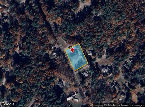
40 Mammoth Rd, Londonderry, NH 03053
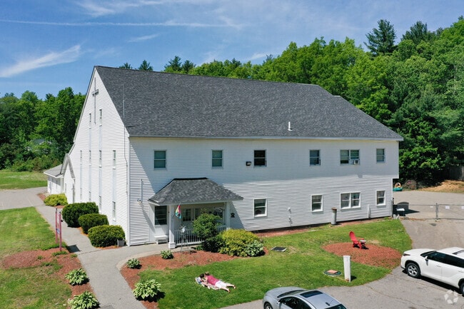
This Property Is For Sale
NEARBY LISTINGS FOR SALE OR LEASE
Property Detail
40 Mammoth Rd
LOND-000001-000000-000043
Rockingham
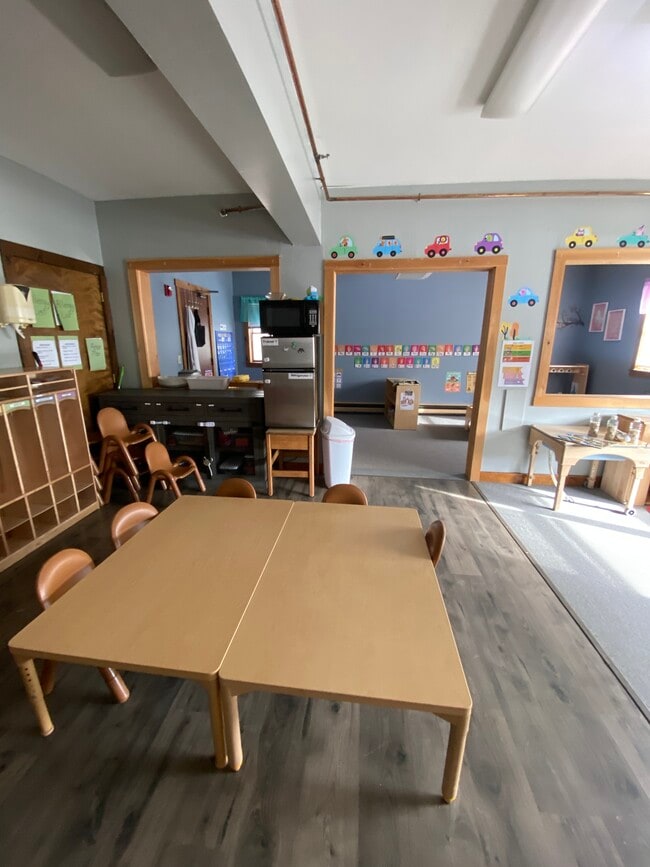
Daycare
New Hampshire
X
43-0
33015C0528E
1.21 AC
2024
Rockingham
2024
Boston
003902
Boston-Cambridge-Newton, MA-NH
14,715 SF
DEMOGRAPHICS near 40 Mammoth Rd
1 Mile
3 Mile
5 Mile
2024 Total Population
2,593
21,458
61,040
2029 Population
2,680
22,184
63,122
Pop Growth 2024-2029
+ 3.36%
+ 3.38%
+ 3.41%
Average Age
41
42
42
2024 Total Households
911
7,573
22,287
HH Growth 2024-2029
+ 3.29%
+ 3.27%
+ 3.36%
Median Household Inc
$126,258
$137,685
$122,336
Avg Household Size
2.80
2.80
2.70
2024 Avg HH Vehicles
2.00
2.00
2.00
Median Home Value
$411,614
$445,030
$417,225
Median Year Built
1978
1984
1984
Nearby Places
Map Layers
Map Styles
 Street
 Aerial
- Restaurants
- Banks
- Shops
- Fitness
- Groceries
PUBLIC TRANSPORTATION
AIRPORT
Manchester Boston Regional
DRIVE
WALK
Distance
Manchester Boston Regional
26 min
11.6 mi
General Edward Lawrence Logan International
DRIVE
WALK
Distance
General Edward Lawrence Logan International
58 min
42.5 mi
Freight Ports
Port of Boston
DRIVE
WALK
Distance
Port of Boston
64 min
43.7 mi
Nearby Properties
Address
Land Use
TOTAL SIZE
Lot Size
Zoning
Address
Land Use
TOTAL SIZE
Lot Size
Zoning
195,778 SF
101.88 AC
RD
Address
Land Use
TOTAL SIZE
Lot Size
Zoning
12.73 AC
C-I
Address
Land Use
TOTAL SIZE
Lot Size
Zoning
80,710 SF
20 AC
AR-I
Address
Land Use
TOTAL SIZE
Lot Size
Zoning
41,989 SF
C-III
Address
Land Use
TOTAL SIZE
Lot Size
Zoning
60,572 SF
5.65 AC
C-I
Address
Land Use
TOTAL SIZE
Lot Size
Zoning
11.28 AC
C-I
Address
Land Use
TOTAL SIZE
Lot Size
Zoning
71,854 SF
26 AC
RD
Address
Land Use
TOTAL SIZE
Lot Size
Zoning
15,000 SF
C-III
Address
Land Use
TOTAL SIZE
Lot Size
Zoning
45,330 SF
1 AC
R3
Address
Land Use
TOTAL SIZE
Lot Size
Zoning
69,900 SF
18.10 AC
BD
Address
Land Use
TOTAL SIZE
Lot Size
Zoning
44,280 SF
1 AC
R3
Address
Land Use
TOTAL SIZE
Lot Size
Zoning
25,083 SF
1.42 AC
C-III
Address
Land Use
TOTAL SIZE
Lot Size
Zoning
2,400 SF
15.50 AC
G1
Address
Land Use
TOTAL SIZE
Lot Size
Zoning
31,091 SF
3.42 AC
BD
Address
Land Use
TOTAL SIZE
Lot Size
Zoning
20,986 SF
2.41 AC
C-III
Address
Land Use
TOTAL SIZE
Lot Size
Zoning
80,145 SF
6.10 AC
ID
Address
Land Use
TOTAL SIZE
Lot Size
Zoning
13,890 SF
4.56 AC
ID
Address
Land Use
TOTAL SIZE
Lot Size
Zoning
9,800 SF
10.09 AC
B
Address
Land Use
TOTAL SIZE
Lot Size
Zoning
12,300 SF
9.93 AC
AR-1/C
Address
Land Use
TOTAL SIZE
Lot Size
Zoning
4.15 AC
C-I
Address
Land Use
TOTAL SIZE
Lot Size
Zoning
24,225 SF
7 AC
AR-I
Address
Land Use
TOTAL SIZE
Lot Size
Zoning
48,675 SF
3.83 AC
ID
Address
Land Use
TOTAL SIZE
Lot Size
Zoning
9,960 SF
3.11 AC
C-I
Address
Land Use
TOTAL SIZE
Lot Size
Zoning
600 SF
21.74 AC
ID
Address
Land Use
TOTAL SIZE
Lot Size
Zoning
3.48 AC
C-I
Address
Land Use
TOTAL SIZE
Lot Size
Zoning
9,600 SF
15.14 AC
C-II
Address
Land Use
TOTAL SIZE
Lot Size
Zoning
37,590 SF
3.94 AC
ID
Address
Land Use
TOTAL SIZE
Lot Size
Zoning
3.60 AC
C-I
Address
Land Use
TOTAL SIZE
Lot Size
Zoning
10.81 AC
C-I
Address
Land Use
TOTAL SIZE
Lot Size
Zoning
3,095 SF
5.61 AC
NBD
The World's #1 Commercial Real Estate Marketplace
Connect with us
© 2025 CoStar Group
The information above has been obtained from sources believed reliable. While we do not doubt its accuracy we have not verified it and make no guarantee, warranty or representation about it. It is your responsibility to independently confirm its accuracy and completeness. Any projections, opinions, assumptions, or estimates used are for example only and do not represent the current or future performance of the property. The value of this transaction to you depends on tax and other factors which should be evaluated by your tax, financial, and legal advisors. You and your advisors should conduct a careful, independent investigation of the property to determine to your satisfaction the suitability of the property for your needs.