Property Record
40 Meadow Access Ln, Walpole, NH 03608
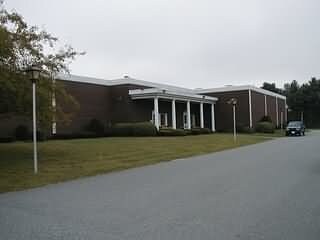

Property Detail
40 Meadow Access Ln
WLPO-000012-000000-000055-000004
CHESHIRE
Commercialnec
New Hampshire
COM C
55
B and X Area of moderate flood hazard, usually the area between the limits of the 100-year and 500-year floods.
4.76 AC
2025
Manchester/New Hampshire South Area
2025
Other Market Areas
970200
Keene, NH
12,565 SF
NEARBY LISTINGS FOR SALE OR LEASE
-
-
View all Walpole listings for sale on LoopNet.com
DEMOGRAPHICS near 40 Meadow Access Ln
1 mile
3 mile
5 mile
2025 Total Population
439
6,224
9,213
2030 Population
420
6,158
9,119
Pop Growth 2025-2030
(4.33%)
(1.06%)
(1.02%)
Average Age
49
45
45
2025 Total Households
207
2,821
4,119
HH Growth 2025-2030
(4.35%)
(1.13%)
(1.12%)
Median Household Inc
$68,684
$68,692
$72,898
Avg Household Size
2.10
2.20
2.20
2025 Avg HH Vehicles
2.00
2.00
2.00
Median Home Value
$386,585
$256,089
$272,222
Median Year Built
1961
1949
1958
Nearby Places
Map Layers
Map Styles
 Street
 Aerial
Transit
 Traffic
 Biking
Places
Listings with unknown addresses are not visible on the map
- Restaurants
- Banks
- Shops
- Fitness
- Groceries
PUBLIC TRANSPORTATION
COMMUTER RAIL
Drive
Walk
Distance
8 min
3.4 mi
Nearby Properties
Address
Land Use
TOTAL SIZE
Lot Size
Zoning
Address
Land Use
TOTAL SIZE
Lot Size
Zoning
13.51 AC
Address
Land Use
TOTAL SIZE
Lot Size
Zoning
Address
Land Use
TOTAL SIZE
Lot Size
Zoning
Address
Land Use
TOTAL SIZE
Lot Size
Zoning
Address
Land Use
TOTAL SIZE
Lot Size
Zoning
8.30 AC
Address
Land Use
TOTAL SIZE
Lot Size
Zoning
Address
Land Use
TOTAL SIZE
Lot Size
Zoning
16.54 AC
RB R
Address
Land Use
TOTAL SIZE
Lot Size
Zoning
95.55 AC
RUR R
Address
Land Use
TOTAL SIZE
Lot Size
Zoning
50.80 AC
Address
Land Use
TOTAL SIZE
Lot Size
Zoning
12.40 AC
Address
Land Use
TOTAL SIZE
Lot Size
Zoning
55,037 SF
12.15 AC
COM C
Address
Land Use
TOTAL SIZE
Lot Size
Zoning
Address
Land Use
TOTAL SIZE
Lot Size
Zoning
28,905 SF
5.85 AC
Address
Land Use
TOTAL SIZE
Lot Size
Zoning
1.90 AC
RB R
Address
Land Use
TOTAL SIZE
Lot Size
Zoning
60,615 SF
0.91 AC
Address
Land Use
TOTAL SIZE
Lot Size
Zoning
176 AC
IND I
Address
Land Use
TOTAL SIZE
Lot Size
Zoning
19,452 SF
4.92 AC
COM C
Address
Land Use
TOTAL SIZE
Lot Size
Zoning
31,332 SF
3.34 AC
COM C
Address
Land Use
TOTAL SIZE
Lot Size
Zoning
Address
Land Use
TOTAL SIZE
Lot Size
Zoning
4.04 AC
COM C
Address
Land Use
TOTAL SIZE
Lot Size
Zoning
9,891 SF
5.10 AC
RUR R
Address
Land Use
TOTAL SIZE
Lot Size
Zoning
8.80 AC
Address
Land Use
TOTAL SIZE
Lot Size
Zoning
15,187 SF
10 AC
NRB11N
Address
Land Use
TOTAL SIZE
Lot Size
Zoning
Address
Land Use
TOTAL SIZE
Lot Size
Zoning
20,063 SF
4.39 AC
RUR R
Address
Land Use
TOTAL SIZE
Lot Size
Zoning
25,902 SF
7.15 AC
IND I
Address
Land Use
TOTAL SIZE
Lot Size
Zoning
12,854 SF
0.27 AC
RB R
Address
Land Use
TOTAL SIZE
Lot Size
Zoning
23,079 SF
0.71 AC
COM C
Address
Land Use
TOTAL SIZE
Lot Size
Zoning
5.94 AC
COM C
The World's #1 Commercial Real Estate Marketplace
Connect with us
© 2026 CoStar Group
The information above has been obtained from sources believed reliable. While we do not doubt its accuracy we have not verified it and make no guarantee, warranty or representation about it. It is your responsibility to independently confirm its accuracy and completeness. Any projections, opinions, assumptions, or estimates used are for example only and do not represent the current or future performance of the property. The value of this transaction to you depends on tax and other factors which should be evaluated by your tax, financial, and legal advisors. You and your advisors should conduct a careful, independent investigation of the property to determine to your satisfaction the suitability of the property for your needs.