Property Record
40 Southmoor Cir Ne, Dayton, OH 45429
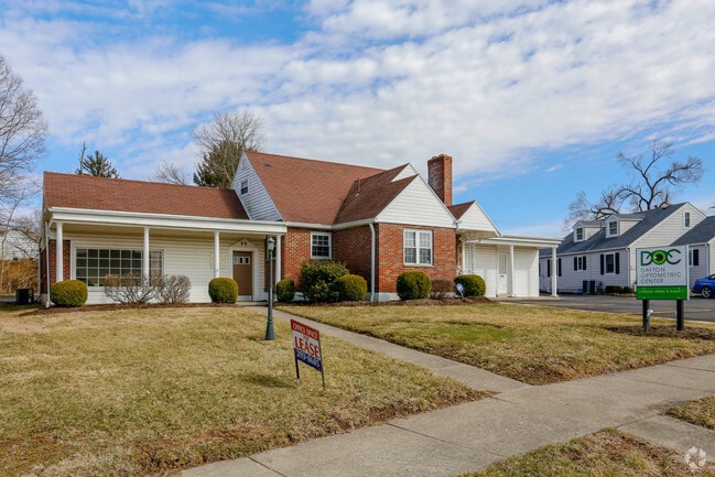
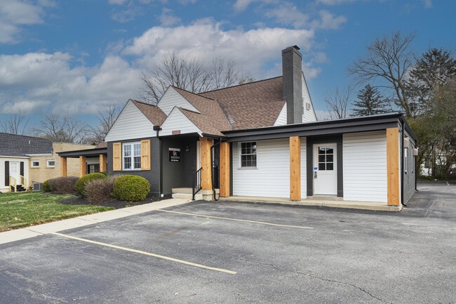
This Property Is For Sale
NEARBY LISTINGS FOR SALE OR LEASE
Property Detail
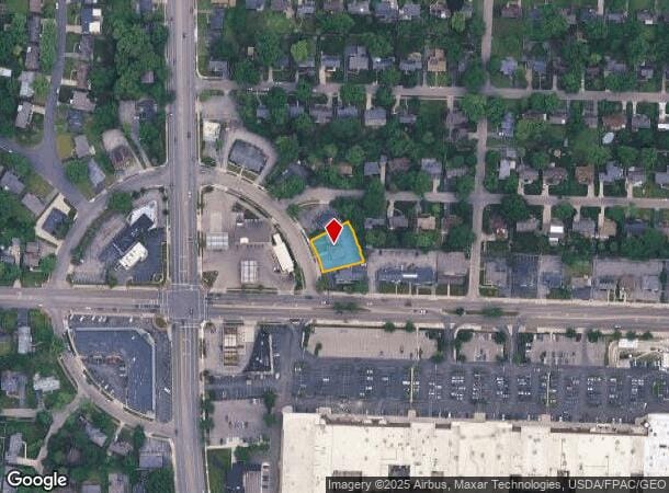
40 Southmoor Cir Ne
Dayton, OH
Oakview
N64-00604-0010
10 OAKVIEW
Officebuilding
Montgomery
X
Ohio
39113C0258E
10
2024
0.26 AC
2025
South Central Dayton
020700
Cincinnati/Dayton
3,473 SF
DEMOGRAPHICS near 40 Southmoor Cir Ne
1 Mile
3 Mile
5 Mile
2024 Total Population
10,505
82,131
208,463
2029 Population
10,297
80,679
207,322
Pop Growth 2024-2029
(1.98%)
(1.77%)
(0.55%)
Average Age
45
42
40
2024 Total Households
5,090
36,691
90,523
HH Growth 2024-2029
(1.96%)
(1.75%)
(0.61%)
Median Household Inc
$74,906
$68,335
$61,676
Avg Household Size
2.00
2.20
2.20
2024 Avg HH Vehicles
2.00
2.00
2.00
Median Home Value
$196,473
$187,614
$174,709
Median Year Built
1957
1959
1963
Nearby Places
Map Layers
Map Styles
 Street
 Aerial
- Restaurants
- Banks
- Shops
- Fitness
- Groceries
PUBLIC TRANSPORTATION
AIRPORT
James M Cox Dayton International
DRIVE
WALK
Distance
James M Cox Dayton International
30 min
18.1 mi
Nearby Properties
Address
Land Use
TOTAL SIZE
Lot Size
Zoning
Address
Land Use
TOTAL SIZE
Lot Size
Zoning
428,925 SF
21.70 AC
Address
Land Use
TOTAL SIZE
Lot Size
Zoning
640,970 SF
94.06 AC
Address
Land Use
TOTAL SIZE
Lot Size
Zoning
414,094 SF
36.48 AC
Address
Land Use
TOTAL SIZE
Lot Size
Zoning
462,864 SF
38.86 AC
Address
Land Use
TOTAL SIZE
Lot Size
Zoning
275,808 SF
19.97 AC
Address
Land Use
TOTAL SIZE
Lot Size
Zoning
55.88 AC
Address
Land Use
TOTAL SIZE
Lot Size
Zoning
490,354 SF
60 AC
Address
Land Use
TOTAL SIZE
Lot Size
Zoning
3.27 AC
Address
Land Use
TOTAL SIZE
Lot Size
Zoning
18.33 AC
Address
Land Use
TOTAL SIZE
Lot Size
Zoning
69,939 SF
90.27 AC
Address
Land Use
TOTAL SIZE
Lot Size
Zoning
5.95 AC
Address
Land Use
TOTAL SIZE
Lot Size
Zoning
10.33 AC
Address
Land Use
TOTAL SIZE
Lot Size
Zoning
152,844 SF
14.80 AC
Address
Land Use
TOTAL SIZE
Lot Size
Zoning
301,146 SF
19.40 AC
Address
Land Use
TOTAL SIZE
Lot Size
Zoning
155,702 SF
5.95 AC
Address
Land Use
TOTAL SIZE
Lot Size
Zoning
236,103 SF
7.28 AC
Address
Land Use
TOTAL SIZE
Lot Size
Zoning
124,197 SF
13.72 AC
Address
Land Use
TOTAL SIZE
Lot Size
Zoning
278,085 SF
7.98 AC
Address
Land Use
TOTAL SIZE
Lot Size
Zoning
205,801 SF
37.77 AC
Address
Land Use
TOTAL SIZE
Lot Size
Zoning
10,152 SF
7.57 AC
Address
Land Use
TOTAL SIZE
Lot Size
Zoning
5,040 SF
9.71 AC
Address
Land Use
TOTAL SIZE
Lot Size
Zoning
92,512 SF
9.24 AC
Address
Land Use
TOTAL SIZE
Lot Size
Zoning
184,770 SF
14.37 AC
Address
Land Use
TOTAL SIZE
Lot Size
Zoning
78,993 SF
9 AC
Address
Land Use
TOTAL SIZE
Lot Size
Zoning
82,683 SF
14.31 AC
Address
Land Use
TOTAL SIZE
Lot Size
Zoning
12,114 SF
113.57 AC
Address
Land Use
TOTAL SIZE
Lot Size
Zoning
44,986 SF
13.48 AC
Address
Land Use
TOTAL SIZE
Lot Size
Zoning
209,991 SF
11.77 AC
Address
Land Use
TOTAL SIZE
Lot Size
Zoning
13.66 AC
Address
Land Use
TOTAL SIZE
Lot Size
Zoning
193,989 SF
9.09 AC
The World's #1 Commercial Real Estate Marketplace
Connect with us
© 2026 CoStar Group
The information above has been obtained from sources believed reliable. While we do not doubt its accuracy we have not verified it and make no guarantee, warranty or representation about it. It is your responsibility to independently confirm its accuracy and completeness. Any projections, opinions, assumptions, or estimates used are for example only and do not represent the current or future performance of the property. The value of this transaction to you depends on tax and other factors which should be evaluated by your tax, financial, and legal advisors. You and your advisors should conduct a careful, independent investigation of the property to determine to your satisfaction the suitability of the property for your needs.