Property Record
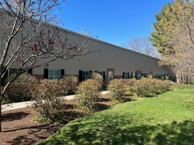
40 Southville Rd, Southborough, MA 01772


Current Lease Availabilities
NEARBY LISTINGS FOR SALE OR LEASE
Property Detail
40 Southville Rd
SBOR-000004-000000-000058
Worcester
Commercialbuilding
Massachusetts
X
58.0
25027C0669F
1.06 AC
2025
The Boroughs
2025
Boston
741101
Worcester, MA-CT
8,056 SF
DEMOGRAPHICS near 40 Southville Rd
1 Mile
3 Mile
5 Mile
2024 Total Population
3,081
27,833
87,794
2029 Population
3,076
27,859
87,371
Pop Growth 2024-2029
(0.16%)
+ 0.09%
(0.48%)
Average Age
41
40
40
2024 Total Households
1,076
10,443
32,220
HH Growth 2024-2029
(0.28%)
+ 0.05%
(0.45%)
Median Household Inc
$168,062
$146,963
$124,147
Avg Household Size
2.90
2.60
2.60
2024 Avg HH Vehicles
2.00
2.00
2.00
Median Home Value
$682,735
$685,642
$632,839
Median Year Built
1987
1987
1978
Nearby Places
Map Layers
Map Styles
 Street
 Aerial
- Restaurants
- Banks
- Shops
- Fitness
- Groceries
PUBLIC TRANSPORTATION
TRANSIT/SUBWAY
Southborough (Framingham/Worcester Line - Massachusetts Bay Transportation Authority Commuter Rail (Purple Line))
DRIVE
WALK
Distance
Southborough (Framingham/Worcester Line - Massachusetts Bay Transportation Authority Commuter Rail (Purple Line))
2 min
11 min
0.6 mi
COMMUTER RAIL
Southborough (Framingham/Worcester Line - Massachusetts Bay Transportation Authority Commuter Rail (Purple Line))
DRIVE
WALK
Distance
Southborough (Framingham/Worcester Line - Massachusetts Bay Transportation Authority Commuter Rail (Purple Line))
1 min
11 min
0.6 mi
Ashland (Framingham/Worcester Line - Massachusetts Bay Transportation Authority Commuter Rail (Purple Line))
DRIVE
WALK
Distance
Ashland (Framingham/Worcester Line - Massachusetts Bay Transportation Authority Commuter Rail (Purple Line))
5 min
2.2 mi
AIRPORT
Worcester Regional
DRIVE
WALK
Distance
Worcester Regional
39 min
21.7 mi
General Edward Lawrence Logan International
DRIVE
WALK
Distance
General Edward Lawrence Logan International
46 min
32.2 mi
Freight Ports
Port of Boston
DRIVE
WALK
Distance
Port of Boston
45 min
30.5 mi
Nearby Properties
Address
Land Use
TOTAL SIZE
Lot Size
Zoning
Address
Land Use
TOTAL SIZE
Lot Size
Zoning
556,849 SF
28.44 AC
R4
Address
Land Use
TOTAL SIZE
Lot Size
Zoning
51.50 AC
A2
Address
Land Use
TOTAL SIZE
Lot Size
Zoning
906,841 SF
47.93 AC
M1
Address
Land Use
TOTAL SIZE
Lot Size
Zoning
664,397 SF
15.78 AC
TP
Address
Land Use
TOTAL SIZE
Lot Size
Zoning
18.22 AC
OSMU
Address
Land Use
TOTAL SIZE
Lot Size
Zoning
367,779 SF
59.22 AC
IB
Address
Land Use
TOTAL SIZE
Lot Size
Zoning
292,608 SF
5.19 AC
B
Address
Land Use
TOTAL SIZE
Lot Size
Zoning
293,180 SF
5.10 AC
B
Address
Land Use
TOTAL SIZE
Lot Size
Zoning
7,383 SF
80.70 AC
RA
Address
Land Use
TOTAL SIZE
Lot Size
Zoning
8,160 SF
11 AC
RA
Address
Land Use
TOTAL SIZE
Lot Size
Zoning
19.07 AC
IP
Address
Land Use
TOTAL SIZE
Lot Size
Zoning
191,520 SF
7.99 AC
B
Address
Land Use
TOTAL SIZE
Lot Size
Zoning
191,520 SF
5.03 AC
B
Address
Land Use
TOTAL SIZE
Lot Size
Zoning
578,873 SF
94.26 AC
IB
Address
Land Use
TOTAL SIZE
Lot Size
Zoning
347,607 SF
51.50 AC
IP
Address
Land Use
TOTAL SIZE
Lot Size
Zoning
174,988 SF
5.54 AC
TP
Address
Land Use
TOTAL SIZE
Lot Size
Zoning
15,204 SF
5.79 AC
BH
Address
Land Use
TOTAL SIZE
Lot Size
Zoning
289,642 SF
8.13 AC
M
Address
Land Use
TOTAL SIZE
Lot Size
Zoning
25.20 AC
A
Address
Land Use
TOTAL SIZE
Lot Size
Zoning
202,609 SF
1.70 AC
TP
Address
Land Use
TOTAL SIZE
Lot Size
Zoning
82,554 SF
11.15 AC
RB
Address
Land Use
TOTAL SIZE
Lot Size
Zoning
149,806 SF
11.20 AC
B
Address
Land Use
TOTAL SIZE
Lot Size
Zoning
67,760 SF
11.65 AC
RB
Address
Land Use
TOTAL SIZE
Lot Size
Zoning
121,889 SF
2.01 AC
M1
Address
Land Use
TOTAL SIZE
Lot Size
Zoning
101,140 SF
10 AC
TP
Address
Land Use
TOTAL SIZE
Lot Size
Zoning
6,420 SF
28 AC
IP
Address
Land Use
TOTAL SIZE
Lot Size
Zoning
237,486 SF
18.61 AC
TP
Address
Land Use
TOTAL SIZE
Lot Size
Zoning
27,836 SF
4.22 AC
RB
Address
Land Use
TOTAL SIZE
Lot Size
Zoning
122,031 SF
4.90 AC
B
Address
Land Use
TOTAL SIZE
Lot Size
Zoning
4.65 AC
I
The World's #1 Commercial Real Estate Marketplace
Connect with us
© 2026 CoStar Group
The information above has been obtained from sources believed reliable. While we do not doubt its accuracy we have not verified it and make no guarantee, warranty or representation about it. It is your responsibility to independently confirm its accuracy and completeness. Any projections, opinions, assumptions, or estimates used are for example only and do not represent the current or future performance of the property. The value of this transaction to you depends on tax and other factors which should be evaluated by your tax, financial, and legal advisors. You and your advisors should conduct a careful, independent investigation of the property to determine to your satisfaction the suitability of the property for your needs.