Property Record
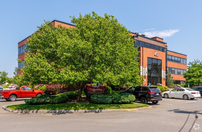
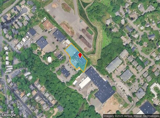
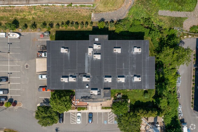
40 Tioga Way, Marblehead, MA 01945
Current Lease Availabilities
NEARBY LISTINGS FOR SALE OR LEASE
Property Detail
40 Tioga Way
Commercialbuilding
Essex
X
Massachusetts
25009C0438G
0.85 AC
2025
Peabody/Salem
2025
Boston
203302
Boston-Cambridge-Newton, MA-NH
25,848 SF
MARB-000152-000012
DEMOGRAPHICS near 40 Tioga Way
1 Mile
3 Mile
5 Mile
2024 Total Population
11,124
65,371
167,387
2029 Population
11,168
64,914
165,882
Pop Growth 2024-2029
+ 0.40%
(0.70%)
(0.90%)
Average Age
46
42
41
2024 Total Households
4,993
28,175
67,147
HH Growth 2024-2029
+ 0.18%
(0.89%)
(1.02%)
Median Household Inc
$119,609
$88,843
$86,703
Avg Household Size
2.20
2.20
2.40
2024 Avg HH Vehicles
2.00
2.00
2.00
Median Home Value
$833,374
$645,620
$561,987
Median Year Built
1949
1948
1950
Nearby Places
Map Layers
Map Styles
 Street
 Aerial
- Restaurants
- Banks
- Shops
- Fitness
- Groceries
PUBLIC TRANSPORTATION
COMMUTER RAIL
Salem (Newburyport/Rockport Line - Massachusetts Bay Transportation Authority Commuter Rail (Purple Line))
DRIVE
WALK
Distance
Salem (Newburyport/Rockport Line - Massachusetts Bay Transportation Authority Commuter Rail (Purple Line))
11 min
4.8 mi
Swampscott (Newburyport/Rockport Line - Massachusetts Bay Transportation Authority Commuter Rail (Purple Line))
DRIVE
WALK
Distance
Swampscott (Newburyport/Rockport Line - Massachusetts Bay Transportation Authority Commuter Rail (Purple Line))
10 min
5.5 mi
AIRPORT
General Edward Lawrence Logan International
DRIVE
WALK
Distance
General Edward Lawrence Logan International
29 min
15.8 mi
Freight Ports
Port of Boston
DRIVE
WALK
Distance
Port of Boston
35 min
18.5 mi
Nearby Properties
Address
Land Use
TOTAL SIZE
Lot Size
Zoning
Address
Land Use
TOTAL SIZE
Lot Size
Zoning
14.69 AC
I
Address
Land Use
TOTAL SIZE
Lot Size
Zoning
9,860 SF
17.80 AC
R1
Address
Land Use
TOTAL SIZE
Lot Size
Zoning
192,341 SF
2.10 AC
B5
Address
Land Use
TOTAL SIZE
Lot Size
Zoning
29.12 AC
I
Address
Land Use
TOTAL SIZE
Lot Size
Zoning
223,689 SF
11.60 AC
R1
Address
Land Use
TOTAL SIZE
Lot Size
Zoning
205,353 SF
18.74 AC
Address
Land Use
TOTAL SIZE
Lot Size
Zoning
4.14 AC
NRCC
Address
Land Use
TOTAL SIZE
Lot Size
Zoning
118,110 SF
0.67 AC
CC
Address
Land Use
TOTAL SIZE
Lot Size
Zoning
14.50 AC
R1
Address
Land Use
TOTAL SIZE
Lot Size
Zoning
123,588 SF
1.50 AC
B5
Address
Land Use
TOTAL SIZE
Lot Size
Zoning
125,862 SF
5.30 AC
R1
Address
Land Use
TOTAL SIZE
Lot Size
Zoning
108,259 SF
17.30 AC
R45
Address
Land Use
TOTAL SIZE
Lot Size
Zoning
112,023 SF
0.74 AC
CC
Address
Land Use
TOTAL SIZE
Lot Size
Zoning
80,069 SF
3.13 AC
A-2
Address
Land Use
TOTAL SIZE
Lot Size
Zoning
40,939 SF
12.48 AC
Address
Land Use
TOTAL SIZE
Lot Size
Zoning
22.35 AC
R1
Address
Land Use
TOTAL SIZE
Lot Size
Zoning
42.30 AC
I
Address
Land Use
TOTAL SIZE
Lot Size
Zoning
31.90 AC
I
Address
Land Use
TOTAL SIZE
Lot Size
Zoning
84,871 SF
0.96 AC
CC
Address
Land Use
TOTAL SIZE
Lot Size
Zoning
112,034 SF
1.06 AC
CC
Address
Land Use
TOTAL SIZE
Lot Size
Zoning
90,004 SF
3.46 AC
R3
Address
Land Use
TOTAL SIZE
Lot Size
Zoning
91,968 SF
2.20 AC
R1
Address
Land Use
TOTAL SIZE
Lot Size
Zoning
123,936 SF
2.50 AC
B5
Address
Land Use
TOTAL SIZE
Lot Size
Zoning
69,351 SF
0.49 AC
CC
Address
Land Use
TOTAL SIZE
Lot Size
Zoning
595 SF
36.94 AC
SR
Address
Land Use
TOTAL SIZE
Lot Size
Zoning
52,898 SF
1.84 AC
R2
Address
Land Use
TOTAL SIZE
Lot Size
Zoning
140,453 SF
18.20 AC
SR
Address
Land Use
TOTAL SIZE
Lot Size
Zoning
86,449 SF
0.52 AC
Address
Land Use
TOTAL SIZE
Lot Size
Zoning
1.04 AC
B5
Address
Land Use
TOTAL SIZE
Lot Size
Zoning
84,173 SF
4.50 AC
SR
The World's #1 Commercial Real Estate Marketplace
Connect with us
© 2026 CoStar Group
The information above has been obtained from sources believed reliable. While we do not doubt its accuracy we have not verified it and make no guarantee, warranty or representation about it. It is your responsibility to independently confirm its accuracy and completeness. Any projections, opinions, assumptions, or estimates used are for example only and do not represent the current or future performance of the property. The value of this transaction to you depends on tax and other factors which should be evaluated by your tax, financial, and legal advisors. You and your advisors should conduct a careful, independent investigation of the property to determine to your satisfaction the suitability of the property for your needs.