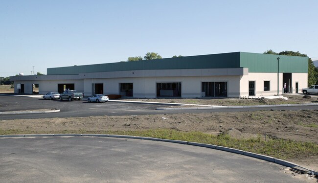
Property Record
40 Whitecap Dr, North Kingstown, RI 02852

Property Detail
40 Whitecap Dr
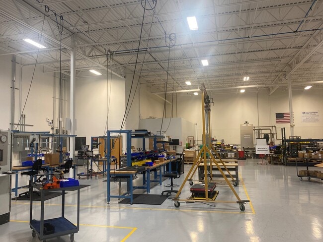
Industrialgeneral
WASHINGTON
QBPD
Rhode Island
AE The base floodplain where base flood elevations are provided. AE Zones are now used on new format FIRMs instead of A1-A30 Zones.
2.71 AC
2025
Washington County
2025
Providence
050103
Providence-Warwick, RI-MA
37,679 SF
NKIN-000185-000021
NEARBY LISTINGS FOR SALE OR LEASE
DEMOGRAPHICS near 40 Whitecap Dr
1 mile
3 mile
5 mile
2025 Total Population
1,400
13,169
32,078
2030 Population
1,385
12,889
31,558
Pop Growth 2025-2030
(1.07%)
(2.13%)
(1.62%)
Average Age
44
45
45
2025 Total Households
571
5,764
13,116
HH Growth 2025-2030
(1.23%)
(2.50%)
(1.91%)
Median Household Inc
$122,622
$109,620
$115,948
Avg Household Size
2.40
2.20
2.40
2025 Avg HH Vehicles
2.00
2.00
2.00
Median Home Value
$669,603
$491,633
$574,000
Median Year Built
1977
1966
1970
Nearby Places
Map Layers
Map Styles
 Street
 Aerial
Layers
 Traffic
 Biking
Places
Listings with unknown addresses are not visible on the map
- Restaurants
- Banks
- Shops
- Fitness
- Groceries
SALE & LEASE HISTORY
LISTING DATE
SALE/LEASE

Jun 14, 2023
For Lease
Nearby Properties
Address
Land Use
TOTAL SIZE
Lot Size
Zoning
Address
Land Use
TOTAL SIZE
Lot Size
Zoning
556,793 SF
56.95 AC
QBPD
Address
Land Use
TOTAL SIZE
Lot Size
Zoning
122,785 SF
43.80 AC
QBPD
Address
Land Use
TOTAL SIZE
Lot Size
Zoning
39.12 AC
P
Address
Land Use
TOTAL SIZE
Lot Size
Zoning
72.28 AC
QBPD
Address
Land Use
TOTAL SIZE
Lot Size
Zoning
175.70 AC
QBPD
Address
Land Use
TOTAL SIZE
Lot Size
Zoning
32.58 AC
QBPD
Address
Land Use
TOTAL SIZE
Lot Size
Zoning
461,128 SF
21.54 AC
QBPD
Address
Land Use
TOTAL SIZE
Lot Size
Zoning
39.16 AC
QBPD
Address
Land Use
TOTAL SIZE
Lot Size
Zoning
61,984 SF
14.46 AC
QBPD
Address
Land Use
TOTAL SIZE
Lot Size
Zoning
466,871 SF
17.96 AC
QBPD
Address
Land Use
TOTAL SIZE
Lot Size
Zoning
8.10 AC
PR
Address
Land Use
TOTAL SIZE
Lot Size
Zoning
28,800 SF
18.70 AC
QBPD
Address
Land Use
TOTAL SIZE
Lot Size
Zoning
63,014 SF
167.39 AC
QBPD
Address
Land Use
TOTAL SIZE
Lot Size
Zoning
196,759 SF
33.67 AC
QBPD
Address
Land Use
TOTAL SIZE
Lot Size
Zoning
27.90 AC
QBPD
Address
Land Use
TOTAL SIZE
Lot Size
Zoning
121,016 SF
13.50 AC
QBPD
Address
Land Use
TOTAL SIZE
Lot Size
Zoning
4,288 SF
33.30 AC
PVD
Address
Land Use
TOTAL SIZE
Lot Size
Zoning
3,417 SF
7.13 AC
PR
Address
Land Use
TOTAL SIZE
Lot Size
Zoning
8.73 AC
PR
Address
Land Use
TOTAL SIZE
Lot Size
Zoning
97,308 SF
9.36 AC
P
Address
Land Use
TOTAL SIZE
Lot Size
Zoning
92,700 SF
9.90 AC
QBPD
Address
Land Use
TOTAL SIZE
Lot Size
Zoning
8.92 AC
PR
Address
Land Use
TOTAL SIZE
Lot Size
Zoning
18.60 AC
QBPD
Address
Land Use
TOTAL SIZE
Lot Size
Zoning
25.10 AC
QBPD
Address
Land Use
TOTAL SIZE
Lot Size
Zoning
12.68 AC
PR
Address
Land Use
TOTAL SIZE
Lot Size
Zoning
15.50 AC
PVD
Address
Land Use
TOTAL SIZE
Lot Size
Zoning
9.35 AC
PR
Address
Land Use
TOTAL SIZE
Lot Size
Zoning
8.85 AC
PR
Address
Land Use
TOTAL SIZE
Lot Size
Zoning
25.97 AC
QBPD
Address
Land Use
TOTAL SIZE
Lot Size
Zoning
15.90 AC
QBPD
The World's #1 Commercial Real Estate Marketplace
Connect with us
© 2026 CoStar Group
The information above has been obtained from sources believed reliable. While we do not doubt its accuracy we have not verified it and make no guarantee, warranty or representation about it. It is your responsibility to independently confirm its accuracy and completeness. Any projections, opinions, assumptions, or estimates used are for example only and do not represent the current or future performance of the property. The value of this transaction to you depends on tax and other factors which should be evaluated by your tax, financial, and legal advisors. You and your advisors should conduct a careful, independent investigation of the property to determine to your satisfaction the suitability of the property for your needs.