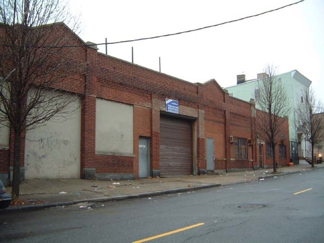
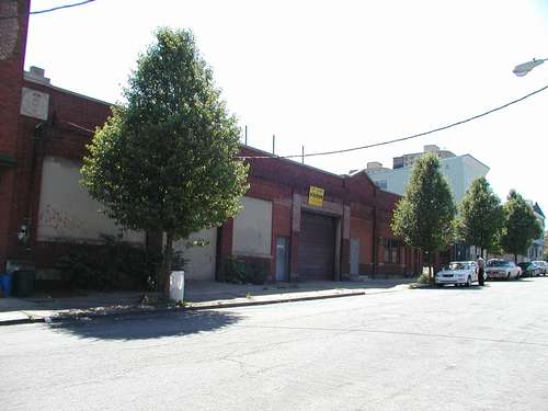
Property Record
400-402 New St, Newark, NJ 07103
NEARBY LISTINGS FOR SALE OR LEASE
Property Detail
400-402 New St
Newark, NJ-PA
90X106.2
14-01838-0000-00026
Essex
Industrialgeneral
New Jersey
X
26
34013C0152F
0.22 AC
2023
West Newark
2025
Northern New Jersey
023000
DEMOGRAPHICS near 400-402 New St
1 Mile
3 Mile
5 Mile
2024 Total Population
54,046
451,985
752,685
2029 Population
52,537
437,613
730,872
Pop Growth 2024-2029
(2.79%)
(3.18%)
(2.90%)
Average Age
34
37
38
2024 Total Households
18,504
166,537
276,228
HH Growth 2024-2029
(2.60%)
(3.21%)
(2.98%)
Median Household Inc
$37,831
$47,868
$58,986
Avg Household Size
2.60
2.60
2.60
2024 Avg HH Vehicles
1.00
1.00
1.00
Median Home Value
$262,242
$297,768
$365,400
Median Year Built
1974
1963
1957
Nearby Places
Map Layers
Map Styles
 Street
 Aerial
- Restaurants
- Banks
- Shops
- Fitness
- Groceries
PUBLIC TRANSPORTATION
TRANSIT/SUBWAY
Norfolk Street (Grove Street - Newark Penn Station - Newark Light Rail (Newark Light Rail))
DRIVE
WALK
Distance
Norfolk Street (Grove Street - Newark Penn Station - Newark Light Rail (Newark Light Rail))
1 min
7 min
0.4 mi
Orange Street (Grove Street - Newark Penn Station - Newark Light Rail (Newark Light Rail))
DRIVE
WALK
Distance
Orange Street (Grove Street - Newark Penn Station - Newark Light Rail (Newark Light Rail))
1 min
9 min
0.5 mi
Warren Street (Grove Street - Newark Penn Station - Newark Light Rail (Newark Light Rail))
DRIVE
WALK
Distance
Warren Street (Grove Street - Newark Penn Station - Newark Light Rail (Newark Light Rail))
2 min
10 min
0.5 mi
Park Avenue (Grove Street - Newark Penn Station - Newark Light Rail (Newark Light Rail))
DRIVE
WALK
Distance
Park Avenue (Grove Street - Newark Penn Station - Newark Light Rail (Newark Light Rail))
2 min
18 min
1.0 mi
Washington Street (Grove Street - Newark Penn Station - Newark Light Rail (Newark Light Rail))
DRIVE
WALK
Distance
Washington Street (Grove Street - Newark Penn Station - Newark Light Rail (Newark Light Rail))
3 min
19 min
1.0 mi
COMMUTER RAIL
Newark Broad Street (Montclair-Boonton Line - NJ Transit Commuter Rail (NJ Transit), Morris & Essex Gladstone Branch - NJ Transit Commuter Rail (NJ Transit), Morris & Essex Morristown Line - NJ Transit Commuter Rail (NJ Transit))
DRIVE
WALK
Distance
Newark Broad Street (Montclair-Boonton Line - NJ Transit Commuter Rail (NJ Transit), Morris & Essex Gladstone Branch - NJ Transit Commuter Rail (NJ Transit), Morris & Essex Morristown Line - NJ Transit Commuter Rail (NJ Transit))
3 min
1.5 mi
Newark Penn Station (Broad Street Station - Newark Penn Station - Newark Light Rail (Newark Light Rail), Grove Street - Newark Penn Station - Newark Light Rail (Newark Light Rail), North Jersey Coast Line - NJ Transit Commuter Rail (NJ Transit), Northeast Corridor Line - NJ Transit Commuter Rail (NJ Transit), Raritan Valley Line - NJ Transit Commuter Rail (NJ Transit))
DRIVE
WALK
Distance
Newark Penn Station (Broad Street Station - Newark Penn Station - Newark Light Rail (Newark Light Rail), Grove Street - Newark Penn Station - Newark Light Rail (Newark Light Rail), North Jersey Coast Line - NJ Transit Commuter Rail (NJ Transit), Northeast Corridor Line - NJ Transit Commuter Rail (NJ Transit), Raritan Valley Line - NJ Transit Commuter Rail (NJ Transit))
7 min
1.9 mi
AIRPORT
Newark Liberty International
DRIVE
WALK
Distance
Newark Liberty International
13 min
10.1 mi
LaGuardia
DRIVE
WALK
Distance
LaGuardia
37 min
23.2 mi
John F Kennedy International
DRIVE
WALK
Distance
John F Kennedy International
47 min
31.1 mi
Freight Ports
Port Newark Container Terminal
DRIVE
WALK
Distance
Port Newark Container Terminal
1 min
4.3 mi
SALE & LEASE HISTORY
LISTING DATE
SALE/LEASE

Sep 24, 2016
For Lease
Nearby Properties
Address
Land Use
TOTAL SIZE
Lot Size
Zoning
Address
Land Use
TOTAL SIZE
Lot Size
Zoning
0.57 AC
Address
Land Use
TOTAL SIZE
Lot Size
Zoning
57.23 AC
U
Address
Land Use
TOTAL SIZE
Lot Size
Zoning
0.45 AC
Address
Land Use
TOTAL SIZE
Lot Size
Zoning
926,120 SF
11.46 AC
Address
Land Use
TOTAL SIZE
Lot Size
Zoning
0.61 AC
Address
Land Use
TOTAL SIZE
Lot Size
Zoning
31.86 AC
Address
Land Use
TOTAL SIZE
Lot Size
Zoning
Address
Land Use
TOTAL SIZE
Lot Size
Zoning
877 SF
7.25 AC
Address
Land Use
TOTAL SIZE
Lot Size
Zoning
1,136 SF
6.51 AC
Address
Land Use
TOTAL SIZE
Lot Size
Zoning
683 SF
9.59 AC
Address
Land Use
TOTAL SIZE
Lot Size
Zoning
2.01 AC
Address
Land Use
TOTAL SIZE
Lot Size
Zoning
3.42 AC
Address
Land Use
TOTAL SIZE
Lot Size
Zoning
320 SF
1.25 AC
Address
Land Use
TOTAL SIZE
Lot Size
Zoning
9.77 AC
Address
Land Use
TOTAL SIZE
Lot Size
Zoning
877 SF
0.91 AC
Address
Land Use
TOTAL SIZE
Lot Size
Zoning
1.64 AC
Address
Land Use
TOTAL SIZE
Lot Size
Zoning
Address
Land Use
TOTAL SIZE
Lot Size
Zoning
1.63 AC
Address
Land Use
TOTAL SIZE
Lot Size
Zoning
17.97 AC
Address
Land Use
TOTAL SIZE
Lot Size
Zoning
Address
Land Use
TOTAL SIZE
Lot Size
Zoning
2.79 AC
Address
Land Use
TOTAL SIZE
Lot Size
Zoning
4.82 AC
Address
Land Use
TOTAL SIZE
Lot Size
Zoning
0.13 AC
Address
Land Use
TOTAL SIZE
Lot Size
Zoning
1,264 SF
3.20 AC
Address
Land Use
TOTAL SIZE
Lot Size
Zoning
Address
Land Use
TOTAL SIZE
Lot Size
Zoning
0.06 AC
Address
Land Use
TOTAL SIZE
Lot Size
Zoning
0.09 AC
Address
Land Use
TOTAL SIZE
Lot Size
Zoning
877 SF
1.95 AC
Address
Land Use
TOTAL SIZE
Lot Size
Zoning
877 SF
1.35 AC
Address
Land Use
TOTAL SIZE
Lot Size
Zoning
16,084 SF
7.23 AC
The World's #1 Commercial Real Estate Marketplace
Connect with us
© 2025 CoStar Group
The information above has been obtained from sources believed reliable. While we do not doubt its accuracy we have not verified it and make no guarantee, warranty or representation about it. It is your responsibility to independently confirm its accuracy and completeness. Any projections, opinions, assumptions, or estimates used are for example only and do not represent the current or future performance of the property. The value of this transaction to you depends on tax and other factors which should be evaluated by your tax, financial, and legal advisors. You and your advisors should conduct a careful, independent investigation of the property to determine to your satisfaction the suitability of the property for your needs.