Property Record
400 S Martin Luther King Dr, Chicago, IL 60637


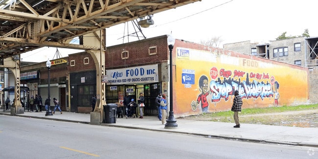
Property Detail
400 S Martin Luther King Dr
20-15-416-022-0000
(RESUBDIVISION) OF (WASHINGTON) PARK (CLUB) ADD TO CH ICAGO SUB OF SH SE SEC 15-38-14
Commercialbuilding
COOK
B3-3
Illinois
B and X Area of moderate flood hazard, usually the area between the limits of the 100-year and 500-year floods.
14,13
2023
0.19 AC
2025
South Chicago
420400
Chicago
10,578 SF
Chicago-Naperville-Elgin, IL-IN
NEARBY LISTINGS FOR SALE OR LEASE
-
-
-
-
-
-
-
-
-
-
-
-
-
-
-
-
No Photo
-
-
View all Chicago listings for sale on LoopNet.com
DEMOGRAPHICS near 400 S Martin Luther King Dr
1 mile
3 mile
5 mile
2025 Total Population
37,032
295,338
646,531
2030 Population
37,557
296,489
639,680
Pop Growth 2025-2030
+ 1.42%
+ 0.39%
(1.06%)
Average Age
36
39
39
2025 Total Households
15,053
128,351
256,497
HH Growth 2025-2030
+ 1.16%
+ 0.23%
(0.97%)
Median Household Inc
$34,269
$43,200
$48,744
Avg Household Size
2.30
2.20
2.40
2025 Avg HH Vehicles
1.00
1.00
1.00
Median Home Value
$232,060
$244,843
$233,038
Median Year Built
1949
1949
1949
Nearby Places
Map Layers
Map Styles
 Street
 Aerial
Layers
 Traffic
 Biking
Places
Listings with unknown addresses are not visible on the map
- Restaurants
- Banks
- Shops
- Fitness
- Groceries
PUBLIC TRANSPORTATION
TRANSIT/SUBWAY
King Drive Station (Green Line - Chicago Transit Authority "L" Trains (The "L"))
Drive
Walk
Distance
King Drive Station (Green Line - Chicago Transit Authority "L" Trains (The "L"))
1 min
1 min
0.0 mi
Cottage Grove Station (Green Line - Chicago Transit Authority "L" Trains (The "L"))
Drive
Walk
Distance
Cottage Grove Station (Green Line - Chicago Transit Authority "L" Trains (The "L"))
3 min
11 min
0.5 mi
63rd Street Station (Red Line - Chicago Transit Authority "L" Trains (The "L"))
Drive
Walk
Distance
63rd Street Station (Red Line - Chicago Transit Authority "L" Trains (The "L"))
4 min
16 min
0.8 mi
COMMUTER RAIL
Gresham Station (Rock Island District Line - Northeast Illinois Regional Commuter Railroad (Metra))
Drive
Walk
Distance
Gresham Station (Rock Island District Line - Northeast Illinois Regional Commuter Railroad (Metra))
12 min
4.7 mi
Brainerd Station (Rock Island District Line - Northeast Illinois Regional Commuter Railroad (Metra))
Drive
Walk
Distance
Brainerd Station (Rock Island District Line - Northeast Illinois Regional Commuter Railroad (Metra))
15 min
5.6 mi
AIRPORT
Chicago Midway International
Drive
Walk
Distance
Chicago Midway International
24 min
13.8 mi
Chicago O'Hare International
Drive
Walk
Distance
Chicago O'Hare International
35 min
25.3 mi
SALE & LEASE HISTORY
LISTING DATE
SALE/LEASE

Sep 24, 2016
For Sale
Jun 12, 2019
For Sale
Nearby Properties
Address
Land Use
TOTAL SIZE
Lot Size
Zoning
Address
Land Use
TOTAL SIZE
Lot Size
Zoning
10.73 AC
PD 1243
Address
Land Use
TOTAL SIZE
Lot Size
Zoning
Address
Land Use
TOTAL SIZE
Lot Size
Zoning
0.28 AC
PD 38
Address
Land Use
TOTAL SIZE
Lot Size
Zoning
109,145 SF
0.46 AC
RM-5
Address
Land Use
TOTAL SIZE
Lot Size
Zoning
1,302,463 SF
3.14 AC
PD 1211
Address
Land Use
TOTAL SIZE
Lot Size
Zoning
3.14 AC
PD 1211
Address
Land Use
TOTAL SIZE
Lot Size
Zoning
115,000 SF
1.97 AC
C1-2
Address
Land Use
TOTAL SIZE
Lot Size
Zoning
0.91 AC
PD 1177
Address
Land Use
TOTAL SIZE
Lot Size
Zoning
62,216 SF
0.65 AC
RM-5
Address
Land Use
TOTAL SIZE
Lot Size
Zoning
2.65 AC
PD 38
Address
Land Use
TOTAL SIZE
Lot Size
Zoning
304,685 SF
1.11 AC
PD 1218
Address
Land Use
TOTAL SIZE
Lot Size
Zoning
115,000 SF
1.12 AC
C1-2
Address
Land Use
TOTAL SIZE
Lot Size
Zoning
7,200 SF
0.22 AC
B3-3
Address
Land Use
TOTAL SIZE
Lot Size
Zoning
156,800 SF
2.65 AC
PD 38
Address
Land Use
TOTAL SIZE
Lot Size
Zoning
PD 43
Address
Land Use
TOTAL SIZE
Lot Size
Zoning
Address
Land Use
TOTAL SIZE
Lot Size
Zoning
451,349 SF
1.62 AC
PD 1062
Address
Land Use
TOTAL SIZE
Lot Size
Zoning
0.29 AC
PD 1548
Address
Land Use
TOTAL SIZE
Lot Size
Zoning
1.65 AC
B2-3
Address
Land Use
TOTAL SIZE
Lot Size
Zoning
PD 43
Address
Land Use
TOTAL SIZE
Lot Size
Zoning
769,600 SF
PD 282
Address
Land Use
TOTAL SIZE
Lot Size
Zoning
78,000 SF
0.62 AC
RM-5
Address
Land Use
TOTAL SIZE
Lot Size
Zoning
117,557 SF
2.69 AC
B3-3
Address
Land Use
TOTAL SIZE
Lot Size
Zoning
36,365 SF
Address
Land Use
TOTAL SIZE
Lot Size
Zoning
7.47 AC
RT-4
Address
Land Use
TOTAL SIZE
Lot Size
Zoning
33,162 SF
1.18 AC
RM-5
Address
Land Use
TOTAL SIZE
Lot Size
Zoning
4,900 SF
0.29 AC
PD 1548
Address
Land Use
TOTAL SIZE
Lot Size
Zoning
134,655 SF
2.40 AC
B3-3
Address
Land Use
TOTAL SIZE
Lot Size
Zoning
0.84 AC
RM-5
Address
Land Use
TOTAL SIZE
Lot Size
Zoning
283,228 SF
14.47 AC
PMD 8
The World's #1 Commercial Real Estate Marketplace
Connect with us
© 2026 CoStar Group
The information above has been obtained from sources believed reliable. While we do not doubt its accuracy we have not verified it and make no guarantee, warranty or representation about it. It is your responsibility to independently confirm its accuracy and completeness. Any projections, opinions, assumptions, or estimates used are for example only and do not represent the current or future performance of the property. The value of this transaction to you depends on tax and other factors which should be evaluated by your tax, financial, and legal advisors. You and your advisors should conduct a careful, independent investigation of the property to determine to your satisfaction the suitability of the property for your needs.