Property Record
400 Arial St, Easley, SC 29640
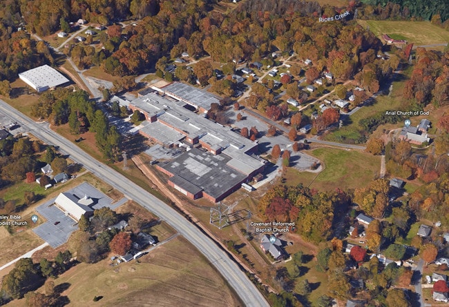


This Property Is For Sale
Property Detail
400 Arial St
Greenville-Anderson-Greer, SC
S/SIDE ARIAL ST, PLAT 614/208 TRACT C
5009-08-79-5182
PICKENS
Manufacturinglight
South Carolina
2025
16.17 AC
2025
Southeast Pickens County
010802
Greenville/Spartanburg
450,792 SF
NEARBY LISTINGS FOR SALE OR LEASE
-
-
View all Easley listings for sale on LoopNet.com
DEMOGRAPHICS near 400 Arial St
1 mile
3 mile
5 mile
2025 Total Population
1,816
20,041
45,216
2030 Population
1,930
21,156
47,772
Pop Growth 2025-2030
+ 6.28%
+ 5.56%
+ 5.65%
Average Age
41
41
41
2025 Total Households
704
8,145
18,220
HH Growth 2025-2030
+ 6.53%
+ 5.88%
+ 5.96%
Median Household Inc
$47,187
$58,822
$57,724
Avg Household Size
2.50
2.40
2.40
2025 Avg HH Vehicles
2.00
2.00
2.00
Median Home Value
$163,868
$208,523
$226,016
Median Year Built
1981
1982
1985
Nearby Places
Map Layers
Map Styles
 Street
 Aerial
Layers
 Traffic
 Biking
Places
Listings with unknown addresses are not visible on the map
- Restaurants
- Banks
- Shops
- Fitness
- Groceries
PUBLIC TRANSPORTATION
AIRPORT
Greenville Spartanburg International
Drive
Walk
Distance
Greenville Spartanburg International
48 min
31.2 mi
Nearby Properties
Address
Land Use
TOTAL SIZE
Lot Size
Zoning
Address
Land Use
TOTAL SIZE
Lot Size
Zoning
2,291 SF
6.44 AC
GR2
Address
Land Use
TOTAL SIZE
Lot Size
Zoning
21.71 AC
GR2
Address
Land Use
TOTAL SIZE
Lot Size
Zoning
13,376 SF
12.36 AC
Address
Land Use
TOTAL SIZE
Lot Size
Zoning
19,088 SF
3 AC
CC
Address
Land Use
TOTAL SIZE
Lot Size
Zoning
10,906 SF
2.59 AC
CORE COMME
Address
Land Use
TOTAL SIZE
Lot Size
Zoning
3.60 AC
CORE COMME
Address
Land Use
TOTAL SIZE
Lot Size
Zoning
44,601 SF
3 AC
Address
Land Use
TOTAL SIZE
Lot Size
Zoning
4,829 SF
2 AC
Address
Land Use
TOTAL SIZE
Lot Size
Zoning
5,356 SF
17.33 AC
Address
Land Use
TOTAL SIZE
Lot Size
Zoning
5,645 SF
0.67 AC
Address
Land Use
TOTAL SIZE
Lot Size
Zoning
3,250 SF
0.07 AC
GENERAL RE
Address
Land Use
TOTAL SIZE
Lot Size
Zoning
5,000 SF
0.12 AC
CORE COMME
Address
Land Use
TOTAL SIZE
Lot Size
Zoning
30,000 SF
3.30 AC
Address
Land Use
TOTAL SIZE
Lot Size
Zoning
4,450 SF
1.28 AC
MED MEDICA
Address
Land Use
TOTAL SIZE
Lot Size
Zoning
3,867 SF
1.22 AC
CORE COMME
Address
Land Use
TOTAL SIZE
Lot Size
Zoning
20,406 SF
1.26 AC
CORE COMME
Address
Land Use
TOTAL SIZE
Lot Size
Zoning
27,700 SF
12.91 AC
Address
Land Use
TOTAL SIZE
Lot Size
Zoning
6,314 SF
2.20 AC
GR1
Address
Land Use
TOTAL SIZE
Lot Size
Zoning
5,508 SF
4.78 AC
Address
Land Use
TOTAL SIZE
Lot Size
Zoning
180.03 AC
Address
Land Use
TOTAL SIZE
Lot Size
Zoning
400 SF
1.62 AC
OC OFFICE
Address
Land Use
TOTAL SIZE
Lot Size
Zoning
5,472 SF
1.28 AC
GR2
Address
Land Use
TOTAL SIZE
Lot Size
Zoning
20,652 SF
3.89 AC
Address
Land Use
TOTAL SIZE
Lot Size
Zoning
1,514 SF
0.34 AC
Address
Land Use
TOTAL SIZE
Lot Size
Zoning
19.43 AC
Address
Land Use
TOTAL SIZE
Lot Size
Zoning
922 SF
14.30 AC
Address
Land Use
TOTAL SIZE
Lot Size
Zoning
4,267 SF
0.77 AC
R 10 ONE F
Address
Land Use
TOTAL SIZE
Lot Size
Zoning
16,800 SF
8.85 AC
GENERAL RE
Address
Land Use
TOTAL SIZE
Lot Size
Zoning
15,798 SF
7.35 AC
Address
Land Use
TOTAL SIZE
Lot Size
Zoning
26,276 SF
4.22 AC
GENERAL RE
The World's #1 Commercial Real Estate Marketplace
Connect with us
© 2026 CoStar Group
The information above has been obtained from sources believed reliable. While we do not doubt its accuracy we have not verified it and make no guarantee, warranty or representation about it. It is your responsibility to independently confirm its accuracy and completeness. Any projections, opinions, assumptions, or estimates used are for example only and do not represent the current or future performance of the property. The value of this transaction to you depends on tax and other factors which should be evaluated by your tax, financial, and legal advisors. You and your advisors should conduct a careful, independent investigation of the property to determine to your satisfaction the suitability of the property for your needs.