Property Record
400 Blossom Hill Rd, Los Gatos, CA 95032


NEARBY LISTINGS FOR SALE OR LEASE
Property Detail
400 Blossom Hill Rd
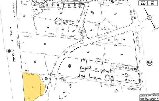
529-16-071
Roberts
Financialbuilding
Santa Clara
X
California
06087C0150E
2.72 AC
2024
Los Gatos/Saratoga
2025
South Bay/San Jose
506801
San Jose-Sunnyvale-Santa Clara, CA
6,514 SF
DEMOGRAPHICS near 400 Blossom Hill Rd
1 Mile
3 Mile
5 Mile
2024 Total Population
14,570
79,438
246,295
2029 Population
13,978
76,434
236,503
Pop Growth 2024-2029
(4.06%)
(3.78%)
(3.98%)
Average Age
44
43
42
2024 Total Households
5,560
28,844
88,322
HH Growth 2024-2029
(4.32%)
(4.04%)
(4.24%)
Median Household Inc
$200,359
$187,574
$165,789
Avg Household Size
2.60
2.70
2.70
2024 Avg HH Vehicles
2.00
2.00
2.00
Median Home Value
$1,139,991
$1,137,234
$1,131,631
Median Year Built
1966
1968
1967
Nearby Places
Map Layers
Map Styles
 Street
 Aerial
- Restaurants
- Banks
- Shops
- Fitness
- Groceries
PUBLIC TRANSPORTATION
COMMUTER RAIL
San Jose Diridon (Caltrain - Caltrain (Caltrain))
DRIVE
WALK
Distance
San Jose Diridon (Caltrain - Caltrain (Caltrain))
16 min
9.9 mi
AIRPORT
Norman Y Mineta San Jose International
DRIVE
WALK
Distance
Norman Y Mineta San Jose International
18 min
11.0 mi
San Francisco International
DRIVE
WALK
Distance
San Francisco International
52 min
39.5 mi
Metro Oakland International
DRIVE
WALK
Distance
Metro Oakland International
56 min
44.2 mi
Freight Ports
Port of Redwood City
DRIVE
WALK
Distance
Port of Redwood City
37 min
26.4 mi
Nearby Properties
Address
Land Use
TOTAL SIZE
Lot Size
Zoning
Address
Land Use
TOTAL SIZE
Lot Size
Zoning
13.17 AC
C1
Address
Land Use
TOTAL SIZE
Lot Size
Zoning
222,000 SF
11.56 AC
IP
Address
Land Use
TOTAL SIZE
Lot Size
Zoning
148,429 SF
0.97 AC
CMPD
Address
Land Use
TOTAL SIZE
Lot Size
Zoning
147,459 SF
0.97 AC
CMPD
Address
Land Use
TOTAL SIZE
Lot Size
Zoning
290,688 SF
8.45 AC
APD
Address
Land Use
TOTAL SIZE
Lot Size
Zoning
112,470 SF
1 AC
CMPD
Address
Land Use
TOTAL SIZE
Lot Size
Zoning
113,500 SF
0.99 AC
ASP
Address
Land Use
TOTAL SIZE
Lot Size
Zoning
115,528 SF
5.32 AC
C1
Address
Land Use
TOTAL SIZE
Lot Size
Zoning
162,265 SF
6.80 AC
O
Address
Land Use
TOTAL SIZE
Lot Size
Zoning
72,000 SF
4.46 AC
C-M
Address
Land Use
TOTAL SIZE
Lot Size
Zoning
175,685 SF
9.66 AC
IP
Address
Land Use
TOTAL SIZE
Lot Size
Zoning
8.01 AC
A(PD)
Address
Land Use
TOTAL SIZE
Lot Size
Zoning
174 SF
R18
Address
Land Use
TOTAL SIZE
Lot Size
Zoning
1.27 AC
CO
Address
Land Use
TOTAL SIZE
Lot Size
Zoning
195,565 SF
25.03 AC
R140
Address
Land Use
TOTAL SIZE
Lot Size
Zoning
170,285 SF
16.76 AC
G
Address
Land Use
TOTAL SIZE
Lot Size
Zoning
31,280 SF
5.71 AC
CM
Address
Land Use
TOTAL SIZE
Lot Size
Zoning
124,360 SF
10.48 AC
R140
Address
Land Use
TOTAL SIZE
Lot Size
Zoning
71,711 SF
6.26 AC
CM
Address
Land Use
TOTAL SIZE
Lot Size
Zoning
10.60 AC
RM
Address
Land Use
TOTAL SIZE
Lot Size
Zoning
20,140.41 AC
SJ
Address
Land Use
TOTAL SIZE
Lot Size
Zoning
113,400 SF
7.42 AC
A-PD
Address
Land Use
TOTAL SIZE
Lot Size
Zoning
102,759 SF
5.18 AC
RM520
Address
Land Use
TOTAL SIZE
Lot Size
Zoning
40,000 SF
4.26 AC
CM
Address
Land Use
TOTAL SIZE
Lot Size
Zoning
72,400 SF
2.45 AC
A-PD
Address
Land Use
TOTAL SIZE
Lot Size
Zoning
43,400 SF
8.86 AC
RM512
Address
Land Use
TOTAL SIZE
Lot Size
Zoning
58,366 SF
3.49 AC
CO
Address
Land Use
TOTAL SIZE
Lot Size
Zoning
8,184 SF
5.80 AC
CI
Address
Land Use
TOTAL SIZE
Lot Size
Zoning
111,257 SF
7.48 AC
IP
The World's #1 Commercial Real Estate Marketplace
Connect with us
© 2026 CoStar Group
The information above has been obtained from sources believed reliable. While we do not doubt its accuracy we have not verified it and make no guarantee, warranty or representation about it. It is your responsibility to independently confirm its accuracy and completeness. Any projections, opinions, assumptions, or estimates used are for example only and do not represent the current or future performance of the property. The value of this transaction to you depends on tax and other factors which should be evaluated by your tax, financial, and legal advisors. You and your advisors should conduct a careful, independent investigation of the property to determine to your satisfaction the suitability of the property for your needs.