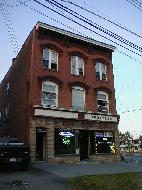
Property Record
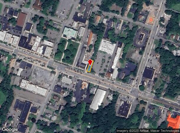
400 Broadway, Monticello, NY 12701
NEARBY LISTINGS FOR SALE OR LEASE
-
-
-
-
No Photo
-
View all Monticello listings for sale on LoopNet.com
Property Detail
400 Broadway
4601-112-0-0008-015-000
WATER METER #197
Bartavern
Sullivan
X
New York
36105C0470F
15.000
2025
0.08 AC
2024
Hudson Valley Area
951801
Other Market Areas
6,186 SF
DEMOGRAPHICS near 400 Broadway
1 Mile
3 Mile
5 Mile
2024 Total Population
6,745
12,993
17,649
2029 Population
7,132
13,689
18,537
Pop Growth 2024-2029
+ 5.74%
+ 5.36%
+ 5.03%
Average Age
39
39
40
2024 Total Households
2,665
5,177
6,967
HH Growth 2024-2029
+ 6.04%
+ 5.64%
+ 5.43%
Median Household Inc
$43,844
$42,021
$46,513
Avg Household Size
2.30
2.30
2.40
2024 Avg HH Vehicles
2.00
2.00
2.00
Median Home Value
$172,528
$168,429
$178,859
Median Year Built
1966
1973
1975
Nearby Places
- Restaurants
- Banks
- Shops
- Fitness
- Groceries
PUBLIC TRANSPORTATION
AIRPORT
New York Stewart International
DRIVE
WALK
Distance
New York Stewart International
55 min
37.7 mi
SALE & LEASE HISTORY
LISTING DATE
SALE/LEASE

Sep 24, 2016
For Sale
Oct 17, 2019
For Sale
Feb 07, 2019
For Sale
Aug 19, 2021
For Sale
Aug 18, 2021
For Sale
Nearby Properties
Address
Land Use
TOTAL SIZE
Lot Size
Zoning
Address
Land Use
TOTAL SIZE
Lot Size
Zoning
1,777,903 SF
117.40 AC
PRD
Address
Land Use
TOTAL SIZE
Lot Size
Zoning
423,920 SF
131.50 AC
PRD
Address
Land Use
TOTAL SIZE
Lot Size
Zoning
154,000 SF
36.19 AC
B1
Address
Land Use
TOTAL SIZE
Lot Size
Zoning
286,801 SF
371.77 AC
SR
Address
Land Use
TOTAL SIZE
Lot Size
Zoning
3,123 SF
48.30 AC
RR
Address
Land Use
TOTAL SIZE
Lot Size
Zoning
222,345 SF
165.77 AC
B1
Address
Land Use
TOTAL SIZE
Lot Size
Zoning
69,742 SF
21.63 AC
PRD
Address
Land Use
TOTAL SIZE
Lot Size
Zoning
135,207 SF
83.50 AC
RM
Address
Land Use
TOTAL SIZE
Lot Size
Zoning
209,366 SF
32.32 AC
HC1
Address
Land Use
TOTAL SIZE
Lot Size
Zoning
100,167 SF
9.60 AC
BLI
Address
Land Use
TOTAL SIZE
Lot Size
Zoning
1,600 SF
72.96 AC
CI / RR1
Address
Land Use
TOTAL SIZE
Lot Size
Zoning
17,812 SF
3.50 AC
RM
Address
Land Use
TOTAL SIZE
Lot Size
Zoning
3,699 SF
334.81 AC
PUD #6
Address
Land Use
TOTAL SIZE
Lot Size
Zoning
Address
Land Use
TOTAL SIZE
Lot Size
Zoning
14,841 SF
17.19 AC
HC2
Address
Land Use
TOTAL SIZE
Lot Size
Zoning
104,739 SF
9.68 AC
HC2
Address
Land Use
TOTAL SIZE
Lot Size
Zoning
4,950 SF
56.24 AC
PRD
Address
Land Use
TOTAL SIZE
Lot Size
Zoning
54,525 SF
6.33 AC
HC
Address
Land Use
TOTAL SIZE
Lot Size
Zoning
1,764 SF
167.44 AC
RR2
Address
Land Use
TOTAL SIZE
Lot Size
Zoning
1,984 SF
215.35 AC
PRD
Address
Land Use
TOTAL SIZE
Lot Size
Zoning
4,480 SF
14.40 AC
RM
Address
Land Use
TOTAL SIZE
Lot Size
Zoning
34,604 SF
9.14 AC
B1
Address
Land Use
TOTAL SIZE
Lot Size
Zoning
6,042 SF
12.38 AC
EBG
Address
Land Use
TOTAL SIZE
Lot Size
Zoning
56,378 SF
13.65 AC
HC2
Address
Land Use
TOTAL SIZE
Lot Size
Zoning
10,787 SF
13.80 AC
HC
Address
Land Use
TOTAL SIZE
Lot Size
Zoning
55,365 SF
13.01 AC
HC2
Address
Land Use
TOTAL SIZE
Lot Size
Zoning
55,365 SF
9.33 AC
HC2
Address
Land Use
TOTAL SIZE
Lot Size
Zoning
39,176 SF
64.72 AC
SR
Address
Land Use
TOTAL SIZE
Lot Size
Zoning
55,365 SF
11.85 AC
HC2
Address
Land Use
TOTAL SIZE
Lot Size
Zoning
76,528 SF
12.08 AC
BL1
The World's #1 Commercial Real Estate Marketplace
Connect with us
© 2025 CoStar Group
The information above has been obtained from sources believed reliable. While we do not doubt its accuracy we have not verified it and make no guarantee, warranty or representation about it. It is your responsibility to independently confirm its accuracy and completeness. Any projections, opinions, assumptions, or estimates used are for example only and do not represent the current or future performance of the property. The value of this transaction to you depends on tax and other factors which should be evaluated by your tax, financial, and legal advisors. You and your advisors should conduct a careful, independent investigation of the property to determine to your satisfaction the suitability of the property for your needs.