Property Record
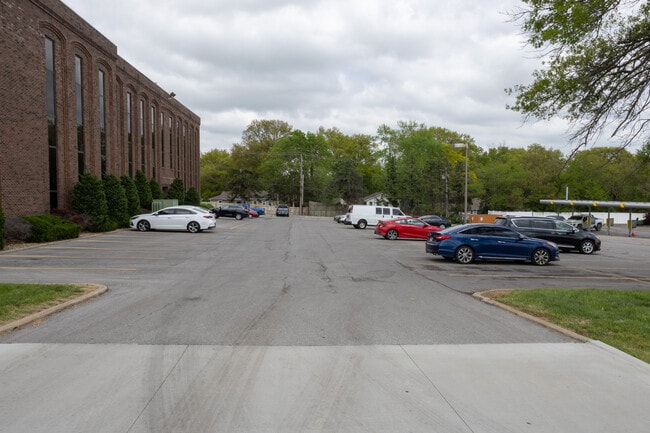
400 E Red Bridge Rd, Kansas City, MO 64131


This Property Is For Sale
Current Lease Availabilities
NEARBY LISTINGS FOR SALE OR LEASE
Property Detail
400 E Red Bridge Rd
65-210-13-26-00-0-00-000
SEC 5 TWP 47 RNG 33 PT SW NE DAF: BEG 836 W & 66 N OF SE C OR SW NE TH N 282.28 282.28 TH W 451.81 TH S 259.04 TH AL G CURV 30.83 TH E 424.27 TO POB
Officebuilding
Jackson
X
Missouri
29095C0387G
2.84 AC
2024
South Kansas City MO
2025
Kansas City
017300
Kansas City, MO-KS
34,168 SF
DEMOGRAPHICS near 400 E Red Bridge Rd
1 Mile
3 Mile
5 Mile
2024 Total Population
8,164
52,739
171,155
2029 Population
8,045
53,279
174,528
Pop Growth 2024-2029
(1.46%)
+ 1.02%
+ 1.97%
Average Age
44
43
41
2024 Total Households
3,722
23,410
74,360
HH Growth 2024-2029
(1.88%)
+ 0.91%
+ 1.95%
Median Household Inc
$73,433
$84,063
$76,098
Avg Household Size
2.00
2.20
2.20
2024 Avg HH Vehicles
2.00
2.00
2.00
Median Home Value
$266,579
$317,532
$311,056
Median Year Built
1972
1974
1971
Nearby Places
Map Layers
Map Styles
 Street
 Aerial
- Restaurants
- Banks
- Shops
- Fitness
- Groceries
PUBLIC TRANSPORTATION
AIRPORT
Kansas City International
DRIVE
WALK
Distance
Kansas City International
49 min
35.8 mi
Freight Ports
Tulsa Port Of Catoosa
DRIVE
WALK
Distance
Tulsa Port Of Catoosa
256 min
226.5 mi
Nearby Properties
Address
Land Use
TOTAL SIZE
Lot Size
Zoning
Address
Land Use
TOTAL SIZE
Lot Size
Zoning
47.39 AC
AG
Address
Land Use
TOTAL SIZE
Lot Size
Zoning
616,742 SF
13.59 AC
Address
Land Use
TOTAL SIZE
Lot Size
Zoning
79,917 SF
7.86 AC
SD-NCR
Address
Land Use
TOTAL SIZE
Lot Size
Zoning
59,570 SF
8.46 AC
SD-O
Address
Land Use
TOTAL SIZE
Lot Size
Zoning
73,383 SF
9.53 AC
R-1
Address
Land Use
TOTAL SIZE
Lot Size
Zoning
166,097 SF
37.29 AC
R-1
Address
Land Use
TOTAL SIZE
Lot Size
Zoning
105,110 SF
8.93 AC
AG
Address
Land Use
TOTAL SIZE
Lot Size
Zoning
465,394 SF
16.63 AC
Address
Land Use
TOTAL SIZE
Lot Size
Zoning
436,499 SF
22.71 AC
Address
Land Use
TOTAL SIZE
Lot Size
Zoning
387,197 SF
Address
Land Use
TOTAL SIZE
Lot Size
Zoning
159,274 SF
14.38 AC
SD-CR
Address
Land Use
TOTAL SIZE
Lot Size
Zoning
457,500 SF
Address
Land Use
TOTAL SIZE
Lot Size
Zoning
157,280 SF
25.10 AC
Address
Land Use
TOTAL SIZE
Lot Size
Zoning
109,553 SF
3.08 AC
Address
Land Use
TOTAL SIZE
Lot Size
Zoning
60,960 SF
4.82 AC
SD-NCR
Address
Land Use
TOTAL SIZE
Lot Size
Zoning
85,287 SF
2.35 AC
R-1
Address
Land Use
TOTAL SIZE
Lot Size
Zoning
39,984 SF
2.56 AC
RP-4 (PREV
Address
Land Use
TOTAL SIZE
Lot Size
Zoning
244,478 SF
26.69 AC
Address
Land Use
TOTAL SIZE
Lot Size
Zoning
431,078 SF
Address
Land Use
TOTAL SIZE
Lot Size
Zoning
65,128 SF
8.70 AC
Address
Land Use
TOTAL SIZE
Lot Size
Zoning
260,629 SF
7.17 AC
Address
Land Use
TOTAL SIZE
Lot Size
Zoning
202,498 SF
Address
Land Use
TOTAL SIZE
Lot Size
Zoning
25,209 SF
3.07 AC
R-1
Address
Land Use
TOTAL SIZE
Lot Size
Zoning
61,456 SF
15.15 AC
SD-O
Address
Land Use
TOTAL SIZE
Lot Size
Zoning
21,520 SF
3.69 AC
R-1
Address
Land Use
TOTAL SIZE
Lot Size
Zoning
355,091 SF
41.50 AC
Address
Land Use
TOTAL SIZE
Lot Size
Zoning
119,387 SF
15.28 AC
SD-NCR
Address
Land Use
TOTAL SIZE
Lot Size
Zoning
195,800 SF
3.21 AC
MXD
Address
Land Use
TOTAL SIZE
Lot Size
Zoning
80,359 SF
5.84 AC
SD-O
Address
Land Use
TOTAL SIZE
Lot Size
Zoning
237,884 SF
0.77 AC
The World's #1 Commercial Real Estate Marketplace
Connect with us
© 2026 CoStar Group
The information above has been obtained from sources believed reliable. While we do not doubt its accuracy we have not verified it and make no guarantee, warranty or representation about it. It is your responsibility to independently confirm its accuracy and completeness. Any projections, opinions, assumptions, or estimates used are for example only and do not represent the current or future performance of the property. The value of this transaction to you depends on tax and other factors which should be evaluated by your tax, financial, and legal advisors. You and your advisors should conduct a careful, independent investigation of the property to determine to your satisfaction the suitability of the property for your needs.