Property Record
400 Granite Rd, Kerhonkson, NY 12446


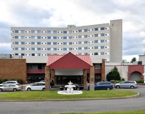

This Property Is For Sale
NEARBY LISTINGS FOR SALE OR LEASE
-
-
View all Kerhonkson listings for sale on LoopNet.com
Property Detail
400 Granite Rd
514400 76.4-1-56.110
Ulster
Hotel
New York
X
56.110
36111C0570F
369.80 AC
2025
Hudson Valley Area
2024
Other Market Areas
955002
Kingston, NY
34,000 SF
DEMOGRAPHICS near 400 Granite Rd
1 Mile
3 Mile
5 Mile
2024 Total Population
692
4,962
8,964
2029 Population
697
4,987
9,030
Pop Growth 2024-2029
+ 0.72%
+ 0.50%
+ 0.74%
Average Age
44
42
43
2024 Total Households
292
1,736
3,161
HH Growth 2024-2029
+ 0.68%
+ 0.63%
+ 0.92%
Median Household Inc
$102,864
$71,182
$71,493
Avg Household Size
2.30
2.40
2.40
2024 Avg HH Vehicles
2.00
2.00
2.00
Median Home Value
$292,682
$278,871
$318,561
Median Year Built
1970
1967
1972
Nearby Places
Map Layers
Map Styles
 Street
 Aerial
- Restaurants
- Banks
- Shops
- Fitness
- Groceries
PUBLIC TRANSPORTATION
AIRPORT
New York Stewart International
DRIVE
WALK
Distance
New York Stewart International
57 min
34.5 mi
Freight Ports
Albany, NY Port
DRIVE
WALK
Distance
Albany, NY Port
88 min
69.9 mi
Nearby Properties
Address
Land Use
TOTAL SIZE
Lot Size
Zoning
Address
Land Use
TOTAL SIZE
Lot Size
Zoning
67.16 AC
AR3
Address
Land Use
TOTAL SIZE
Lot Size
Zoning
2,970.01 AC
R5
Address
Land Use
TOTAL SIZE
Lot Size
Zoning
1,500 SF
141.70 AC
AR3
Address
Land Use
TOTAL SIZE
Lot Size
Zoning
41,876 SF
8 AC
RV15
Address
Land Use
TOTAL SIZE
Lot Size
Zoning
17,749 SF
128.60 AC
RP
Address
Land Use
TOTAL SIZE
Lot Size
Zoning
1,352 SF
184.30 AC
R2
Address
Land Use
TOTAL SIZE
Lot Size
Zoning
5,400 SF
1,032.99 AC
R5
Address
Land Use
TOTAL SIZE
Lot Size
Zoning
6,000 SF
5.10 AC
B
Address
Land Use
TOTAL SIZE
Lot Size
Zoning
15,456 SF
62.40 AC
B
Address
Land Use
TOTAL SIZE
Lot Size
Zoning
5.80 AC
RR40
Address
Land Use
TOTAL SIZE
Lot Size
Zoning
13,224 SF
1.14 AC
H
Address
Land Use
TOTAL SIZE
Lot Size
Zoning
880 SF
45.60 AC
B
Address
Land Use
TOTAL SIZE
Lot Size
Zoning
12,615 SF
1 AC
IL
Address
Land Use
TOTAL SIZE
Lot Size
Zoning
10,844 SF
33.20 AC
AR3
Address
Land Use
TOTAL SIZE
Lot Size
Zoning
4,655 SF
19.67 AC
R2
Address
Land Use
TOTAL SIZE
Lot Size
Zoning
1,440 SF
18.90 AC
AR3
Address
Land Use
TOTAL SIZE
Lot Size
Zoning
3,158 SF
13.10 AC
AR3
Address
Land Use
TOTAL SIZE
Lot Size
Zoning
10,106 SF
11.20 AC
AR3
Address
Land Use
TOTAL SIZE
Lot Size
Zoning
42,660 SF
3.30 AC
MU
Address
Land Use
TOTAL SIZE
Lot Size
Zoning
8,764 SF
1.43 AC
MU
Address
Land Use
TOTAL SIZE
Lot Size
Zoning
4,372 SF
12.50 AC
AR3
Address
Land Use
TOTAL SIZE
Lot Size
Zoning
30,200 SF
6 AC
B
Address
Land Use
TOTAL SIZE
Lot Size
Zoning
24,287 SF
3 AC
B
Address
Land Use
TOTAL SIZE
Lot Size
Zoning
3,200 SF
1.12 AC
B
Address
Land Use
TOTAL SIZE
Lot Size
Zoning
7,819 SF
3.60 AC
RS20
Address
Land Use
TOTAL SIZE
Lot Size
Zoning
2,156 SF
15 AC
R2
Address
Land Use
TOTAL SIZE
Lot Size
Zoning
3,000 SF
2.80 AC
B
Address
Land Use
TOTAL SIZE
Lot Size
Zoning
1,380 SF
12.60 AC
R1
Address
Land Use
TOTAL SIZE
Lot Size
Zoning
3,940 SF
6 AC
AR3
The World's #1 Commercial Real Estate Marketplace
Connect with us
© 2025 CoStar Group
The information above has been obtained from sources believed reliable. While we do not doubt its accuracy we have not verified it and make no guarantee, warranty or representation about it. It is your responsibility to independently confirm its accuracy and completeness. Any projections, opinions, assumptions, or estimates used are for example only and do not represent the current or future performance of the property. The value of this transaction to you depends on tax and other factors which should be evaluated by your tax, financial, and legal advisors. You and your advisors should conduct a careful, independent investigation of the property to determine to your satisfaction the suitability of the property for your needs.