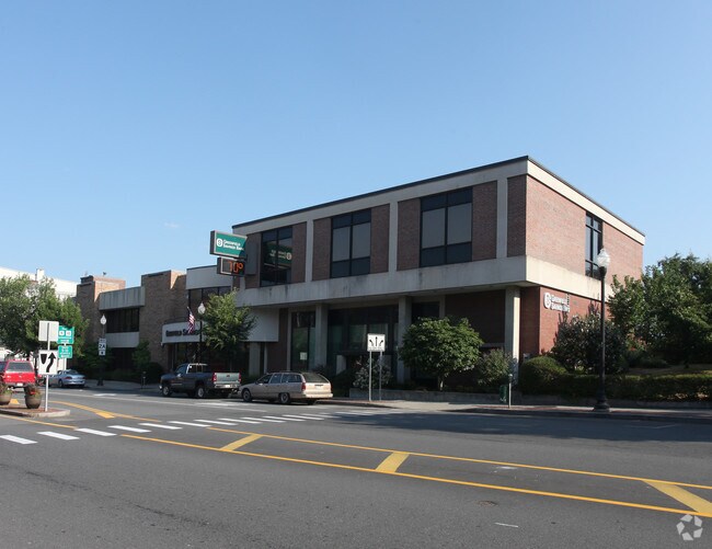
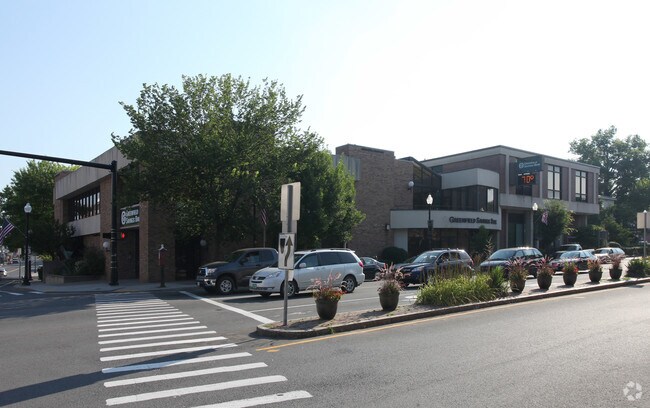
Property Record
400 Main St, Greenfield, MA 01301
NEARBY LISTINGS FOR SALE OR LEASE
Property Detail
400 Main St
GREE-000056-000001
Franklin
Financialbuilding
Massachusetts
2025
1.08 AC
2025
Franklin County
041302
Hartford
30,005 SF
Greenfield, MA
DEMOGRAPHICS near 400 Main St
1 mile
3 mile
5 mile
2024 Total Population
9,441
21,680
26,883
2029 Population
9,397
21,520
26,676
Pop Growth 2024-2029
(0.47%)
(0.74%)
(0.77%)
Average Age
44
44
45
2024 Total Households
4,602
9,980
12,161
HH Growth 2024-2029
(0.39%)
(0.67%)
(0.71%)
Median Household Inc
$49,387
$57,604
$62,795
Avg Household Size
1.90
2.00
2.10
2024 Avg HH Vehicles
1.00
1.00
2.00
Median Home Value
$220,169
$239,924
$254,038
Median Year Built
1947
1949
1951
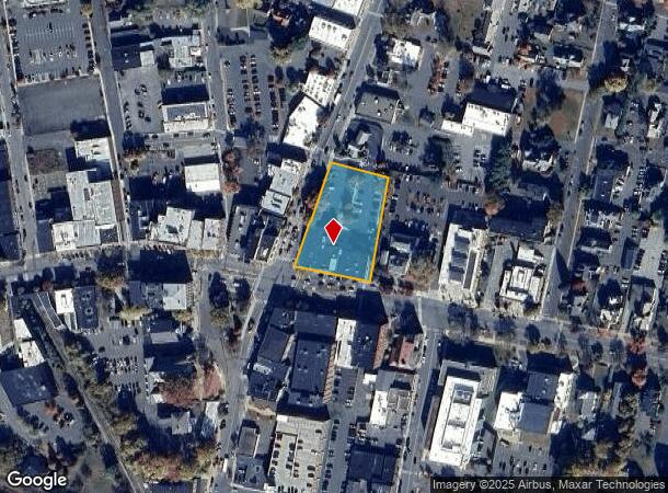
Nearby Places
Map Layers
Map Styles
 Street
 Aerial
Transit
 Traffic
 Biking
Places
Listings with unknown addresses are not visible on the map
- Restaurants
- Banks
- Shops
- Fitness
- Groceries
PUBLIC TRANSPORTATION
COMMUTER RAIL
Drive
Walk
Distance
1 min
5 min
0.2 mi
Nearby Properties
Address
Land Use
TOTAL SIZE
Lot Size
Zoning
Address
Land Use
TOTAL SIZE
Lot Size
Zoning
165,410 SF
26 AC
RA
Address
Land Use
TOTAL SIZE
Lot Size
Zoning
237,722 SF
20.69 AC
RE
Address
Land Use
TOTAL SIZE
Lot Size
Zoning
160,366 SF
56.38 AC
RB
Address
Land Use
TOTAL SIZE
Lot Size
Zoning
159,991 SF
44 AC
RB
Address
Land Use
TOTAL SIZE
Lot Size
Zoning
316,508 SF
80.01 AC
RB
Address
Land Use
TOTAL SIZE
Lot Size
Zoning
213,062 SF
6.50 AC
H
Address
Land Use
TOTAL SIZE
Lot Size
Zoning
173,646 SF
21.77 AC
RA
Address
Land Use
TOTAL SIZE
Lot Size
Zoning
158,638 SF
37.60 AC
RA
Address
Land Use
TOTAL SIZE
Lot Size
Zoning
2 AC
R1
Address
Land Use
TOTAL SIZE
Lot Size
Zoning
97,926 SF
8.65 AC
GC
Address
Land Use
TOTAL SIZE
Lot Size
Zoning
198.76 AC
CII
Address
Land Use
TOTAL SIZE
Lot Size
Zoning
95,712 SF
12.08 AC
RA
Address
Land Use
TOTAL SIZE
Lot Size
Zoning
117,897 SF
6.99 AC
H
Address
Land Use
TOTAL SIZE
Lot Size
Zoning
107,028 SF
14.46 AC
GC
Address
Land Use
TOTAL SIZE
Lot Size
Zoning
42,076 SF
3.49 AC
GI
Address
Land Use
TOTAL SIZE
Lot Size
Zoning
40.50 AC
ID
Address
Land Use
TOTAL SIZE
Lot Size
Zoning
184,872 SF
0.80 AC
ID
Address
Land Use
TOTAL SIZE
Lot Size
Zoning
195,199 SF
16.37 AC
RA
Address
Land Use
TOTAL SIZE
Lot Size
Zoning
94,910 SF
1.79 AC
SR
Address
Land Use
TOTAL SIZE
Lot Size
Zoning
29,600 SF
8.38 AC
NB
Address
Land Use
TOTAL SIZE
Lot Size
Zoning
132,622 SF
16.91 AC
O
Address
Land Use
TOTAL SIZE
Lot Size
Zoning
73,648 SF
2.10 AC
SR
Address
Land Use
TOTAL SIZE
Lot Size
Zoning
125,640 SF
4.98 AC
CC
Address
Land Use
TOTAL SIZE
Lot Size
Zoning
3.90 AC
RA
Address
Land Use
TOTAL SIZE
Lot Size
Zoning
40,606 SF
1.48 AC
GC
Address
Land Use
TOTAL SIZE
Lot Size
Zoning
32,911 SF
5.19 AC
RE
Address
Land Use
TOTAL SIZE
Lot Size
Zoning
28,291 SF
5.05 AC
ID
Address
Land Use
TOTAL SIZE
Lot Size
Zoning
4 AC
RA
Address
Land Use
TOTAL SIZE
Lot Size
Zoning
60,844 SF
15.31 AC
GC
Address
Land Use
TOTAL SIZE
Lot Size
Zoning
89,667 SF
15 AC
PI
The World's #1 Commercial Real Estate Marketplace
Connect with us
© 2026 CoStar Group
The information above has been obtained from sources believed reliable. While we do not doubt its accuracy we have not verified it and make no guarantee, warranty or representation about it. It is your responsibility to independently confirm its accuracy and completeness. Any projections, opinions, assumptions, or estimates used are for example only and do not represent the current or future performance of the property. The value of this transaction to you depends on tax and other factors which should be evaluated by your tax, financial, and legal advisors. You and your advisors should conduct a careful, independent investigation of the property to determine to your satisfaction the suitability of the property for your needs.