Property Record
400 Main St, Peekskill, NY 10566
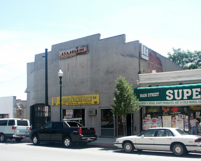
Property Detail
400 Main St
New York-Jersey City-White Plains, NY-NJ
Westchester
1200-032-008-00005-000-0006
New York
Warehouse
3.000
B and X Area of moderate flood hazard, usually the area between the limits of the 100-year and 500-year floods.
0.11 AC
2025
Southeast
2025
Westchester/So Connecticut
008801
NEARBY LISTINGS FOR SALE OR LEASE
DEMOGRAPHICS near 400 Main St
1 mile
3 mile
5 mile
2025 Total Population
43,452
147,999
472,971
2030 Population
44,390
149,148
463,506
Pop Growth 2025-2030
+ 2.16%
+ 0.78%
(2.00%)
Average Age
40
41
42
2025 Total Households
16,147
53,568
176,770
HH Growth 2025-2030
+ 2.46%
+ 0.96%
(1.98%)
Median Household Inc
$85,924
$108,288
$90,617
Avg Household Size
2.50
2.60
2.50
2025 Avg HH Vehicles
1.00
1.00
1.00
Median Home Value
$541,862
$719,610
$633,204
Median Year Built
1956
1948
1953
Nearby Places
Map Layers
Map Styles
 Street
 Aerial
Layers
 Traffic
 Biking
Places
Listings with unknown addresses are not visible on the map
- Restaurants
- Banks
- Shops
- Fitness
- Groceries
PUBLIC TRANSPORTATION
TRANSIT/SUBWAY
Peekskill Station (Hudson Line - Metro-North Commuter Railroad Company (Metro-North))
Drive
Walk
Distance
Peekskill Station (Hudson Line - Metro-North Commuter Railroad Company (Metro-North))
2 min
15 min
0.5 mi
COMMUTER RAIL
Peekskill Station (Hudson Line - Metro-North Commuter Railroad Company (Metro-North))
Drive
Walk
Distance
Peekskill Station (Hudson Line - Metro-North Commuter Railroad Company (Metro-North))
2 min
10 min
0.5 mi
Cortlandt Station (Hudson Line - Metro-North Commuter Railroad Company (Metro-North))
Drive
Walk
Distance
Cortlandt Station (Hudson Line - Metro-North Commuter Railroad Company (Metro-North))
9 min
3.7 mi
AIRPORT
New York Stewart International
Drive
Walk
Distance
New York Stewart International
42 min
24.1 mi
Westchester County
Drive
Walk
Distance
Westchester County
42 min
30.1 mi
Freight Ports
NY - Red Hook Container Terminal
Drive
Walk
Distance
NY - Red Hook Container Terminal
80 min
53.7 mi
Nearby Properties
Address
Land Use
TOTAL SIZE
Lot Size
Zoning
Address
Land Use
TOTAL SIZE
Lot Size
Zoning
Address
Land Use
TOTAL SIZE
Lot Size
Zoning
Address
Land Use
TOTAL SIZE
Lot Size
Zoning
Address
Land Use
TOTAL SIZE
Lot Size
Zoning
157 AC
Address
Land Use
TOTAL SIZE
Lot Size
Zoning
Address
Land Use
TOTAL SIZE
Lot Size
Zoning
74.84 AC
Address
Land Use
TOTAL SIZE
Lot Size
Zoning
Address
Land Use
TOTAL SIZE
Lot Size
Zoning
Address
Land Use
TOTAL SIZE
Lot Size
Zoning
Address
Land Use
TOTAL SIZE
Lot Size
Zoning
Address
Land Use
TOTAL SIZE
Lot Size
Zoning
2.70 AC
Address
Land Use
TOTAL SIZE
Lot Size
Zoning
Address
Land Use
TOTAL SIZE
Lot Size
Zoning
Address
Land Use
TOTAL SIZE
Lot Size
Zoning
15.81 AC
R80
Address
Land Use
TOTAL SIZE
Lot Size
Zoning
7,254 SF
17.32 AC
R80
Address
Land Use
TOTAL SIZE
Lot Size
Zoning
22.61 AC
Address
Land Use
TOTAL SIZE
Lot Size
Zoning
8.93 AC
Address
Land Use
TOTAL SIZE
Lot Size
Zoning
2.99 AC
Address
Land Use
TOTAL SIZE
Lot Size
Zoning
Address
Land Use
TOTAL SIZE
Lot Size
Zoning
Address
Land Use
TOTAL SIZE
Lot Size
Zoning
7.50 AC
Address
Land Use
TOTAL SIZE
Lot Size
Zoning
Address
Land Use
TOTAL SIZE
Lot Size
Zoning
Address
Land Use
TOTAL SIZE
Lot Size
Zoning
5,268 SF
33.90 AC
R80
Address
Land Use
TOTAL SIZE
Lot Size
Zoning
9,707 SF
5.51 AC
R80
Address
Land Use
TOTAL SIZE
Lot Size
Zoning
23.27 AC
Address
Land Use
TOTAL SIZE
Lot Size
Zoning
9,498 SF
0.21 AC
R10
Address
Land Use
TOTAL SIZE
Lot Size
Zoning
48.07 AC
Address
Land Use
TOTAL SIZE
Lot Size
Zoning
26.80 AC
Address
Land Use
TOTAL SIZE
Lot Size
Zoning
0.39 AC
The World's #1 Commercial Real Estate Marketplace
Connect with us
© 2026 CoStar Group
The information above has been obtained from sources believed reliable. While we do not doubt its accuracy we have not verified it and make no guarantee, warranty or representation about it. It is your responsibility to independently confirm its accuracy and completeness. Any projections, opinions, assumptions, or estimates used are for example only and do not represent the current or future performance of the property. The value of this transaction to you depends on tax and other factors which should be evaluated by your tax, financial, and legal advisors. You and your advisors should conduct a careful, independent investigation of the property to determine to your satisfaction the suitability of the property for your needs.